A beautiful Fall Day greeted us for the day’s trail ride. Temps were in the 50’s and the Fall colors were a little past peak, but still showing.
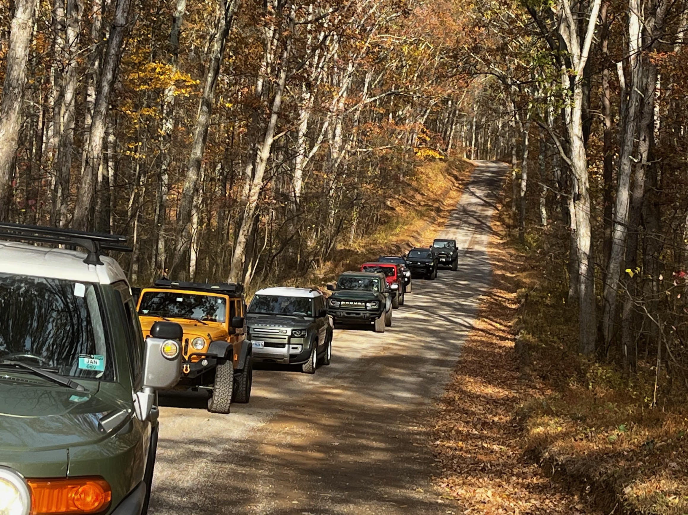
The group of eight vehicles met at the GRSF ranger station at 10am to kick off a day on the trail.
- Javi – Toyota FJC
- Jason – Jeep 4xE
- Mark – Toyota Tacoma
- Mike F+1 – LR Defender
- Garret H – Ford Bronco
- Jendra – Jeep Wrangler Unlimited
- Dawn – Toyota 4Runner
- Darren – Jeep Wrangler Unlimited
The Green Ridge State Forest (GRSF) is a common venue for club activities. There have been trail rides, camping trips, and of course our annual Holiday party. After a brief driver’s meeting, we hit the trail. This trail is pretty mild; about 1 to 2 on the CORE Trail Ratings, but airing down
will make the ride a bit smoother. The group entered the state forest on 15 Mile Creek Road near the Green Ridge Youth Center and continued on that road. When we met the fork with Green Ridge Road, we stayed on 15
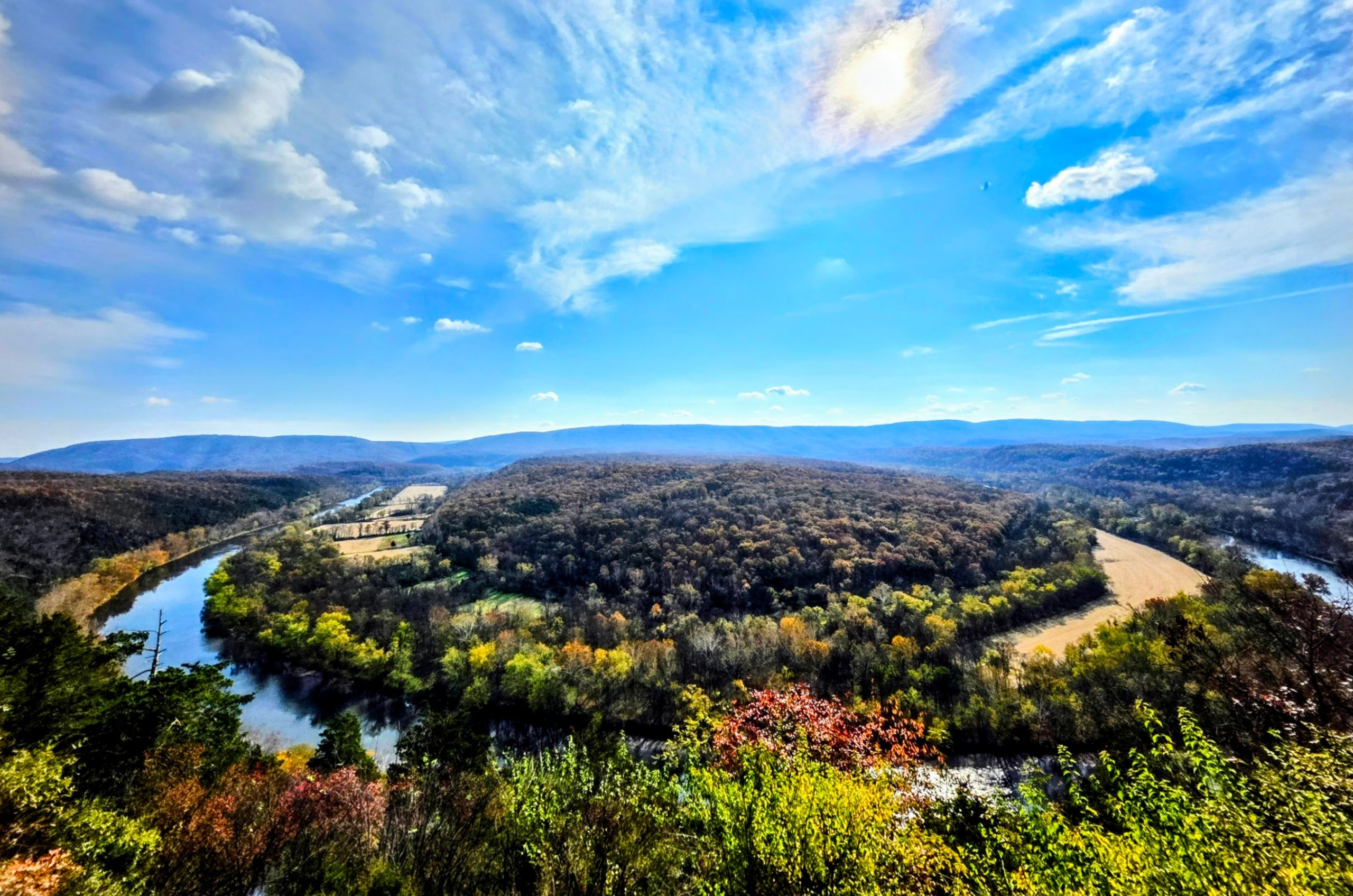
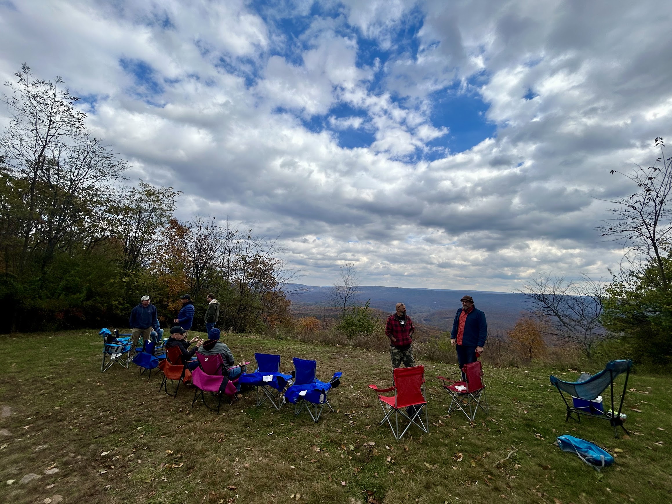
Mile Creek Road and followed it to Point Lookout Overlook. The view did not disappoint. It had been an uneventful ride up to then. We got back on the trail and were making our way down to the Southern end of the forest to Kasecamp road when we came upon newly erected caution tape across the trail with signs “Road Closed” at camp site 89. We doubled back on the trail and instead made our way down Oldtown Orleans to Banner Overlook where we stopped for lunch.
This was a bit disappointing since the drive along the Potomac River and C&O Canal is very nice and I’m sure it would not have disappointed on a Fall Day like today.
After lunch we got back on the trail and made our way down Jacobs Road with a loop along
Twigg Road and finally back toward the freeway where we had entered. Overall, a good day on the trail with a great group of people.
On the Department of Natural Resources (DNR) GRSF web page is listed the following
notice:
Notice:
Due to a recent flood event some roads and campsites at Green Ridge State Forest may be temporarily closed. Please contact the Green Ridge State
Forest Headquarters at 301-478-3124 for current conditions and closures.
Saturday
Profile
No data
No data
No data
No data
No data
No data
Duration:
No data
Trail Report written by Javi Armendariz. Pictures contributed by Javi Armendariz, Jason, Jendra Rambharos, Darren Modzelewski, Garrett Hartzog, . GPS Tracks provided by Jendra Rambharos.