Wolf Den Run, June 2022
Friday I ran a few trails by myself to scout out a plan for the group the following day. Saturday was the big group, some blue and green trails with some harder stuff mixed in. Sunday Zach and I went back and did some random stuff including a black trail. So here’s how it all went down, more or less.

Attendees:
- Kirk – FJ Cruiser
- Jendra – Jeep Wrangler
- Ben & Josiah – Toyota 4Runner
- Zach – Jeep Wrangler
- Steve – Nissan Frontier
- John – Toyota Tacoma
- Kathy & Rick – FJ Cruiser
- Adam – Nissan Xterra
- Jeff – Land Rover Defender
- Kevin – Jeep Wrangler
- Brian & Kelly – Jeep Wrangler
Friday Pre-Run
Friday I planned a reasonably early start from home, my plan was to set up camp, chill, and maybe see if anyone wanted to do a quick run into the park. I got to the Wolf Den park office at the campground around 2:30. I checked in at the ranger station and talked to the rangers there a bit. I decided that since there was time and no one else was there yet, I’d buy a pass and go pre-run some of the trails I’d planned on doing with the group the following day.
Since I’d be by myself I figured I could cover ground a lot faster than with 10-12 trucks on Saturday, and check out some of the trails I wanted to do I hadn’t been on before. Plus, trails change, sometimes quickly, so I wanted to make sure I had an idea of what we’d be getting into. I didn’t want to go down a dead end and have to turn around a big line of trucks or find out that a trail was blocked or closed or otherwise impassable or that the maps were just wrong. All these things have happened before.
I’d never been in the North Hill area of the park and only done a few trails in the Potomac River area at least a year ago. And while I had done all of Huckleberry Rocks, that was right after the park opened and trails changed. I remembered the Huckleberry Rocks trails as really narrow in the bushes, fun and technical, but not that exciting or a challenge, and Potomac being more of a challenge, but also grown in.
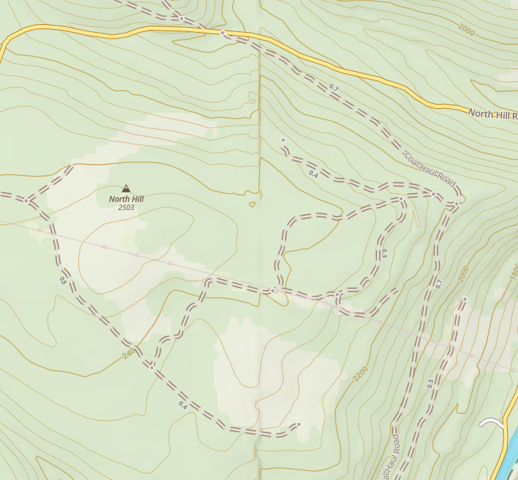
So I figured I’d start Friday by going into North Hill and seeing what that was like. I had a rough idea of a combination of trails that would cover most of the area, and I wanted to see if the trails were muddy or steep or rocky or what, and why some of the trails are marked blue and others green or black and why and if there were areas I really wanted to hit or avoid. Then I wanted to take a look at the Potomac River section to check some trails I hadn’t done and look at what the black trails were like now.
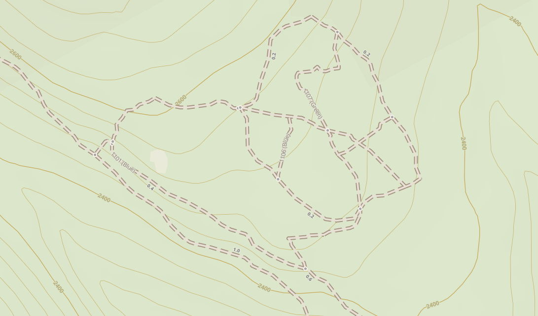
The North Hill area went well, and I mostly cruised through it. The blue trails, 1101 and 1102 are pretty easy, and I think the park might have re-labeled some of 1101 as green. 1102 has a neat rock obstacle at the end where it bends around to join 1101 and I figured people would like that. 1103 was a fun steep climb that I figured no one would have an issue with even though it’s rated black, and 1106 is a milder version of 1103 that we could go both up and down. I found a neat pinch point on 1107 between some trees, and the rest of the green section was basically simple fun for a careful driver. So far so good.
I took the connecting Coal Haul Rd down to the Potomac River section next to check out this area. I kind of assumed the blue bits would be about the same and that I’d have time to at least look at the start of some of the black trails to see what they were like.
I started by getting a bit lost and going in circles around where Coal Haul hits the entry road and the big parking lot. The trails and roads here really don’t match the map at all, but once I figured it out, it’s not really confusing, but not well marked. Also confusing to me was that they closed some trails since I was there last year and moved the portajon, I think. At this point I also found the picnic area that wasn’t open last time I was there.
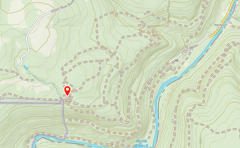
After sorting myself out, I decided to go down 2103, which I hadn’t done. I wanted to see what the “fisherman’s camp” trail thing was as marked on the map. 2103 turned out to be quite a lot of fun. I wasn’t entirely sure if it was a bit more trail than the group would want on Saturday, but I thought I’d keep an open mind on it. Looking back, the last chunk from the spur to 2101 down to the spot to mark the sharp turn and climb up to 2105 is a solid “5” on the CORE trail system.
At the end of 2103, I kind of got a reminder that I was, in fact, wheeling by myself on a week day, not long from the closing time of the park, and that I really needed to be careful. It turns out that the park map and my GPS map disagree on a bunch of stuff around the end of 2103. I was all the way down what the park map shows as a foot trail, though it’s clearly open to driving now as there were no signs, but were new “no motorized vehicles beyond this point” signs at the end. I thought I was at the start of the foot trail, where the park map has a red flag “rally point”. The area is a nice wide open area right along the river and would make a nice lunch spot or place to go fishing, and I marked it as a possible lunch spot for Saturday if we were making good time. And rally points are usually open areas where groups can gather back up if they got too spread out on the trails. So it looked right.
So I thought I was looking for the turn up towards 2104, not off on a dead-end. I saw what looked like a trail up a short, steep hill. Thinking this was the way onward, I attempted to go up it several times, but each time I slid back down. After 3-4 tries using different lines and speed I decided it didn’t matter, since I wasn’t going to be able to get the group up it without winching a bunch of people. And that’s a bad plan.
I then saw another trail heading up the hillside at a different angle, and I thought for sure this was the trail I was looking for. As I went up the trail, it got wetter and steeper and was not an easy climb at all. I then came to a tree that was down across the trail, with an available bypass that was a bit off-camber on a hillside. It looked iffy, but I figured I could do it and once I did, I’d have a good feel for getting others up that way. And sure enough, I went around with no issue. However after this point the trail got a lot steeper and became a mix of soft wet muddy dirt and loose slick rocks, very little tracktion. I got part way up and realized I couldn’t get further safely. And again, there was no way I was going to lead a group up that trai without it being a winch party so it was time to turn around. I backed down, found a wide spot and turned around to head back down and find another route for the group. And that’s when things went wrong. Going back around the downed tree on the off-camber bypass, the truck slide sideways and down the hill. I didn’t think I was in danger of rolling, but there were a number of trees that I didn’t want to hit. I came to a stop with my front bumper pointing right at a small tree, then when I tried to back up, the rear slide sideways and basically parallel parked me between two small trees. At this point I actually got worried. I wasn’t sure I could get out reasonably quickly and it was approaching 4:30, with the park gates locking at 5:00. I knew I could winch myself out at an angle if I had to, but it would take a while to rig since it wasn’t a straight ahead pull, and I might have to drag the front of the truck back and over and up hill since my front bumper was almost touching the one tree. I considered using maxtrax, but I wasn’t really sure they would work in this situation. Cutting down one of the small trees did occur to me as well, it was only 4” or so in diameter. But I didn’t want to do that either. After getting out and walking around the truck a bit, I decided the best thing was to just inch back and forth and work the nose of the truck over until I could clear the tree, using the bumper on the tree as needed to use all the room available. After a whole lot of back and forth, I managed to clear the tree and get back down the trail. Obviously not somewhere I’d be taking the group. At that point it was nearly 4:50 and I really needed to get to the exit as fast as I could. I knew going back through the rocks on 2103 would take too long, I’d never make it to the exit. I was hoping that I could find the spur I’d been looking for to go up to 2104 and out on 2101 and that 2101 wouldn’t actually be blue like 2103 was. As it happens, that way out was pretty smooth sailing, and I think 2101 from the entrance to the intersection with 2104 is really more of a green trail than anything.
Friday Camp Set Up
So I got out of the park before they locked the gates, and headed to the campsite. By this point a bunch of the other folks who were camping had arrived. The campsites at Wolf Den are newly opened, and the state put a lot of work into them. The funny thing is that the sites are all smaller than they “look” on the map. We had all the tent sites at the end of the loop road reserved for our group and a couple of the spots that are available for RVs along the road as well. It turns out that the tent sites are all really small, really only big enough for 1 truck and 1 good size tent or 2 really small ones. And the tent sites are all built from a fairly large size gravel, which is rather uncomfortable.
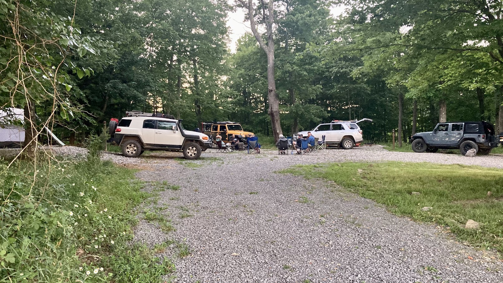
And the sites are rather close together. What looks like a loop road around the portajon on the map is more of a neighborhood cul-de-sac with a tree and portajon stuck in the middle. But the tent sites are in the trees, so there’s lots of shade. The RV sites are spaced further apart and are grass. So they would be more comfortable to camp in, but they are all in an open field with no shade. I’d camp there again, and maybe over time some dirt will build up on the gravel and smooth out the tent sites. I used a tarp under my tent to avoid poking holes in the bottom, and really didn’t have any issues other than it being hard to move around in the tent without shoes on.

Saturday Group Wheeling
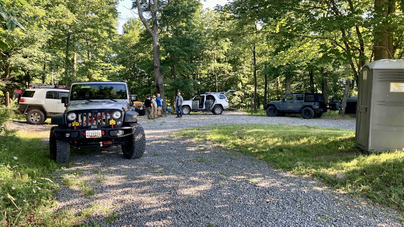
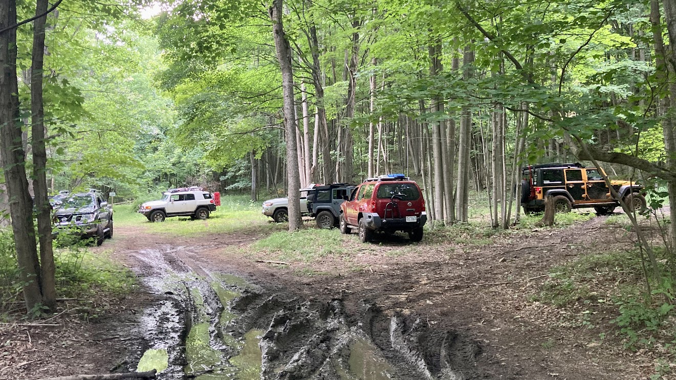
Saturday, everyone showed up, we aired down at the campsite, had a driver’s meeting and off we went. We had 11 trucks total, and a pretty mixed group, which was cool.
Based on my Friday adventure, my plan was to pretty much do North Hill as I did it on Friday and then head over to Potomac River and have lunch at either the picnic area or the fisherman’s spot at the dead end, then head further into the Potomac River area, probably up to the green trails and maybe look at some of the black stuff depending on things were going.
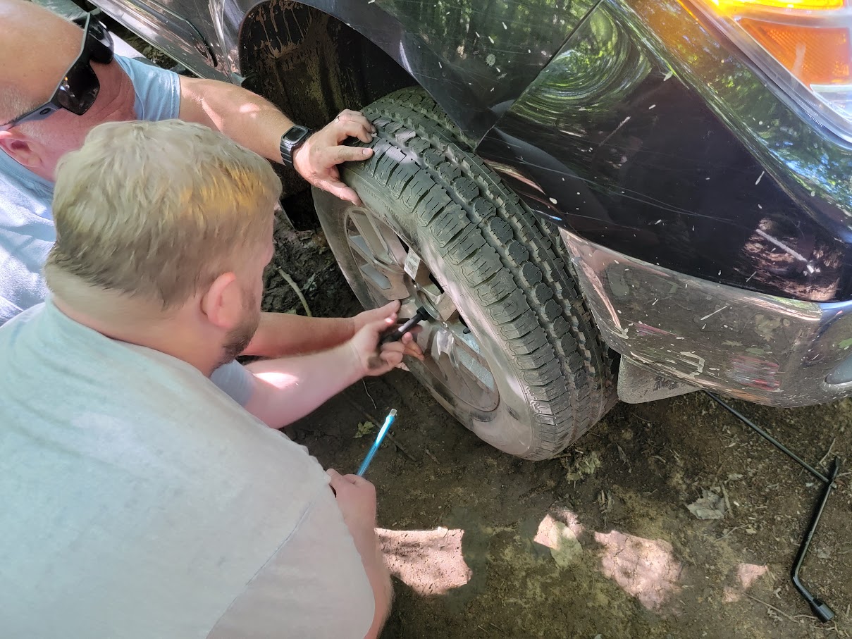
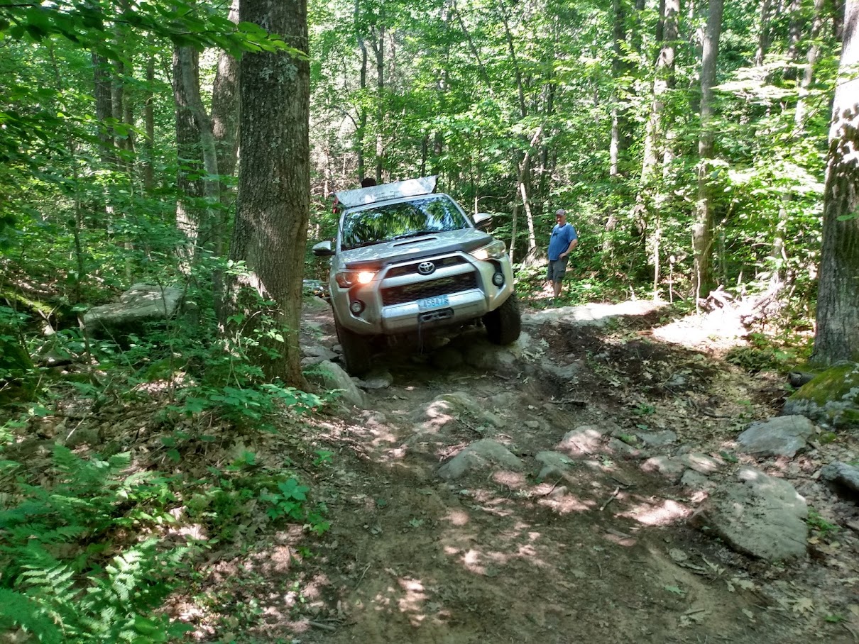
We started out just fine, the North Hill area went pretty smoothly. The trail was nice and wider than we generally expected. Part way down Steve in his Nissan Frontier blew a tire by hitting the sidewall on a rock just wrong. We changed the tire and continued on. At the end of 1102 we did some spotting to help some folks up and over the big rock around the corner since it’s kind of a blind approach. No one had any issue going up the steep 1103 climb.
Then we got to the pinch spot on 1107, a tight turn between 3 trees. This took some of the trucks with longer wheelbases a lot of back and forth and careful spotting to get through. Nothing really hard, but tricky to avoid rubbing body panels or mirrors on the trees. I did make one wrong turn and missed a bit of trail I liked from the day before, but it wasn’t an issue.
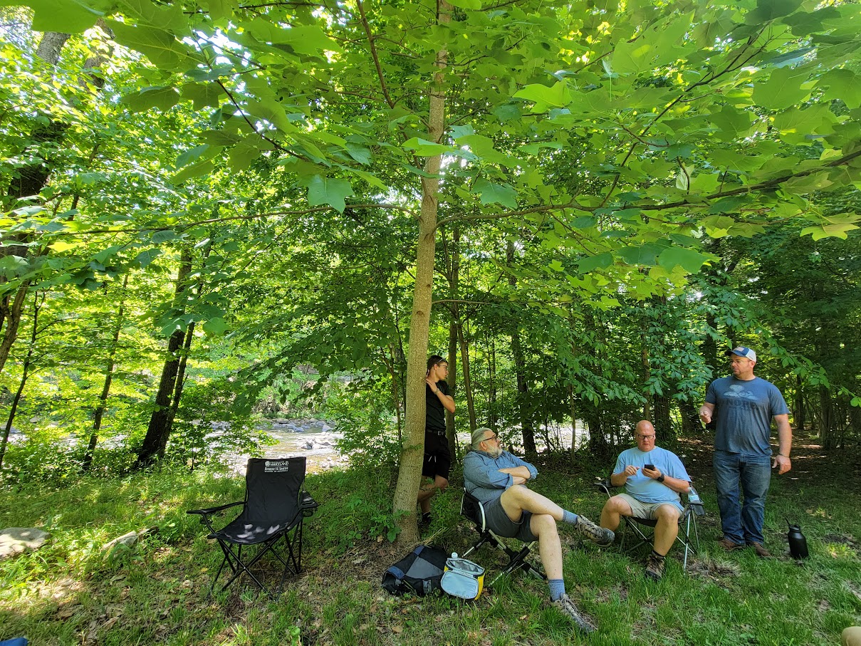
After doing most of the trails in North Hill we headed down Coal Haul road to the Potomac section. We went into the picnic area and had lunch at the spot at the end. There was enough space for all of us to park, more or less. It’s a nice area, and there are several cuts through the bushes to the river.
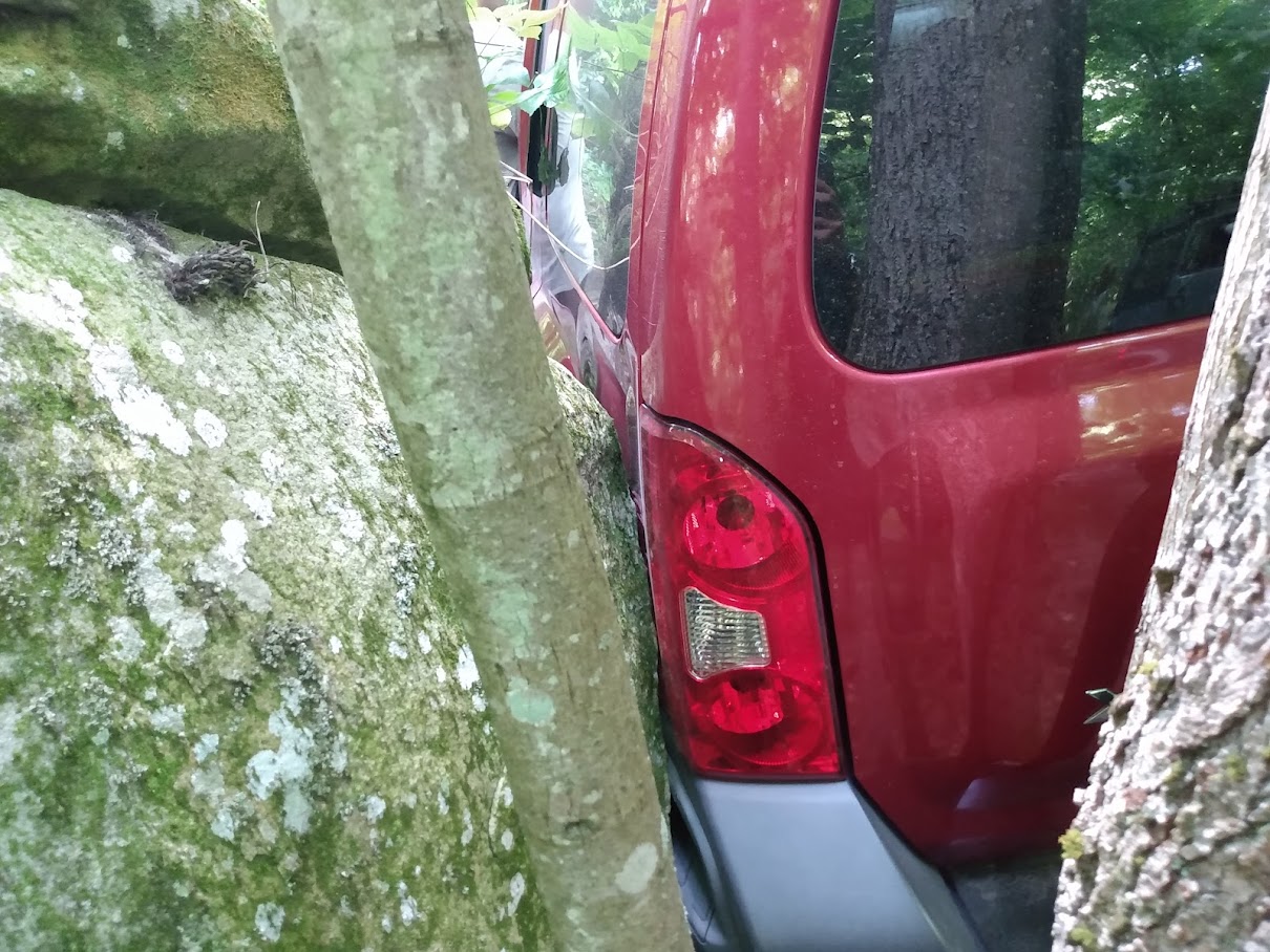
After lunch we headed down 2103. 2103 has a bunch of rocky spots and some of them proved to be tricky for some people. Folks with less aggressive tires or no lift were needing a fair amount of spotting and line choice through some of the spots was really important. At one point the red Xterra got a bit off line then slide sideways on a slanted rock shelf that had gotten damp from the prior trucks. He wound up with his fender against a rock and got a pretty good sized dent. I was worried that if he tried to just drive off forward that he’d break out the tail lights and do more damage, so we rigged a winch to apply sideways force away from the rock as he drove forward and we were able to at least prevent more damage.
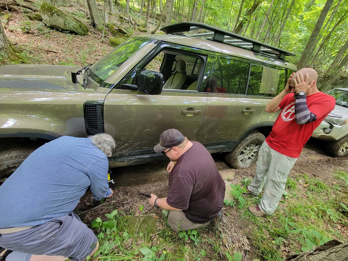
Right around the same time the Xterra was getting cozy with the boulder, Jeff in his Land Rover managed to get his tire sidewall just wrong on an itty bitty rock and get a flat. We changed the tire, and then Steve in the Frontier managed to hit the exact same rock the same way and blow a second tire on the day. Now we had a real problem. Fortunately the Xterra and Frontier share the same bolt pattern so we borrowed a spare tire and got Steve rolling again. But now we had 3 trucks with no spare tires. All of the blown tires were more “street AT” tires than anything, I think they were passenger rated, not LT, and they didn’t have very strong side walls. And I think we aired them down a bit too much, so the sidewalls were bulging out and easy to catch or pinch on rocks.
By the time we cleared the rocks on 2103, it was getting late, and several folks needed to hit the road home, plus several guys were nervous about their tires, so about half the group split off at the next spur and went up to 2104 and then out of the park.
The rest of us continued down to the fisherman’s camp area, where A couple of guys took a few tries at getting up the short hill I hadn’t managed the day before. Zach made it up the climb, followed by Jendra. But the funny thing was that it was a dead end right after the top of the hill, in fact there was so little room at the top that it was safer to just back back down rather than trying to turn around and risk dropping a tire off.
After checking out the fisherman’s camp area, we headed up to 2104 then left on 2101 and then left again onto 2105 which took us up to the “slag pile” This is a big pile of dirt with rock chips that has multiple routes up and down, some of them quite long and steep, some shorter and more tame, it’s a hill climb and descent playground. The cool this is that someone who isn’t sure of themselves or their truck can try some of the milder hills and then work up to the steeper ones if they want. Several of us went up and down a few times and had some fun. Once we were done with this, we left the park and headed to the campsite.
At the campsite, we realized that the local Walmart had a tire center and had tires in stock that would fit Steve’s Frontier. We rushed over there to try to get him tires before they closed. While we got there about an hour before closing, it was clear they didn’t want to help, and the guy working there didn’t seem to quite understand what we wanted and why the truck had a mismatched tire (from the Xterra). So unfortunately, no tires for Steve on Saturday. He was able to get tires on the truck Sunday morning.
With no new tires, several of us went to a local place for dinner, Don Patron. The food was quite good and inexpensive.
What we didn’t know was that while we were trying to get tires and then eating dinner, a hard rain squall came through. I was in a hurry when we left camp because we needed to get to the tire place before they closed, and I didn’t get my tent fully closed up for rain. When we came back, I had several inches of water in my tent and a lot of my clothing and other stuff was soaked. I wound up drying some clothing for the next day at the campfire. At least I had a bunch of microfiber towels that I keep in the truck which allowed me to dry the tent and some of the other stuff.
Sunday Exploration
Sunday we broke camp. Zach and I decided to go back to the park and run some trails, everyone else headed home.
We decided to start by taking a look at the Huckleberry Rocks section of the park. I hadn’t been there in a while so I wanted to see how things changed. Over all, the trails are wider than they were when I’d been there before, so there’s a lot less pinstriping going on, which is a good thing over all. Several of the trails we did are marked green and I’d say are green trails, but when I was there last they were basically dirt roads. Now they’ve had some erosion and traffic on them so there’s a bit of a variety of trail conditions, though the area is mostly flat, no big up or down hill sections. We did go through “the wallows”, a swampy section that’s set aside for anyone who wants to go mudd’n. Of course the depth of the mud is going to vary depending on how much rain has fallen recently. I think now Huckleberry rocks would be a good place for new drivers who want a bit of a variety of terrain.
For those keeping score, we came in the entrance, took a left onto 104, picked up 109 which is marked blue, then went around 303 and 304then left down 101 to 201 then left onto 204, the wallows. 104 is narrow and twisty in the bushes, but is now wide enough that we didn’t get pinstriped as we would have in the past. The blue 109, 303, and 304 were really mild, 303 and 304 had stumps on them in the past, but a lot them have decayed, so the bumps are smaller and more rounded. We then took 205 to 202 to 201, then straight and to the left to get on the rest of 101, past the parking area.
Zach said he also wanted to check out the black trails, so we left Huckleberry rocks and went back to the Potomac River section.
Looking at my GPS tracks from back in November of 2020, the last time I was at Wolf Den, we did the black trails 2301 starting where it intersects the green 2201 and looped around clockwise, then turned onto 2305 and then out 2304 back to 2201 and the exit. I remembered that loop as being rocky, but not that hard, not really “black”.
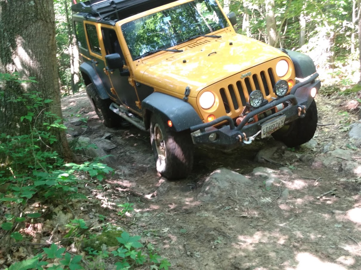
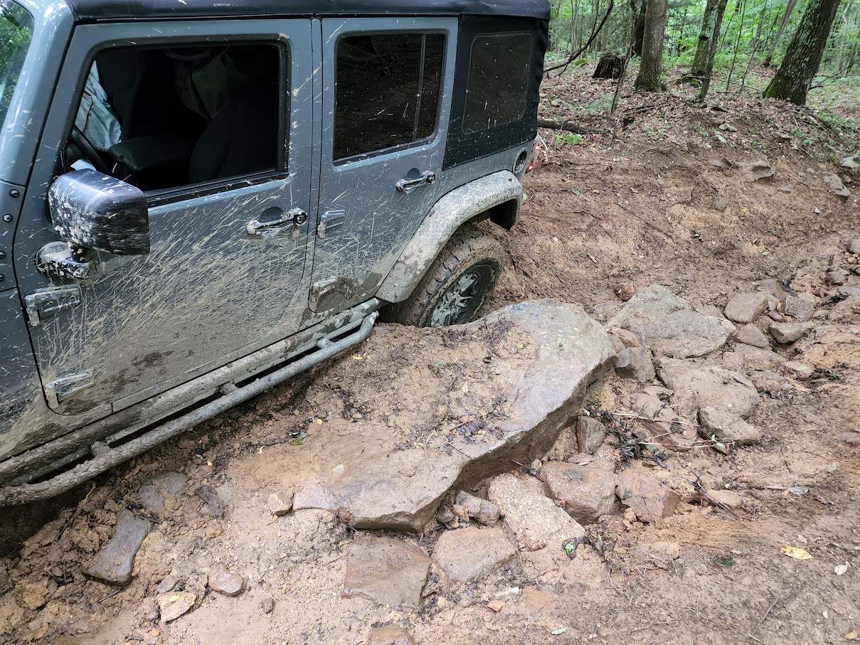
This time, we drove straight in on 2101 and took the right onto the black trail 2301. This trail really is a lot harder than the blue trails we’d done before. Everything was slippery as well since the rains from the night before and the tree cover meant everything was wet, making the rocks slippery. Several other black trails branch off from 2301, but we stayed on 2301 all the way around. Several of the branches lead to really steep climbs, and given the conditions we weren’t sure we could make it up them. Part of the way around, we came to a big rock that had deep ruts on either side, so the choice was either left side of the trail or right side, with one set of tires on the rock and the other on the edge of the trail. I went up the left and managed to keep my tires in the correct spot. Zach tried the right side and sid off the side of the rock and got stuck. He winched out pretty quickly. After finishing 2301 we headed for the exit.
We got the exit of the park and aired up, then we were both heading in the same direction to the highway to go home. But when I hit pavement, my truck felt really wrong. When I touched the gas it felt like the rear moved sideways, it was a very bad feeling. Going into a corner on the pavement, I hit the brakes a bit and again the truck seemed to move the rear sideways or something. Zach was behind me and said on the radio that he could see something hanging down. Since it was along the way anyway, we pulled back into the Wolf Den headquarters/campground to find a spot to check out the truck. It didn’t take long to find the problem, the bolt that holds the rear end of the lower trailing arm had worked out after the nut fell off. So it wasn’t trail damage, just something that came loose. But I didn’t have a spare nut either. We were able to use ratchet straps to move the axle back into position and get the bolt back in place. Lacking a nut, I used some bailing wire Zach had and a gear tie wrapped around the threads to try to keep the bolt from working out, and we left a strap in place as well, just in case.
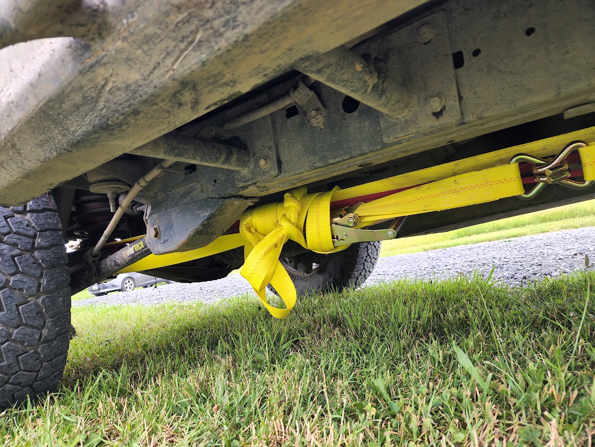
Since we had cell coverage at the park HQ, I found that the local Ace hardware store was still open for a while, and they often have metric hardware, so I was hoping I could get a new nut. We got there just before closing, and I wound up going back and forth into the store, under the truck in the parking lot, back into the store, etc to find a combination of bolt and nut that would fit correctly. The Toyota bolt uses a fine pitch thread that Ace didn’t have, but they did have a standard pitch bolt and nut in the same size, but they used sockets that were bigger than the 19mm of the Toyota nut, and 19 was the biggest socket I had in my tool box,but Ace had me covered there as well.
After tightening up the new bolt good and tight, we headed out for an uneventful drive home.
Track
Profile
No data
No data
No data
No data
No data
No data
Duration:
No data
Trail Report written by Kirk Adams. Pictures and video clips contributed by Jendra Rambharos, Ben Dunkerton, Josiah Dunkerton, John Altomare, Zach Pittman, and Kathy King . GPS track provided by Jendra Rambharos.