After the successful exploration last year to this hidden gem, I’ve been itching to get back. And I know other club members have been curious about it as well since our trip. But life can get busy and this trail isn’t exactly a hop and skip away. It’s a trek, over 4 hours for some of our members. My weekends rapidly get filled during the summer but I noticed one lonely weekend in July that had nothing planned yet. I can’t have a hole in my schedule, so what better way to fix it than to finally make a trek out to Casparis. And what a trip it turned out to be!
Out for out adventure today we had a nice collection of rigs with their drivers:
- Alex – Jeep JK
- Sergey – Jeep JK
- Adam & son – Nissan Xterra
- Wade & Betty – Chevy Colorado ZR2
- Gary & PJ – Jeep TJ
- Brian – Jeep JK
- Jendra – Jeep JK
When planning for this trip, I warned that these trails are not the easiest trails and that while a stock vehicle could make it, that it wasn’t recommended. I’m very glad I put that warning out before this trip because even all of us being modified we still ended up having to break out the tow straps and winches a few times. The new trails we found were on a higher level than anticipated.
The plan for the day was to retrace some of the trails we mapped during our exploration run last year, and to explore any new ones we come across. Casparis has always been this labyrinth of trails crisscrossing and weaving over the mountains. To save on time we skipped going to the mines this round and went straight to the large clearing that marks the start of multiple trails. I had made a note of one trail in particular that I wanted to check out next time we were here but instead found a “no motorized vehicle” sign posted by the PA game warden. Sad thing is that I’m fairly sure that was the original path we took back in 2010 trips here. Hopefully the closure is temporary to let some regrowth happen and on a later trip we’ll be able to go that way.
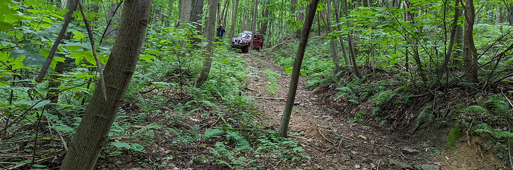
With that, we hung a left instead to follow the old gps trail out to the mud pits. A series of deep mud holes that will literally swallow you truck. Jendra and myself were the only ones brave enough to hit them. Everyone else opted for the narrow bypass. Continuing along we came to the first split in the loop we did before. Can either go straight and that eventually loops up and around to where we are, or we could do a bit of hill climbing and go up the mountain now. At the top of this loop was sort of an overlook. We decided to explore some of the random cut off trails along the way. We wanted to add to the map.
Normal trail up the mountain for the most part. Good bit of rocks to navigate around, some tree roots, few small mud holes. Normal stuff for our merry band of explorers. Then we came to a fork in the road. To the left was the known trail. To the right was something new. It was pointing in the general direction of the other side of the loop so maybe it connected? Let’s find out. And this was when the fun started.
This trail got narrow. Very narrow. And muddy. That thick pa slag mud that turns knobby tires into slicks. All that combined with going up a hill meant lockers and a good bit of gas was needed. Even then we had to break out the winch and tow straps for several due to them getting high centered. The ruts in this part were so deep that folks running 33’s were dragging the diffs in the mud carving new ruts down the center. Having to drag vehicles up a muddy hill isn’t hard to do, but when its on the side of a cliff and very narrow, it can get a bit dicey.
Once we got everyone up the hill we hit another fork in the road that had a trail heading up towards the overlook and a trail heading back down the mountain. We flipped a coin and went down the mountain. This trail is now known as “Threading the Needle” due to its very tight and twisting path through the trees. Think this trail started as a washout that ATV’s would use and then slowly got just wide enough for full size vehicles to navigate, slowly. Several of us had to fold in the mirrors for this. To really add to the fun, parts of this twisted navigation was off cambered. Very off camber. I went full flex a few times while leaning down the hill, and I know some folks were on 3 wheels here and there. Rolling over wasn’t a worry since you had at least 3 trees almost touching you at all times anyway so you wouldn’t go far. Took us a bit to get everyone safely down to the next trail. Which, lucky for us, was the other side of the loop trail that we would have been coming down via if we hadn’t started exploring. Since this was technically a fork in the road, I asked if we wanted to keep going down and find another new trail that eventually leads back to the main start point or turn around and go back up the known loop trail to the overlook. Vote said lets take the easy path to the overlook.
Few tight spots and one good hill climb later, we come to the overlook. Or what was an overlook. 10 years ago, when the trees were just saplings, it was a hell of a view. Now its just a really nice view of the open sky. Speaking of which, this couldn’t have been more perfect day weather wise. Sunny with few clouds dotting the sky. Moderate temperature. Low humidity. Fantastic for off roading if you ask me.
After this it was back the way we came and driving right past the top of the threading the needle trail. I joked saying we should go back down the mountain that way. I don’t think anyone was laughing. From here it was nothing new. Same mud pits and bumps in the road getting back to the start point. Once there we made a sanity check and chatted about the trails before heading back to town. This is when I learned that my electric swaybar system had filled up with mud and would no longer engage. I get to drive home over the mountains at highway speed with no swaybar. Awesome. Folks aired up and started their treks home.
These are not very fast-moving trails due to the constant obstacle avoidance and navigation you have to do. We only did a few miles but we’d been at it for most of the day. Think a few of us still had white knuckles from threading that needle while driving home. That section of the trail was a surprise to us. Pleasant challenge to some of us. This is why I love Casparis. It really does have something for everyone. There are trails here that you could do in a Subaru if you really wanted to. There are trails where you better have skid plates and a clean pair of shorts. I must have left over a dozen markers on my gps noting the start of unexplored trails leading off the main path. I can’t wait to go back and explore the area again and find new challenges.
Casparis never disappoints.
Track
Profile
No data
No data
No data
No data
No data
No data
Duration:
No data
Trail Report written by Alex Hinson. Pictures contributed by Brian Middleton, Jendra Rambharos, and Sergey Revashov. Video clips provided by Brian Middleton and Sergey Revashov. GPS tracks provided by Jendra Rambharos.