In June of 2024, the CORE club planned a visit to Potts Mountain Jeep Trail in Virginia, just west of Roanoke VA. It has become an annual pilgrimage to one of the most challenging trails the club visits, outside of the “pay to play” parks in PA.
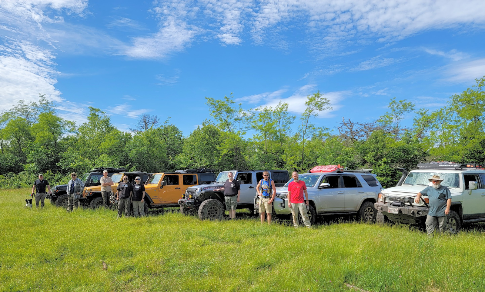
Attendees:
- Jendra & Family – Jeep JKU “The School Bus” (34’s, optimism, and baby seats)
- Brian – Jeep JKU “There was an obstacle there?” (37’s and more ground clearance than the moon)
- Ben & Family – Toyota 4Runner “Started the trip wider than it ended” (33’s, armor, and bravery)
- Ken & Matt – Jeep TJ “Small but Mighty” (33’s and as maneuverable as a mountain bike)
- Rich & Edison – Jeep LJ “Arthur” (35’s and can have oil changes done standing up)
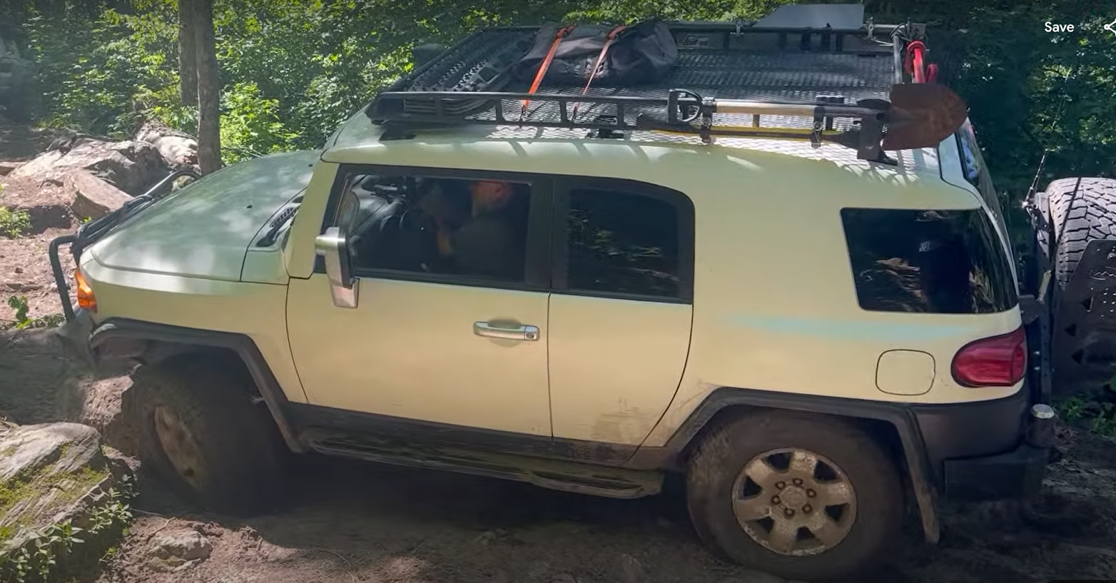
- Kirk – Toyota FJ Cruiser “The GOAT” (33’s and more armor than an M1 Abrams)
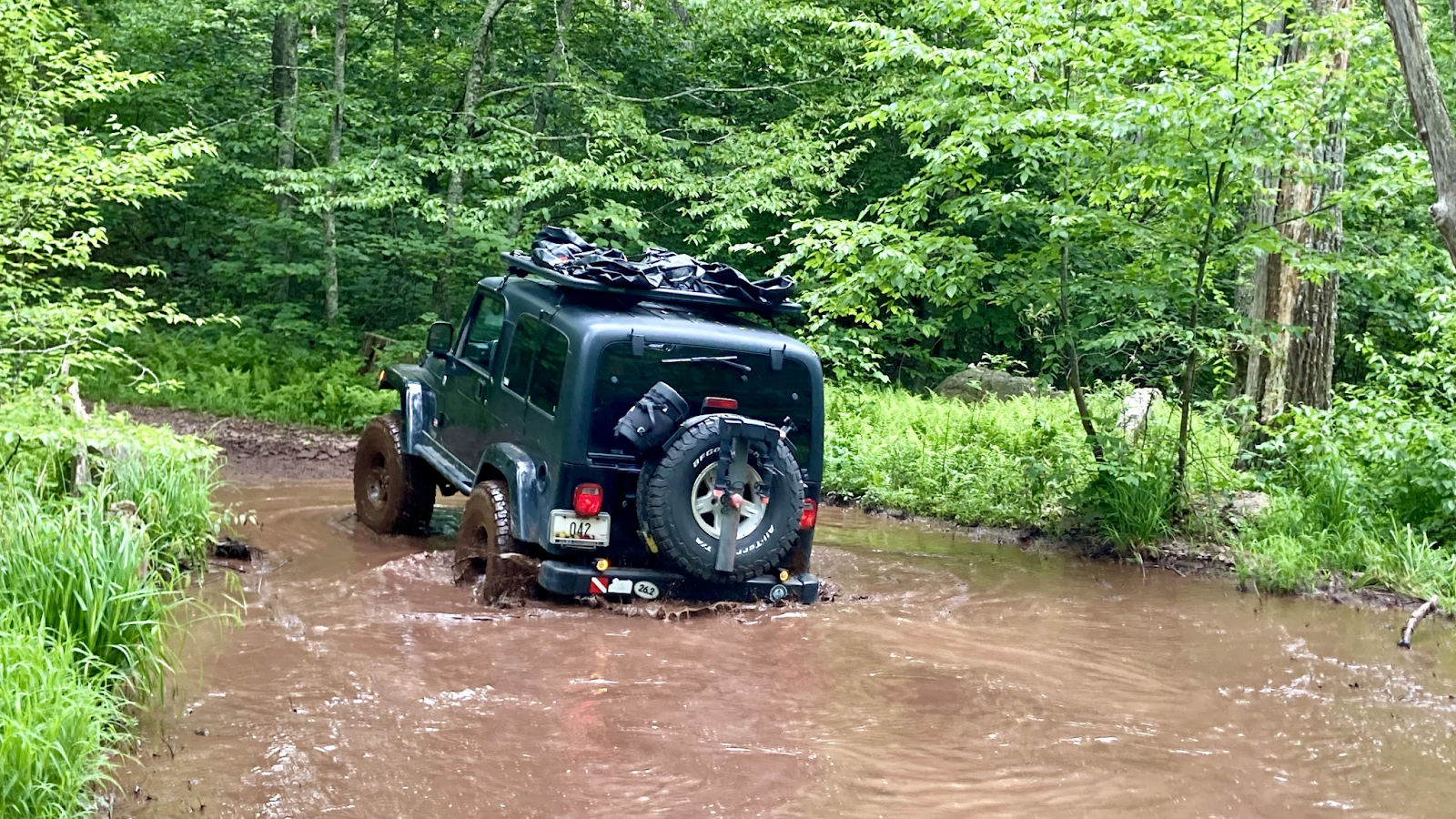
The last time I visited Potts was back in 2021, which was my first trip out. It really pushed our group to the limit, and we found the limits of our vehicles pretty quickly! The trail is a combination of tight forest trails, deep ruts, gatekeeper obstacles (very tight and off-camber gaps to squeeze the vehicles through), and big rock gardens. It is not a particularly muddy trail, save for a handful of puddles scattered throughout, all of which had nice firm bottoms.
The group who signed up presented a great variety of vehicles with owners who were prepared for the challenge! We set the vehicle requirements at 33 inch tires, a lift to support those tires, complete underbody protection, and winch required. The 33 inch tire requirement is a bit on the low side as to what is really needed to navigate the trail, but CORE 4×4 is a mixed breed off road vehicle club, of mostly daily driver rigs, and we made it clear that while 33’s are a tad undersized for this trail, it is doable, with underbody protection and a winch required to make up for the inevitable lack of clearance. We also made the disclaimer to anyone joining, that we’ve had body damage, skid plate damage, and funny noises post-trip in the past, and that it was very much a possibility with this particular trail.
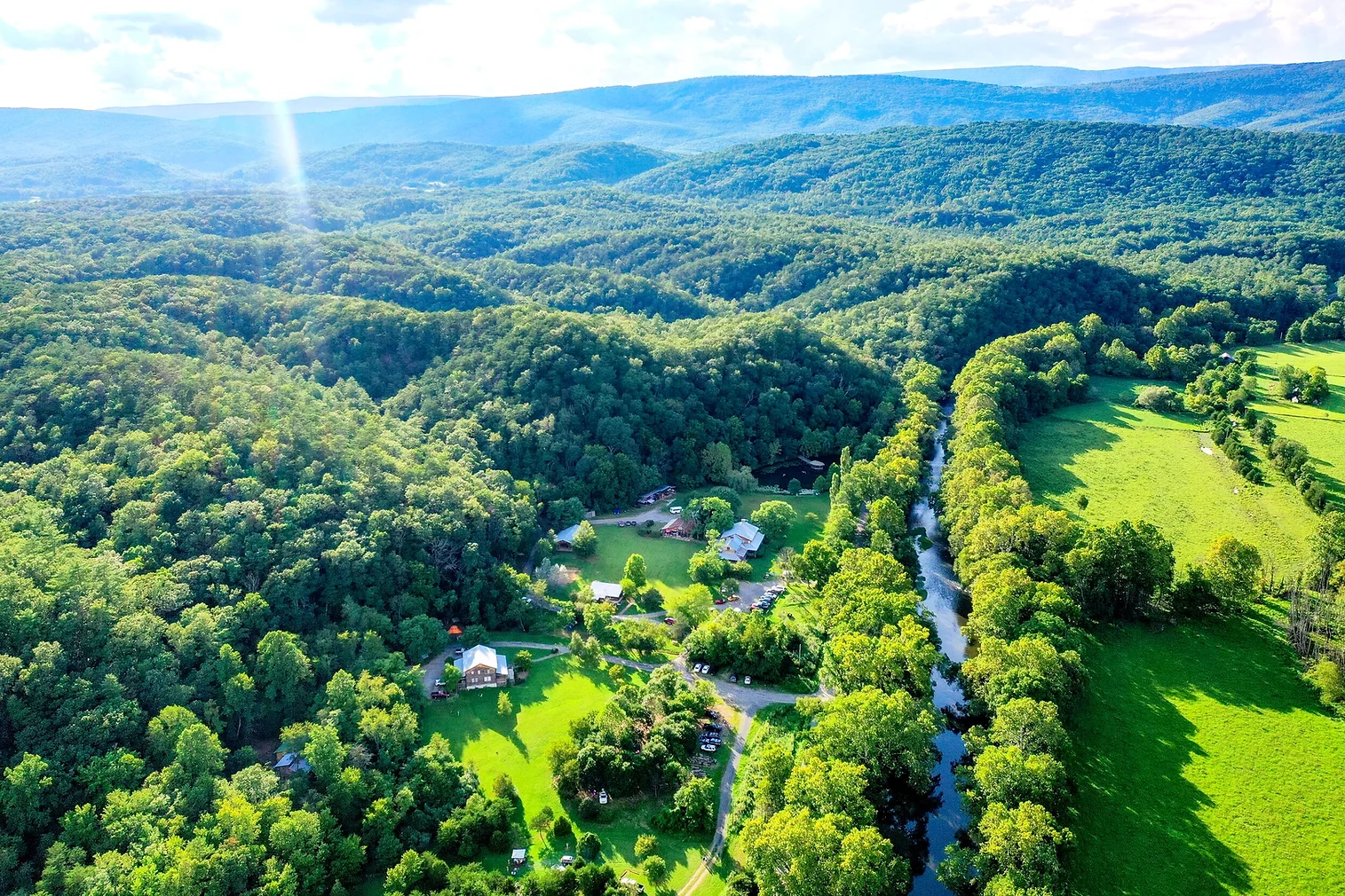
With the disclaimers all out of the way, we made our plans! As we’ve done in the past, we booked our camping at a place called Wilderness Adventures at Eagle Landing. It’s a spot that’s run by some great folks, and there are campsites, lodges, an onsite restaurant, and bathhouse. There’s not a lot out there, and these folks have always taken great care of us, so whenever we’re in this area, it’s one of the club’s go-to spots! It’s about 25 minutes away from the “Potts Mountain Lower Trailhead” where we start the trail.
That first night, we met up and chatted a bit, before heading over to the restaurant. That’s where Ken had his first interaction with a smash burger so good, he was a changed man afterwards. We wrapped up dinner, headed back to camp to chat a bit more, then hit the sack for what was going to be a long and intense day of wheeling!
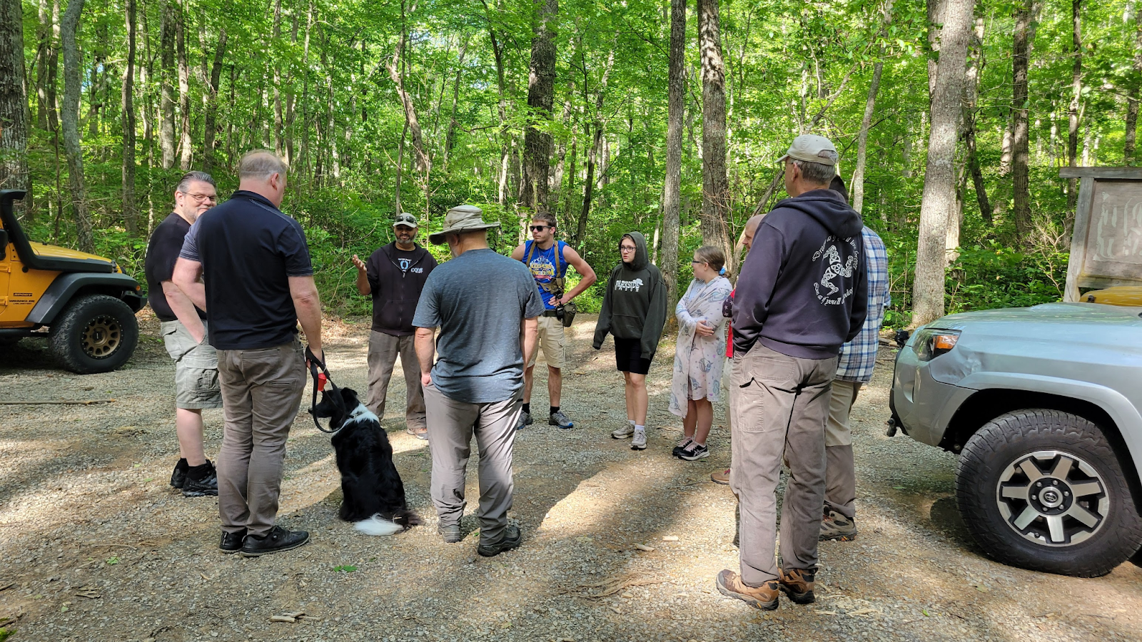
The next morning, we gathered around camp, and headed out to meet Brian at the trailhead. We all aired our tires down, in preparation for the trail. I normally run my BFG KO2s around 36 psi on the street, and most trails in the GWNF area at 20 PSI. For Potts, I go down to the 12-15 range, given the challenge of the trail, and the need for rock conforming grip! Make sure your tires can handle airing down that far, as the risk of popping a bead will increase, and you will spend a lot of time riding the sidewalls into rocks on this trail! After airing down, we had our drivers meeting, did a radio check, and hit the trail!
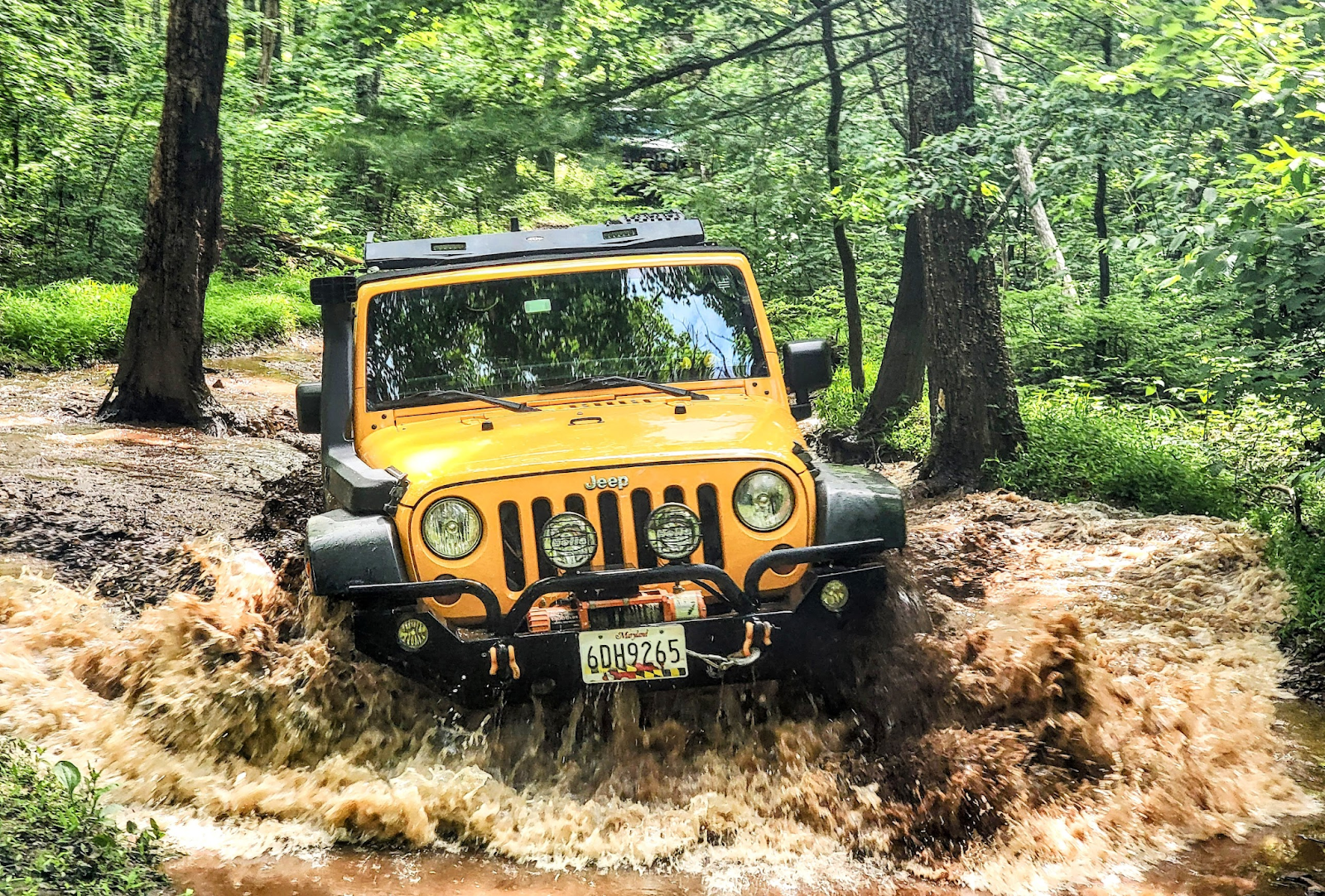
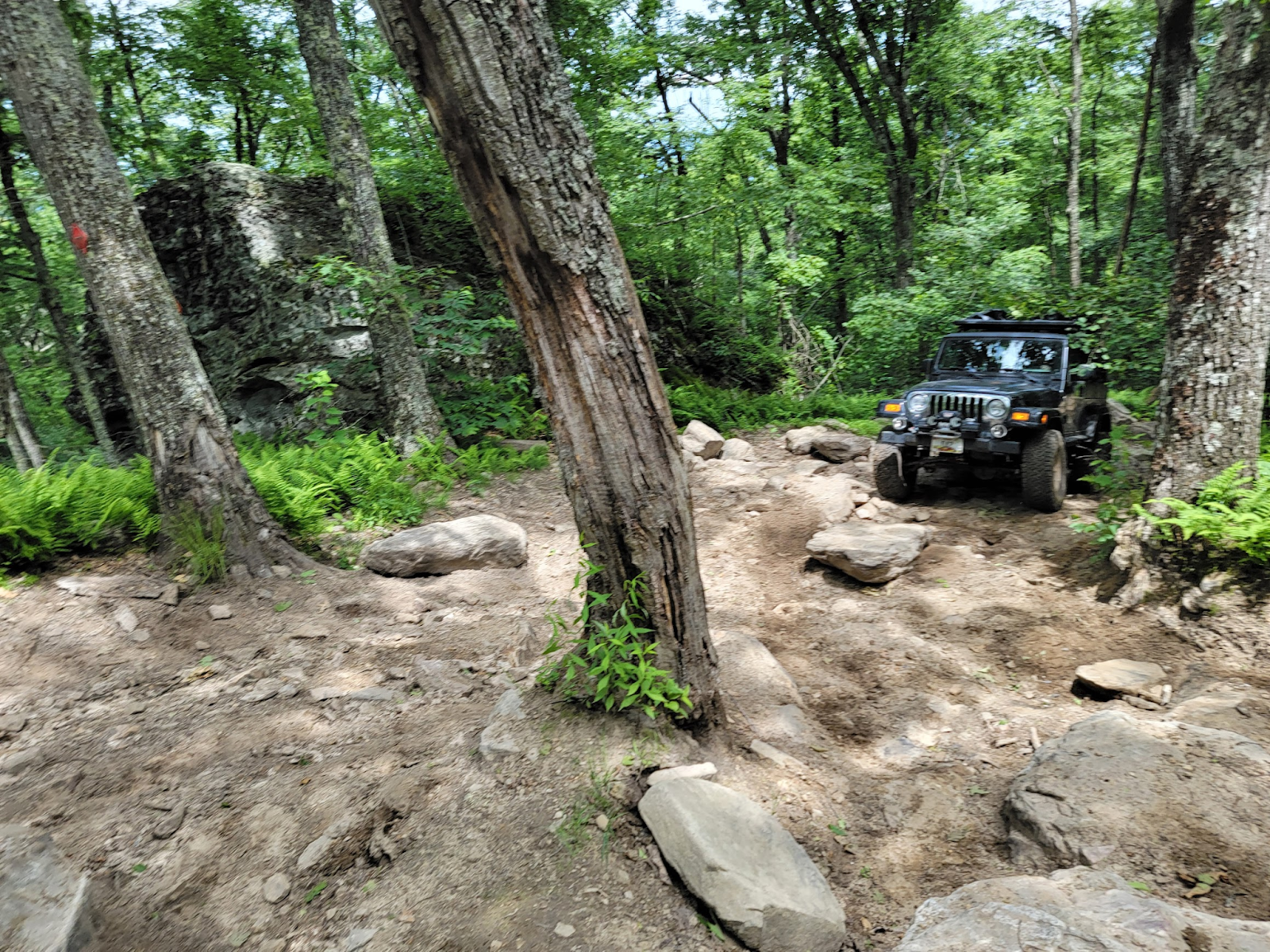
Literally 15 seconds into starting the trail, we were met with our first rock shelf drop into a small creek. Nothing too challenging, just taking it slow to avoid suspension compression and bottoming out, but it’s a good early indicator of what we had ahead of us! As we made our way through, we began our climb up the mountain via heavily forested and rutted out trails. The sides of the ruts were about side mirror height in several places. Looking at the Gaia Topo map, you could see that we were running perpendicular to the topo lines, indicating a steep climb up. We came across a nice big mud puddle, but it had a nice firm bottom, and was easy to traverse.
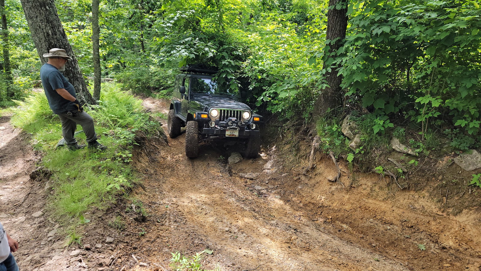
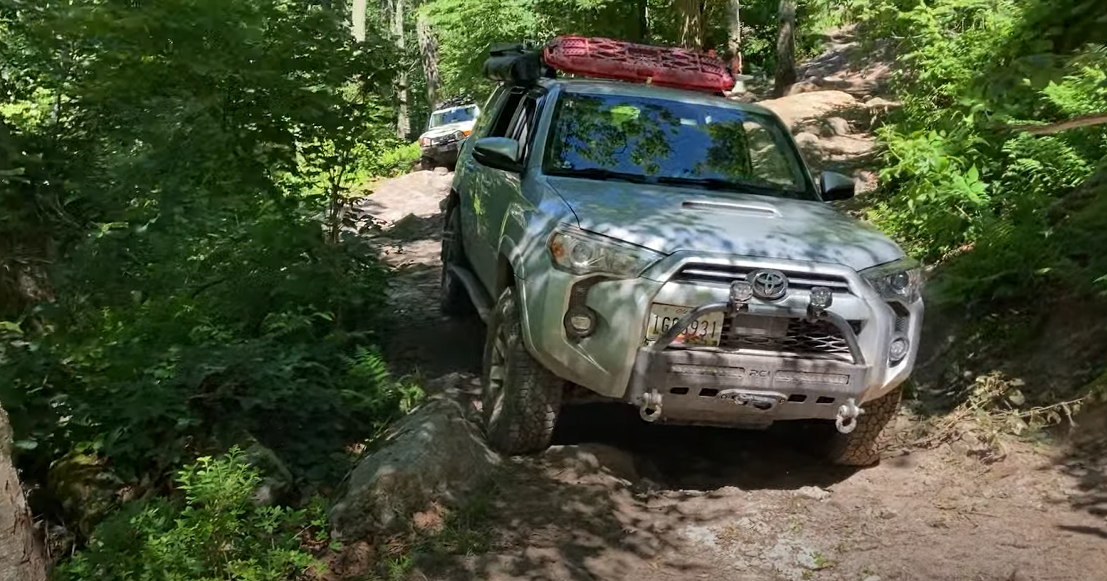
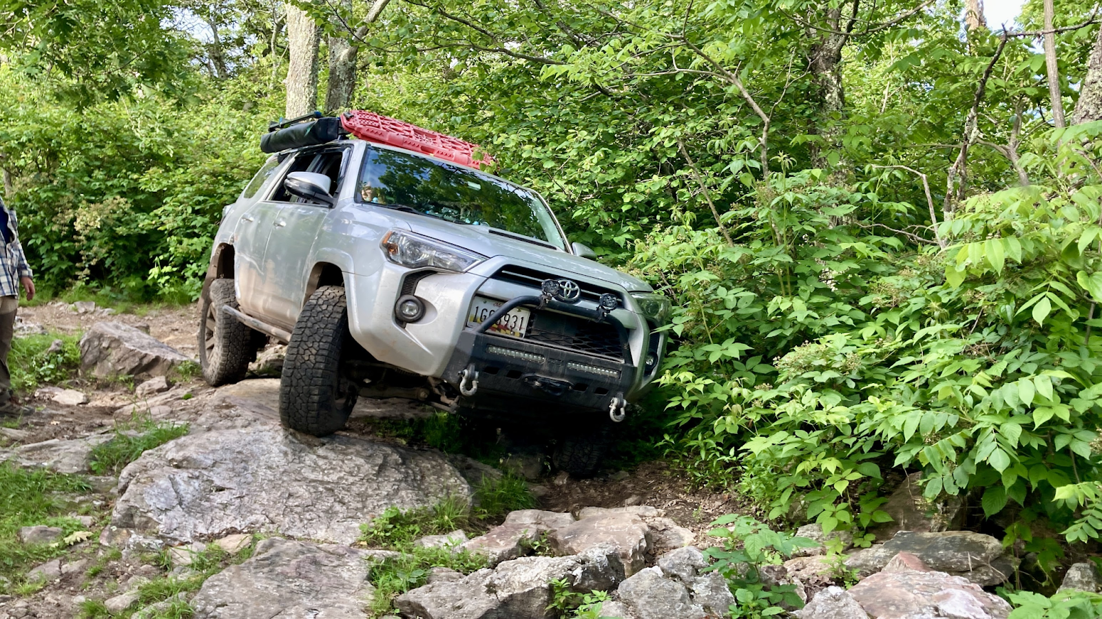
As we continued on, we met our first obstacle, which was a steep rutted climb, with a “gatekeeper” obstacle at the beginning and middle of the climb, right at a tight left turn. I carefully made my way through, and began the climb at a slow pace, pushing as wide as I could against the midpoint, then cutting back driver hard and getting my tires onto the walls of the rut. It was quite a close call! After I got up, I came down to spot others through the rut, focusing on the midpoint outcropping and tight turn. We got everyone through, and then it came to Ben’s turn in the 4Runner. The 4Runner was the widest vehicle of the convoy, and right as he entered the rut, he got too close to a rock on the passenger side, and dented his rear passenger door!

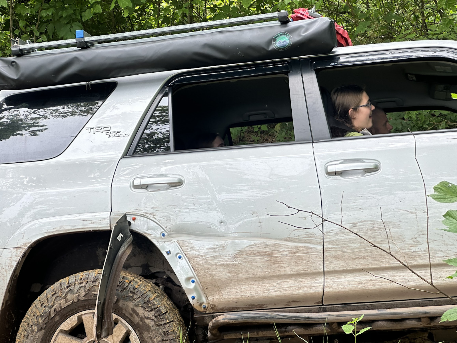
He continued up, and we got him through the midpoint and assessed the damage. It was a healthy, long gouge in the door panel, and his fender flare had also been ripped off. Potts had drawn first blood on our group! After Kirk cleared the obstacle after Ben, we continued on, to see what else the trail had in store!
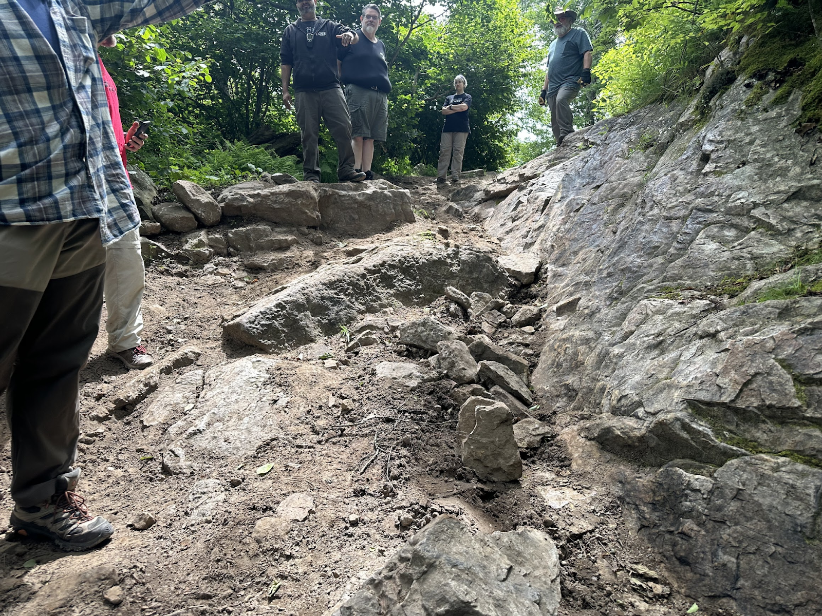
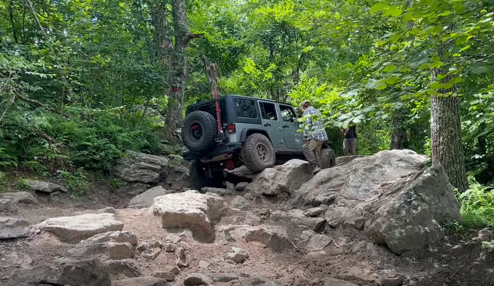
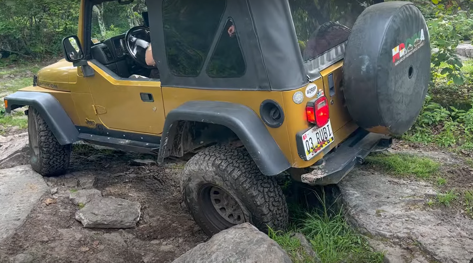
After a few more rocky, but uneventful climbs, we got to the main obstacle that Potts is famous for, “The Valley”. This obstacle consists of a steep, rocky, articulated descent into the valley, and a challenging climb back out over boulders as high as 2 feet tall. To add to the challenge, the boulders are scattered all about the valley. In a change from years past, there were 3 lines available to traverse The Valley on the exit side, whereas I recall only the main route out from my last visit. Now there was the standard path out up the wide left side, which positions you well for the exit, a super gnarly path up the middle that not only is super challenging, but it also positions you badly for the exit, and now an easier bypass up the right side.
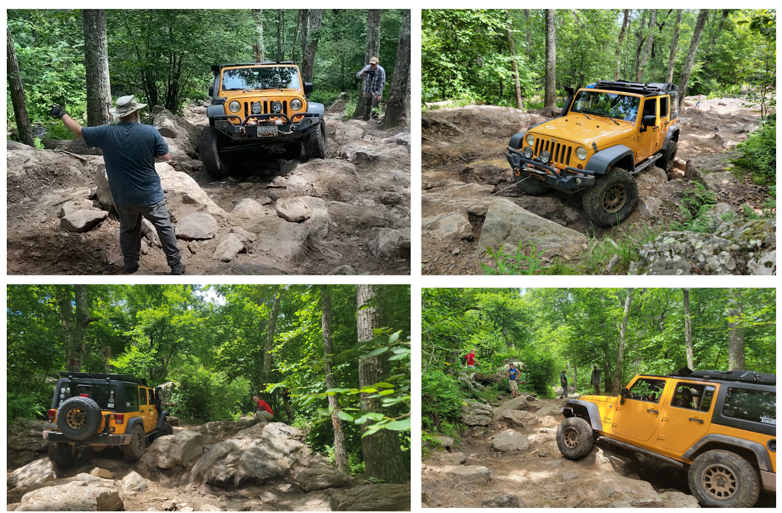
After going down first, I found myself in The Valley that had changed from my last visit, and also found myself positioned badly for the standard wide left line, and lined up with the super hard middle section. I decided to give it a go, which resulted in getting hung up very badly across some huge boulders, and requiring multiple winch rounds to pull myself through, and get positioned for the climb out. This took a lot of time, and I had the opportunity to show everyone which lines NOT to take! But even then, the standard wide left line required going over a huge unstable rock, what moved around as the vehicle went over it, which hung up the longer wheelbase vehicles, causing them to lose grip in the rear, right as the fronts were trying to climb an undercut ledge, and were digging into the dirt, which as soon as you broke through the top, was wet and clogged up the tires immediately. Brian needed to winch to pull past, but once he did, traversed the rest of the obstacle up and out of the valley smoothly. The TJ and LJ with their shorter wheelbases managed to get their tires onto that rock, and made it through easily as well without assistance.

After that, Ben decided to take the new easier line out, given the drama that met the other bigger vehicles. But, the entrance to the easier line was far from easy, once again presenting a challenge for the longer and wider vehicles, forcing them to climb multiple rocks and undercut ledges at once. To add to it, Ben encountered some damage to a skid underneath that required a bit of finesse with a large hammer to free up before continuing. After some time on the winch, Ben got through the entrance, and with some spotting, got all the way through.
Next it was Kirk’s turn, and he decided to take the standard wide left line as well. But, being ever so slightly longer than the TJ and LJ, had to straddle the rock and got hung up the same way Brian did. So, we broke out the winch, and right in that moment, it stopped working! A post trip assessment pointed to dirty contacts on the remote cable being the culprit, but out on the trail, we didn’t have the luxury of time to completely diagnose, so Kirk had to take the new easier line out as well. He did with a bit of spotting as well, without any additional drama. And with that, we all made it out of the valley! It was a 3 hour slog to get us all out, and I can’t thank the crew enough for helping me get my Jeep and everyone else through as a team. It was a long and tiring endeavor, and we learned a lot, and everyone really came together to get through!
Also as a side note, a misguided individual with a completely stock GMC Yukon found himself at the entrance to The Valley behind us, and got high centered before even getting into the obstacle. Some of our group went to help him, and with some convincing, he reassessed his plan to continue, and turned around. There is zero chance he would have made it out, and he did not have any recovery gear, winch, or additional underbody protection.
After that adventure, we continued on, with the occasional rocky climb or obstacle that required a bit of finesse to get through, and then we reached The Meadow, which was a huge clearing at the top of the mountain where we assembled for a group photo! This is a great lunch spot as well, but since the slog through The Valley took so long, most folks snacked and ate their lunch there, so after our photo, we pushed on! After re-entering the forest, we continued to come across the occasional hard obstacle which required spotting and guidance, but we were able to pick up our pace to a degree.

Based on my recollection, the general nature of the trail was more challenging than in the past. The rock ledges and boulders were taller and more undercut, making it easy to get hung up, or making it difficult for the tires to climb. Careful line placement, and the occasional slam into the skid plates or rock sliders got us through most everything.
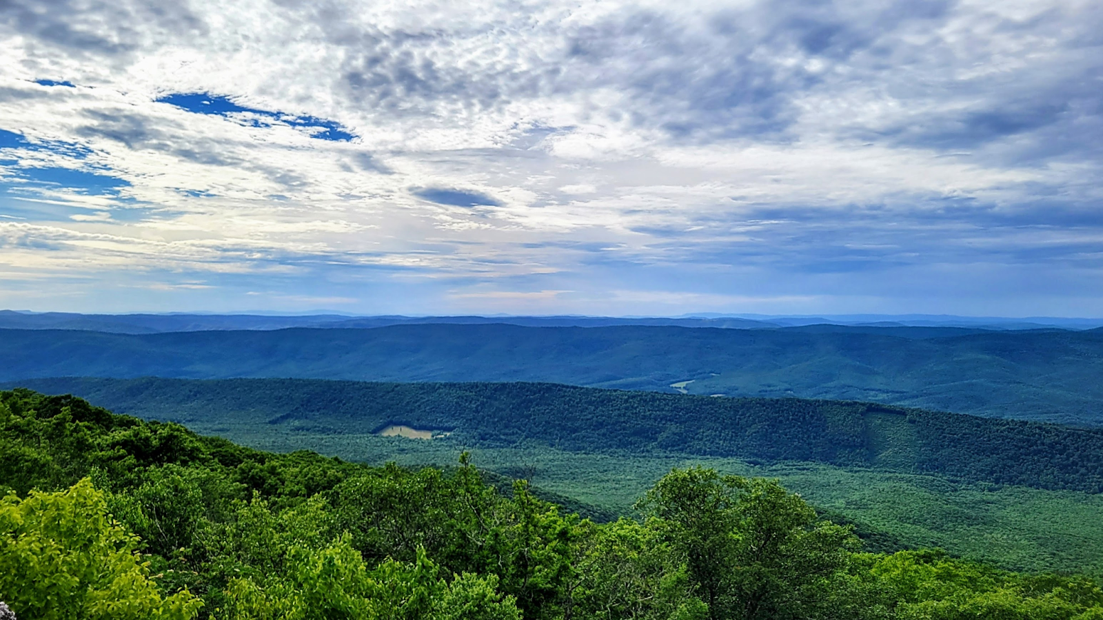
We got to what would be our last major obstacle, a long climb up a steep rocky ascent, with a sharp left turn near the top, followed by a sharp right to the exit. This too seemed a bit more challenging, in that I felt the need to crawl it more slowly this time, whereas I took it with some more momentum in the past and just bounced around on my way up. But, we made it up, parked up, and went over to a rocky outcropping, with a beautiful overlook of the valley below!
After that, we continued on. Same as before, there were sections where it was quite rocky, with 8-12 inch tall pointy rocks and dropoffs, with the occasional 16-20 inch tall rock that required getting around or climbing over. It made for slow going. Also, after all of the challenges that we had already been through, we were starting to get tired as well, and the slow going over challenging terrain was starting to wear on us! We love this kind of stuff, but we were all pretty tired at this point, and could certainly use a break! We (and particularly Ken) were keeping a close eye on the clock as well, because the campsite restaurant closed at 8pm, and if we got back too late, then we’d have to find our own dinner, and would not be able to partake in those delicious smash burgers!
So with growling bellies and fatigue from a hard day, we continued on and got to the last optional obstacle, Poser Rock, which we had tackled in the past. We opted to not take it on this time, and pushed through the rest of the trail. We finally reached the end of the trail, at around 7:20 pm. Navigation and GPS was giving us some spotty advice, but I had mapped out a route prior in Gaia to get from the trail exit back to camp, so we boogied back to camp to get back in time for dinner. We made it, much to the group’s relief!
After another night of delicious food, we had the intention of getting around the fire to reflect on what we just did! But we were all so exhausted, that most of us called it an “early” night, and crawled into our tents to recover! The next morning, a few folks snuck out early to get back, as we were further from home than we usually get, between 4 and 5 hours away for most of us. The rest of us groggily woke up, put ourselves back together, assessed our battle wounds, and headed home.
We had done a big thing! We took a variety of vehicles, from simple, small, and light Jeeps, to big family haulers, Ben and his 3 kids in the 4Runner, and me with my wife and two toddlers in baby seats, to huge built rigs like Rich’s lifted LJ on 35s and Brian’s monster JKU on a big lift and 37’s, to vehicles that straddle the middle ground between long and short wheelbases like the FJ. We took these daily drivers onto a hard gnarly trail that required winching, teamwork, spotting, patience, and support, and made it through Potts, a bit battle bruised, but we made it!
We all came away with thoughts on how to improve our rigs, and look forward to taking this on again in the future!
Potts Mountain
Profile
No data
No data
No data
No data
No data
No data
Duration:
No data
Trail Report written by Jendra Rambharos. Pictures contributed by Jendra Rambharos, Aimee Rambharos, Rich G, Matt M, Ben Dunkerton, Josiah Dunkerton, and Ken Kyler. GPS track provided by Jendra Rambharos.