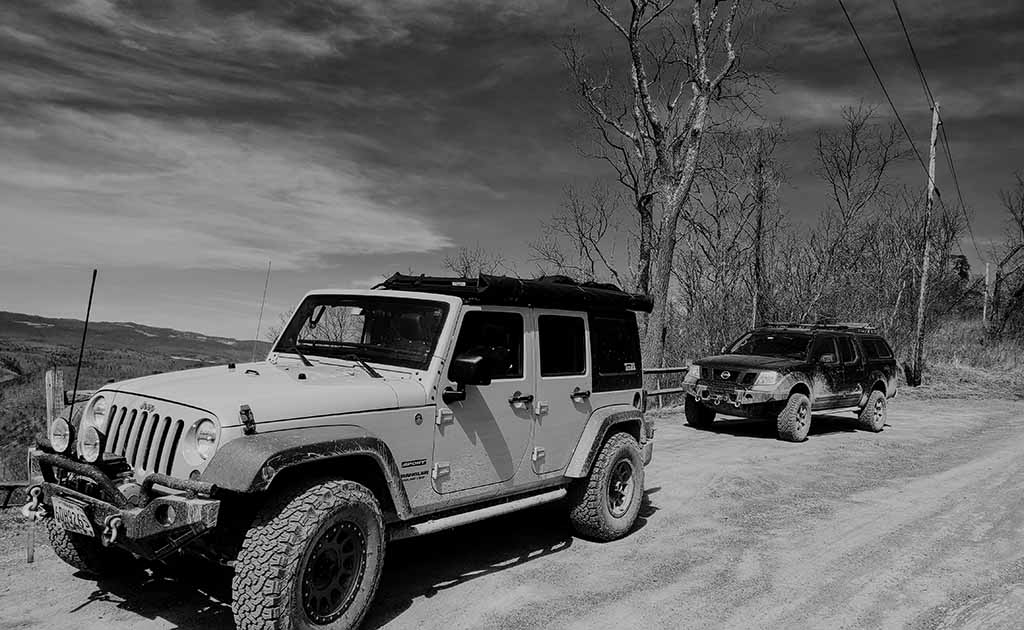
On the weekend of March 13th, a couple of members from the CORE 4×4 Club ventured out to Green Ridge State Forest to do a bit of early season recon on the trails, campsites, and get a feel of the area before things start to get busy.
Temps were expected to be down into the 30’s overnight, with highs in the 50’s. On Friday night, Jan from the club went out to Green Ridge first, and set up at campsite 73, located here.
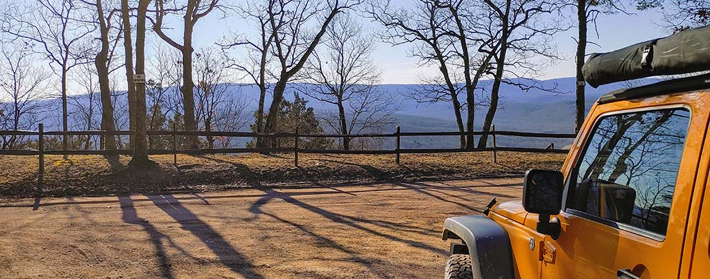
It was a great site, higher up on the ridge line, with a great view of the stars. In the morning of the 13th, I met Jan at his campsite, and we put a plan together for our initial exploration round. The plan was to check out the Trigg Rd and Mertens Rd areas, which from what we’ve heard presented some more interesting trail riding opportunities for 4WD vehicles.
After following a Gaia route, there appears to be a spot on Mertens where you can make a left onto Twigg. Unfortunately, however, that entrance was closed, and seems to be closed permanently. So to access Twigg Rd, you must continue to Jacobs where you make a left, then make a left onto May Rd. Once on May Rd, after a short drive it intersects onto Twigg Rd. From there, you can either make a right onto Twigg, and follow it down, or make a left and head towards the closure.
We took the left towards the closure, to see how far up the closure went. We nearly got to the intersection of Mertins, so the closure isn’t very large. We were unsure why it was closed, possibly a trail obstruction or washout.
We continued down Twigg and followed it through. Right past the May Rd intersection, there was a sign indicating “4×4 Only”. As we continued down, the trail was dotted with some roughly vehicle sized mud puddles. Nothing difficult, but enough to slather the vehicles in the off-road trip obligatory mud splatter!
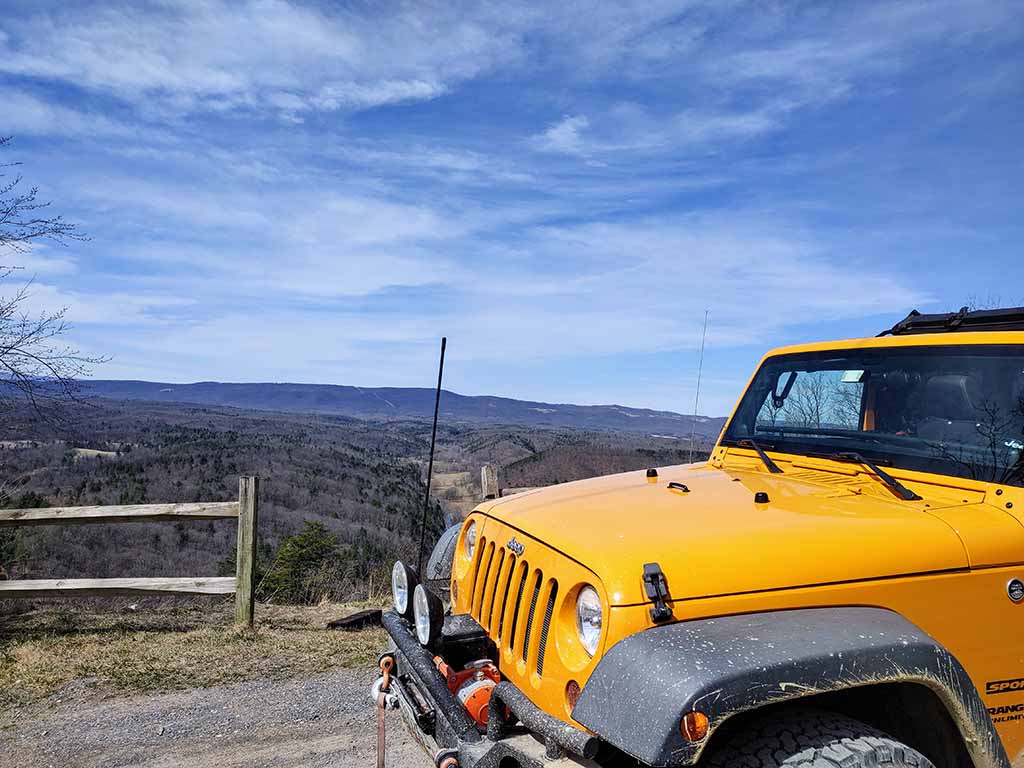
The rest of the trail was beautiful, but not particularly difficult. 4WD was not required for any of it, but some sections did need some decent suspension articulation and good tires.
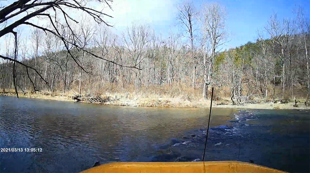
After that, we decided to tackle the Town Creek water crossings on the other side of the forest. They weren’t far from where we were, but there was no direct route from Twigg to the crossings, so we had to get back onto the main road to get over there.
Once there, the crossings presented us a bit of fun crossing them. They were a bit deeper than we remember, so some haste in getting through them was certainly warranted!
After the final cross, Jan had to head home. I decided to stay the night, so I proceeded to the ranger station to put my $10 in the drop box, and sign up on the sheet for a site. The way Green Ridge works for camping is that most sites, about 100 of them, and primitive dispersed sites. This means they have a rock ring, a picnic table, and nothing else! They are first come, first served, and there is a big sign up sheet with all of the sites listed. Once you pick a site, you put your in and out dates, and sign your name, and the site is yours. There are also larger group sites that must be reserved ahead of time. For the primitive sites, most probably max out at 2 vehicles and 2 tents. There were a couple that I came across that looked larger, and could accommodate more vehicles and campers. A trip for another time is to do a little note taking to see which sites could accommodate bigger groups.
Once thing to consider, is that the Ranger Station is a fair distance from most of the sites, so give yourself plenty of time to get to the sites after checking in to get to your site and set up.
After checking in, I went back to site 73, as I knew that site was unreserved. After getting there, I set up camp for the night, enjoyed some dinner, and turned in. It was a comfortable night, getting into the upper 30’s overnight.

The next morning, I packed up camp, and decided to head south, to get down into the valley and do some more exploring before wrapping up the trip. It was a beautiful drive, much of it alongside a small creek. The trail and the creek crossed a couple of times, but there were small crossings, maybe 3 to 4 feet wide. After reaching the Basecamp Rd loop, I went around the loop, but near the end, there was a large tree that had come down across the track. I wasn’t prepared with the equipment to take it down, and was also solo, so didn’t want to take on any risks. So I turned around, and retraced my steps, and headed out of the forest.
It was a great trip, and we look forward to planning another club trip out there soon!
Gaia Track Link here.
Trail Report, photos, and GPS track by Jendra Rambharos.