Intrepid Explorers:
- Ken K – Jeep Wrangler TJ
- Brian S – Jeep Wrangler TJ
- Jendra R – Jeep Wrangler
- Ben D & son Josiah – 4 Runner
- Matt M. – GMC Yukon Denali
The Canaan Loop near Davis, WV along with Canyon Rim Road is a popular offroading destination. Less well known is the Richford Road ford of the Dry Fork of the Cheat River. I wanted to do all three and as I researched for the 2024 club trip, I needed more information about group sites, a river level benchmark using the USGS river gauge at Hendricks, and the difficulty of the washout on Canyon Rim Road. There are several videos on YouTube of the washout and they seemed to be consistently worse over a three year period. As a newbie, I had my doubts about it. What better way to get answers than to go!
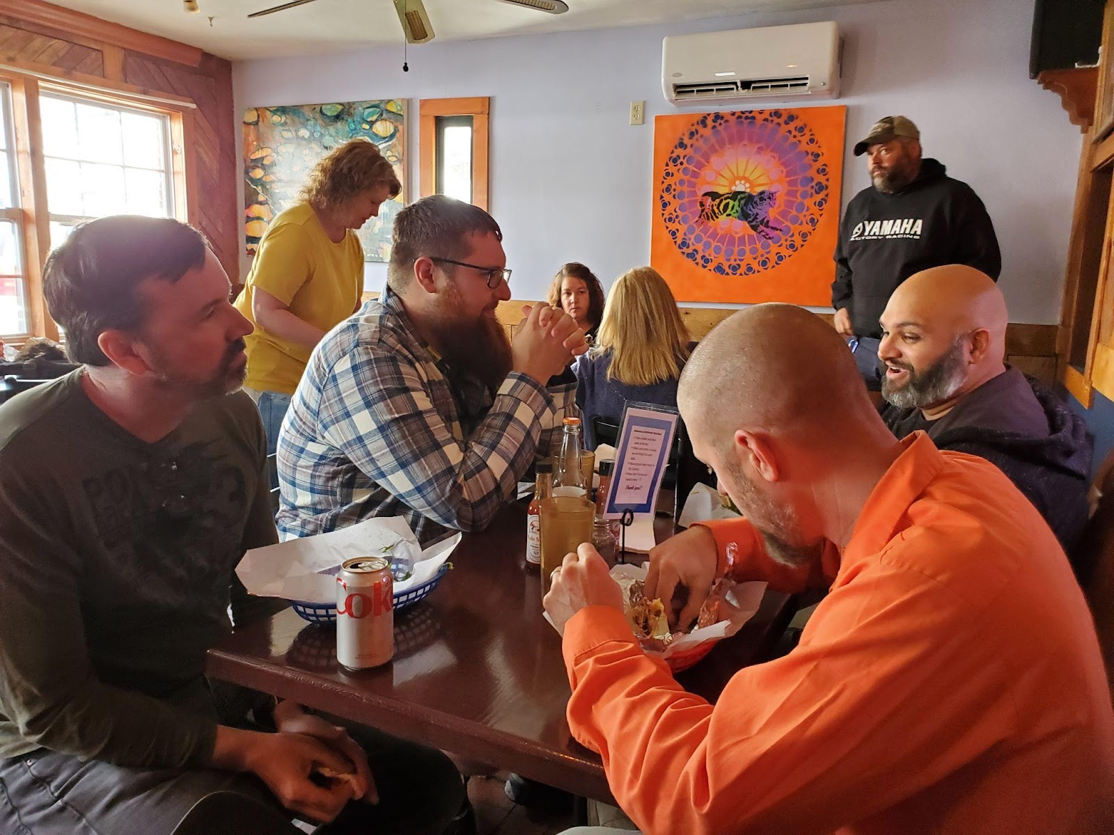
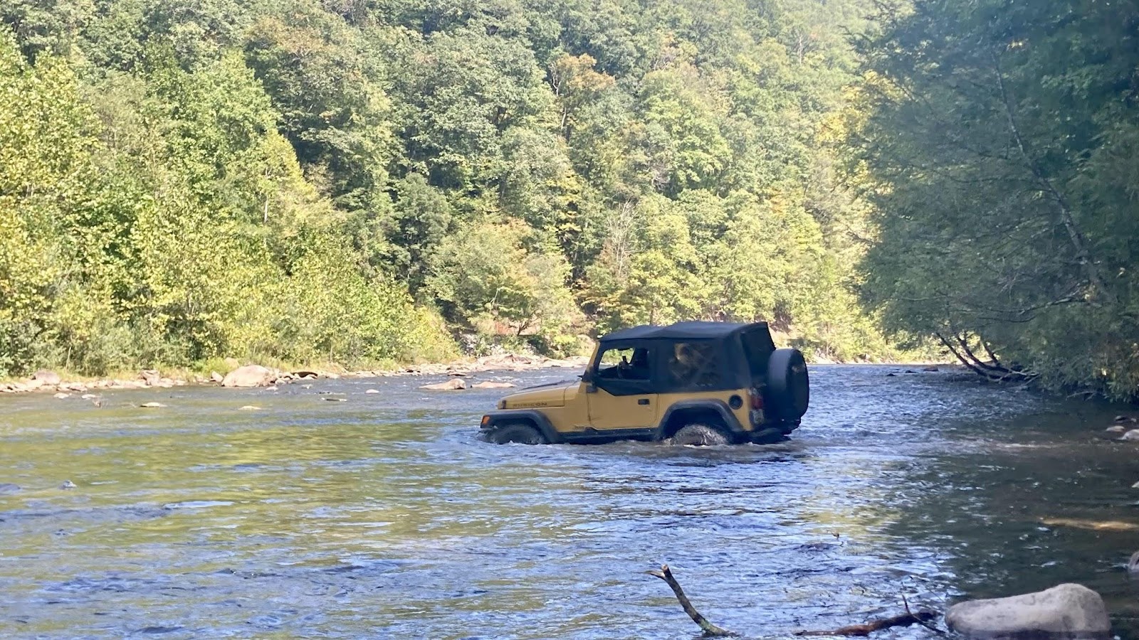
We met at the Big Belly Deli in Davis, WV which turned out to be closed. Fortunately Hellbender Burritos was a few doors down and wow … They serve YOUGE burritos! Properly fattened, we headed to Richford Road scouting camping sites and enjoying the view as we went. For the record, there is a very large group site right at the ford that can easily handle 10-12 tents. The river ford … well, that was our first serious entertainment opportunity and it delivered! Matt demonstrated an interesting technique to testing the river depth; the breast stroke was a new one for me Matt!
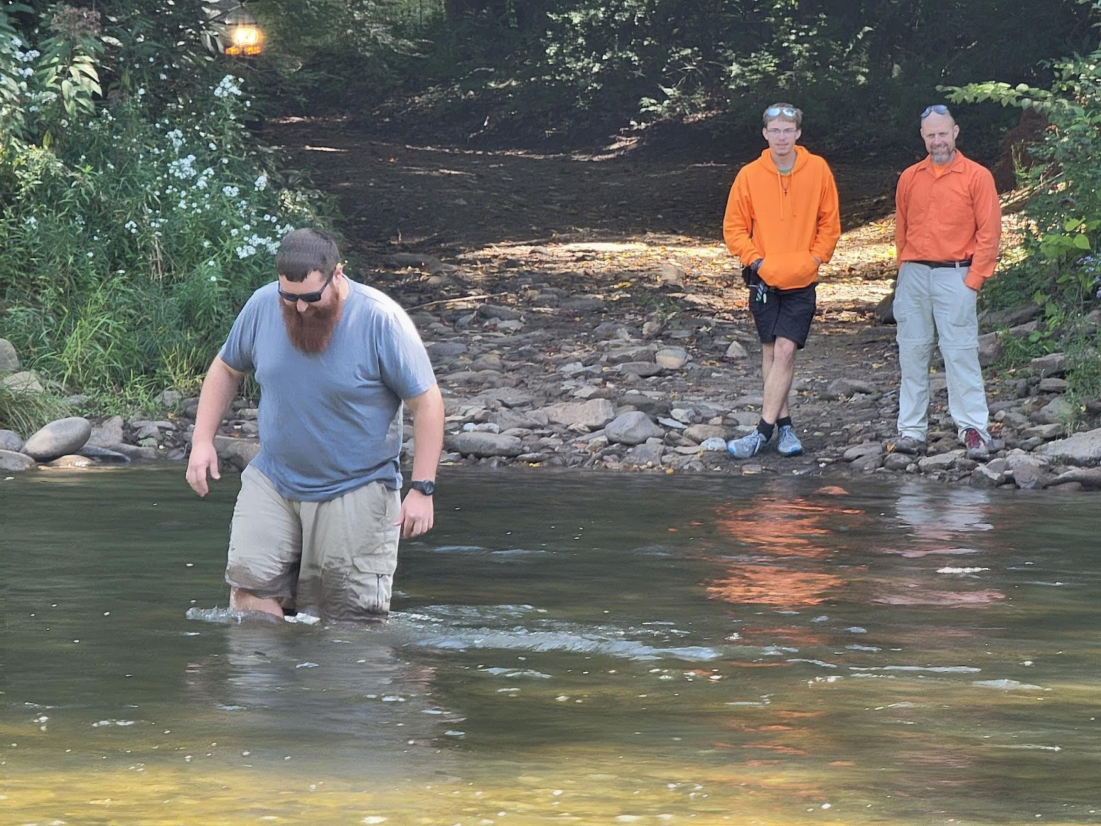
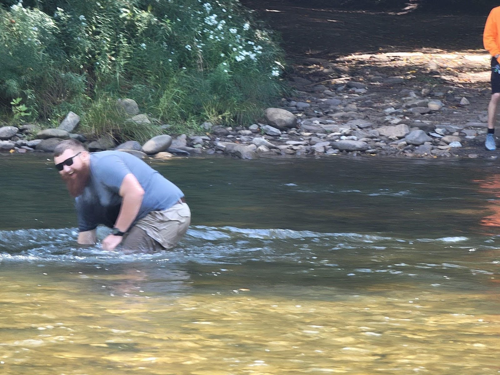
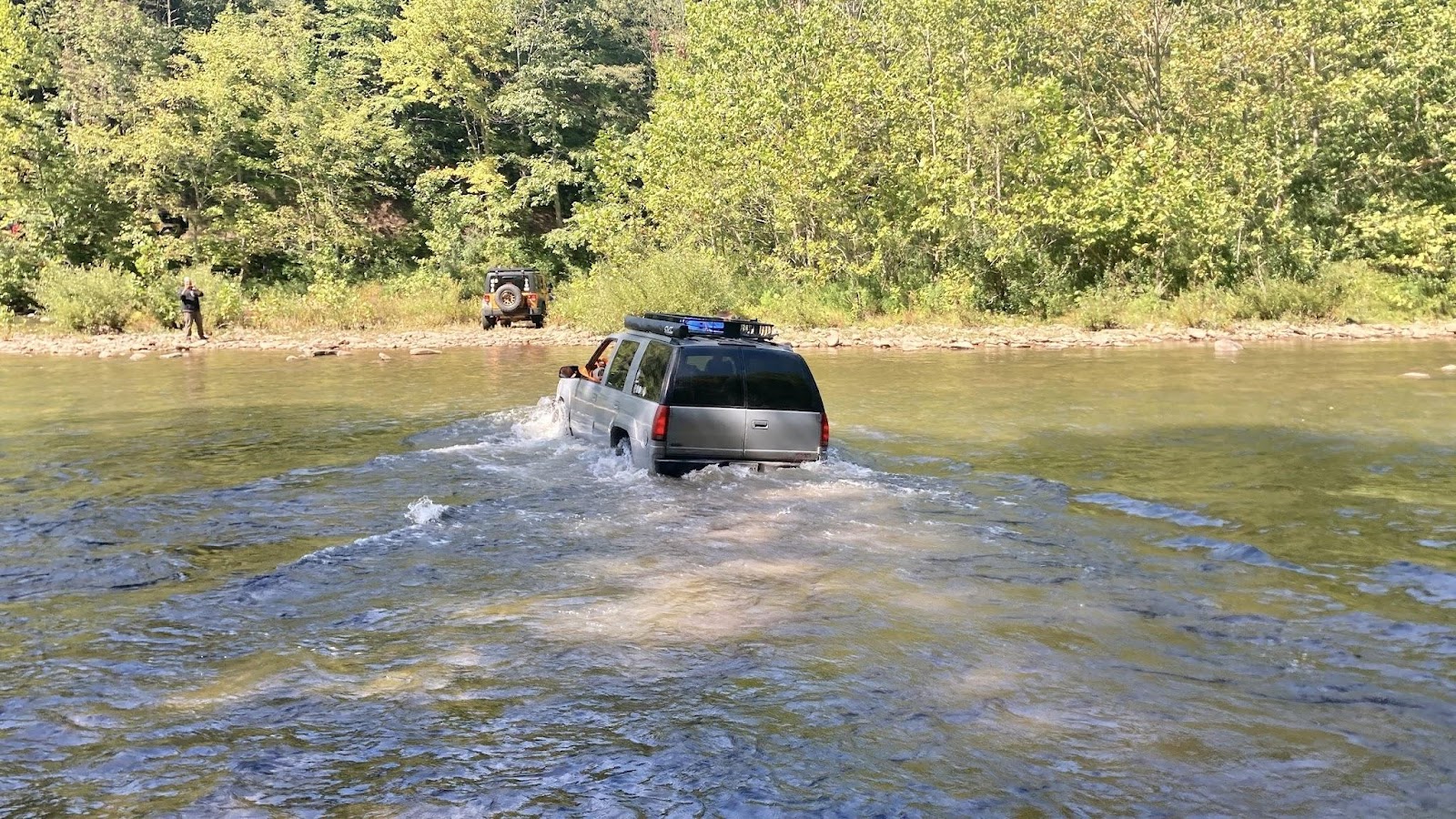
Ken and Brian, both in lifted TJs, made it look easy although Ken was too far right and it got a little deep and bouncy. Everyone made it fine, there were no vehicles flooded, no winching required and a whole lot of grins. For reference, based on the USGS river gauge at Hendricks, WV (https://waterdata.usgs.gov/monitoring-location/03065000/#parameterCode=00065&period=P7D&showMedian=true), we crossed it when the level was 2.3 feet.
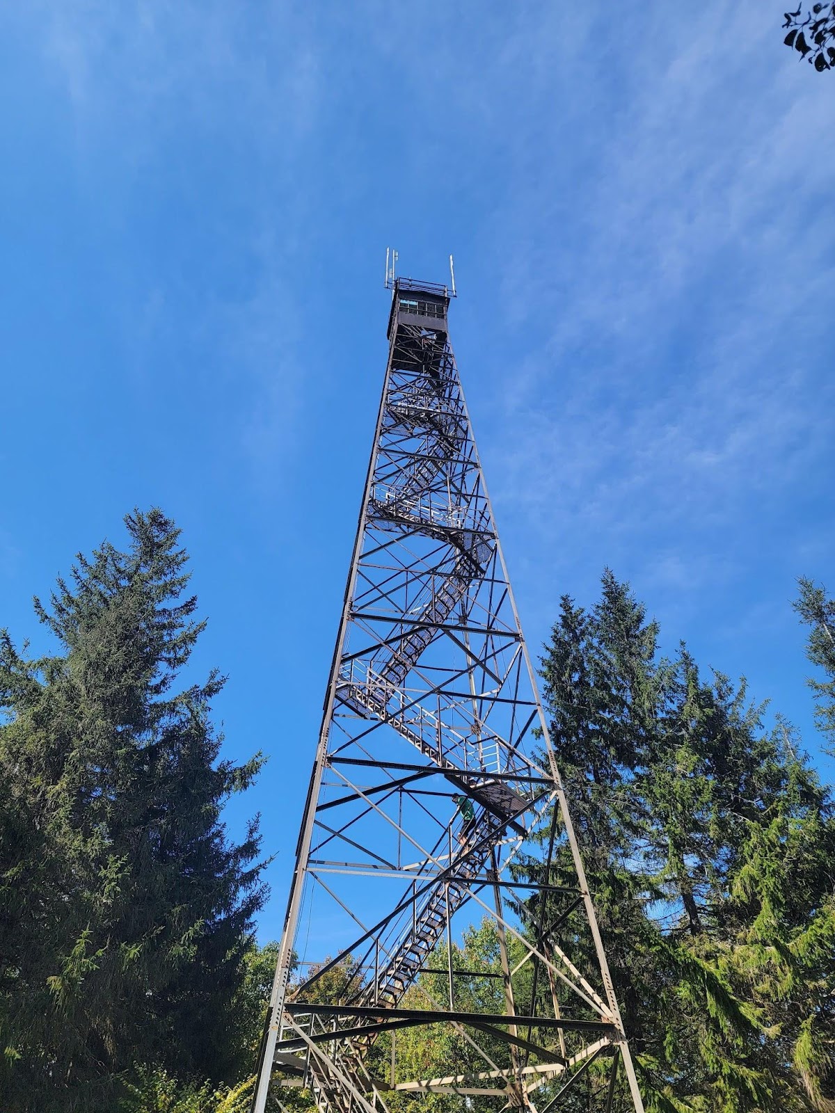
We made a short stop at the fire tower. Ben demonstrated a serious lack of respect for heights, as did Brian. The rest of us either didn’t go or only went up a few flights of stairs.
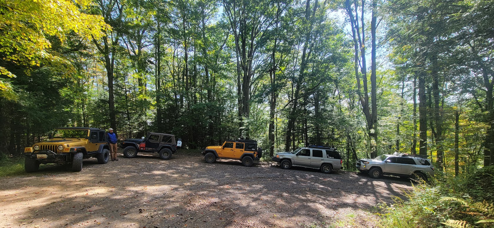
Next was the group site on Canyon Rim Road. It was suitable for five of us and we likely could have gotten one or two more vehicles there. I knew rain was coming and was thankful we had the river crossing behind us.
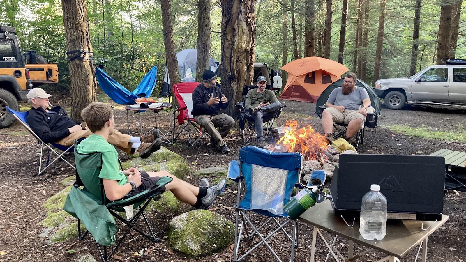
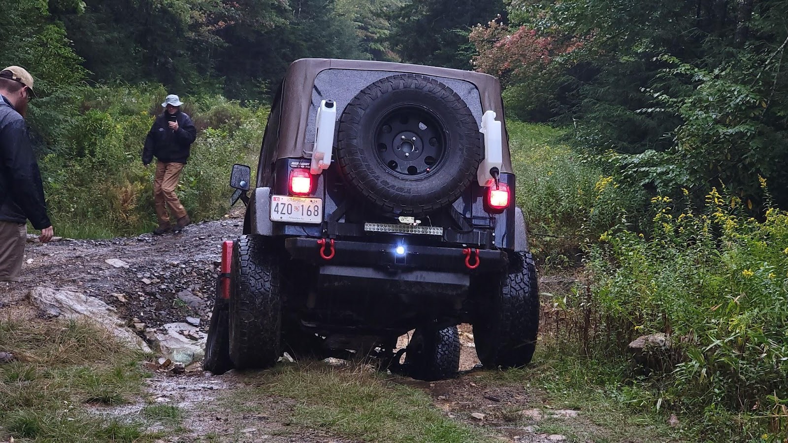
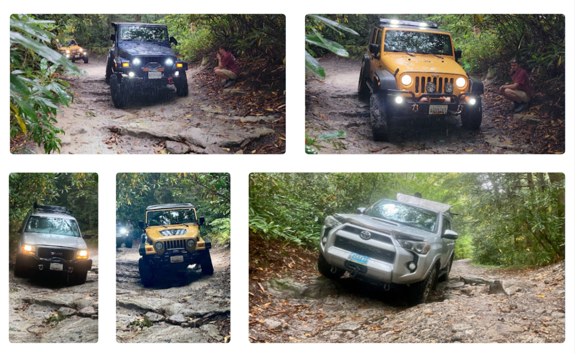
Mother Nature delivered as forecasted and at 5 AM it started raining. Fortunately it was a light rain and when all had arisen, we broke camp. By the way, it rained on and off all day. Next was the infamous washout or so I thought. We first came to a partial washout. There was a safe route on one side and the other looked impassable. I knew we were in trouble when 4 out of 5 drivers stood at the impassible section discussing lines.
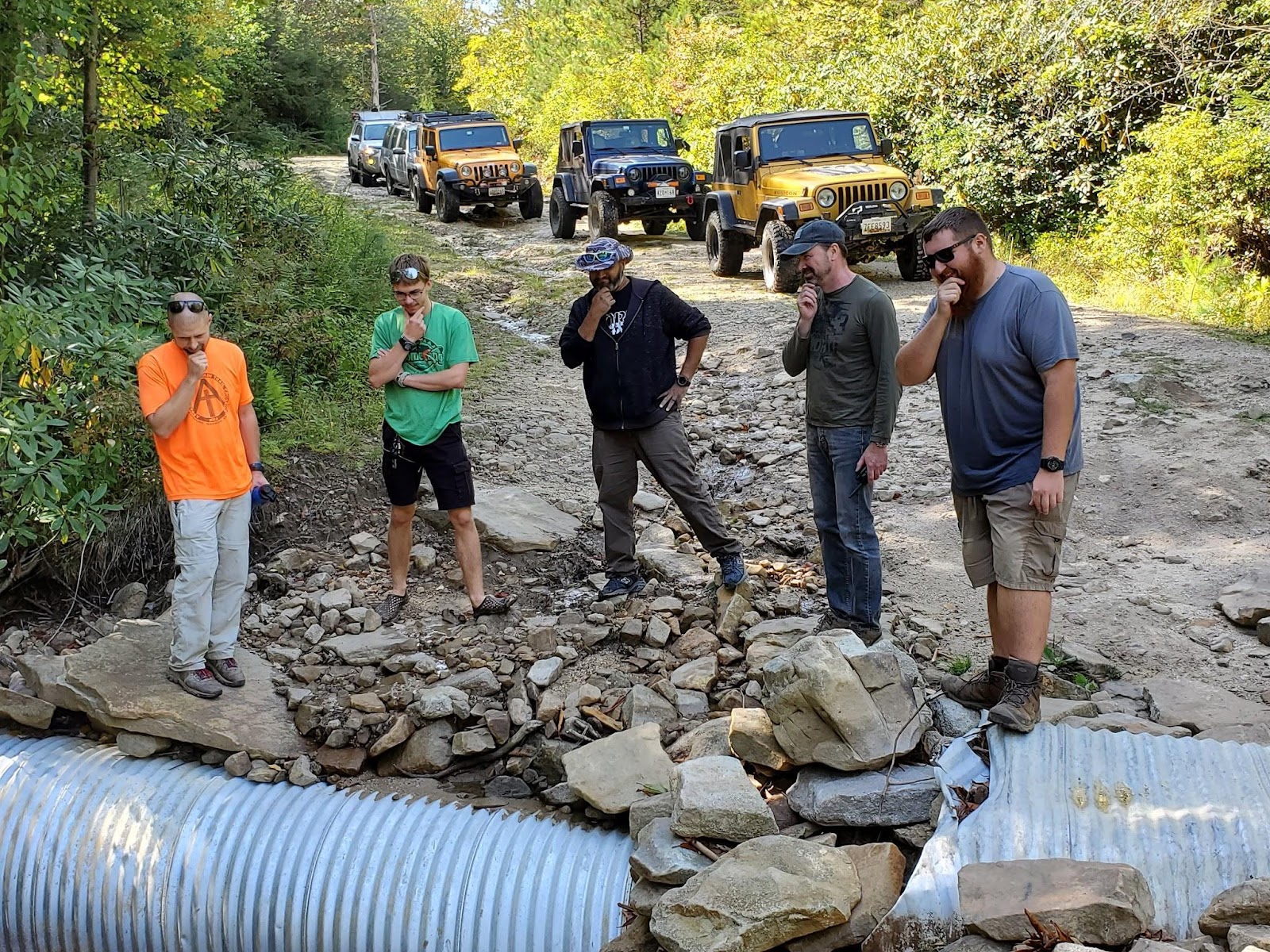
Ben started tossing in rocks and that was it. Matt and I took the easy side. Jendra was first to try the hard line and showed us that the far edge, even though undercut, was doable. That was a spectacular performance and just baited the others to also try it. Brian had an easy time as well. The mighty 4Runner, well, the pictures say it all.
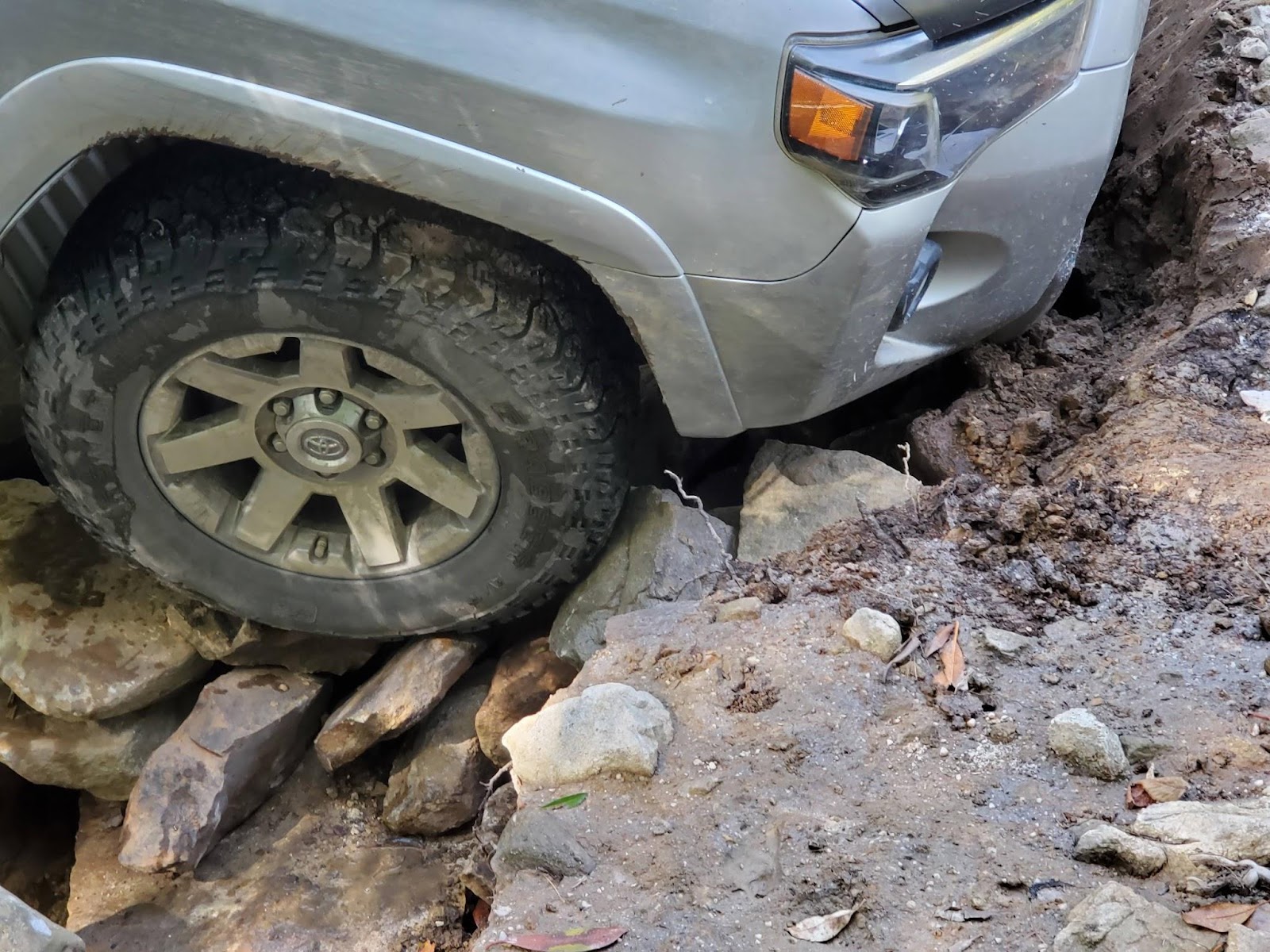
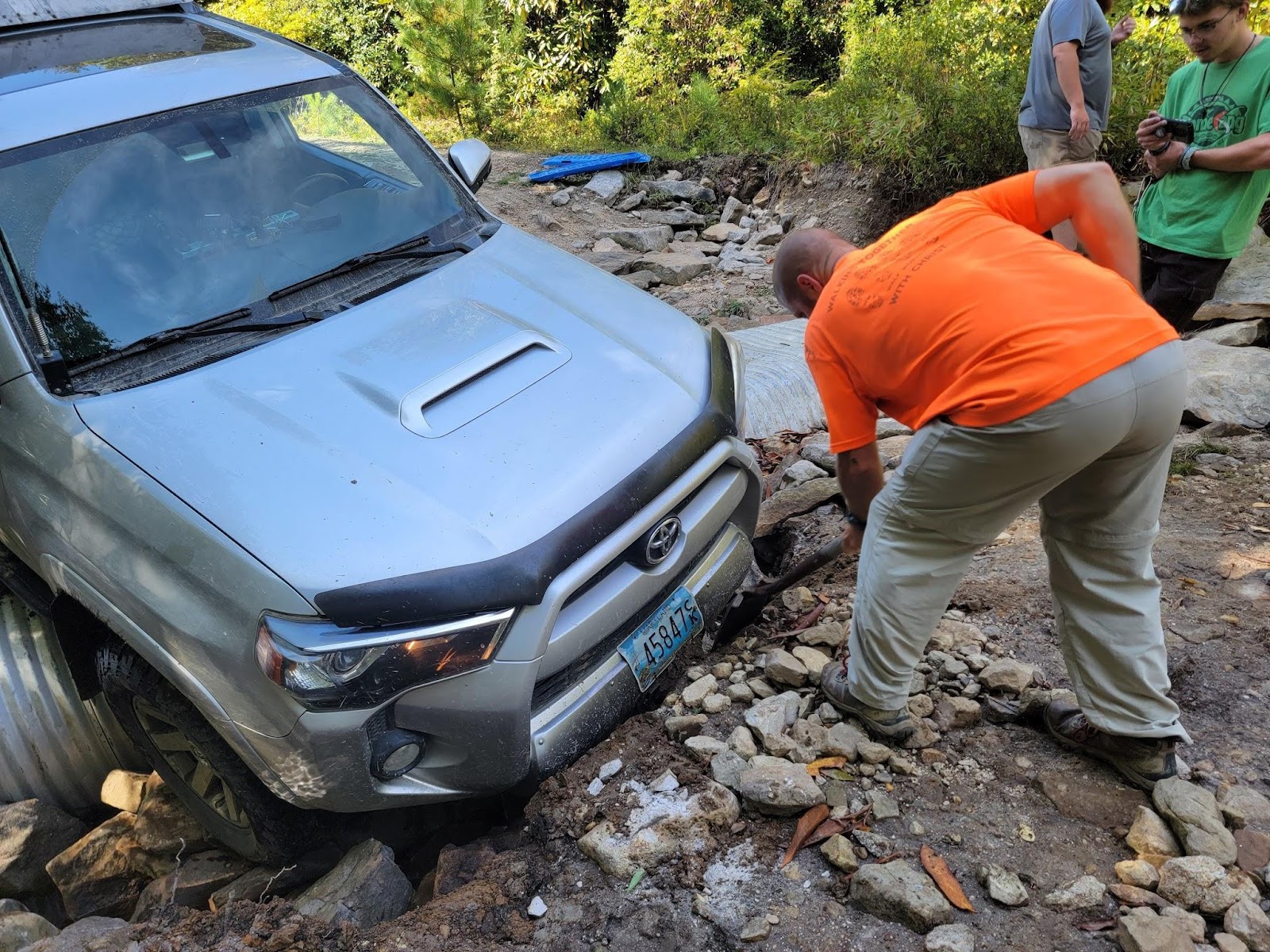
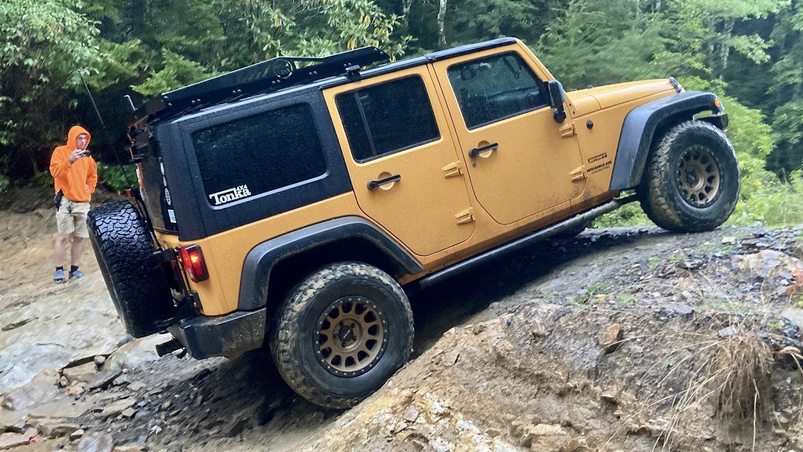
Ben doesn’t take no for an answer. A second bout of rock tossing and judicious digging did the trick and the 4Runner heroically got through. The road continued to deteriorate and became rough. Some of us had aired down a little but I think we all wished we had aired down a lot. The infamous washout came soon enough.
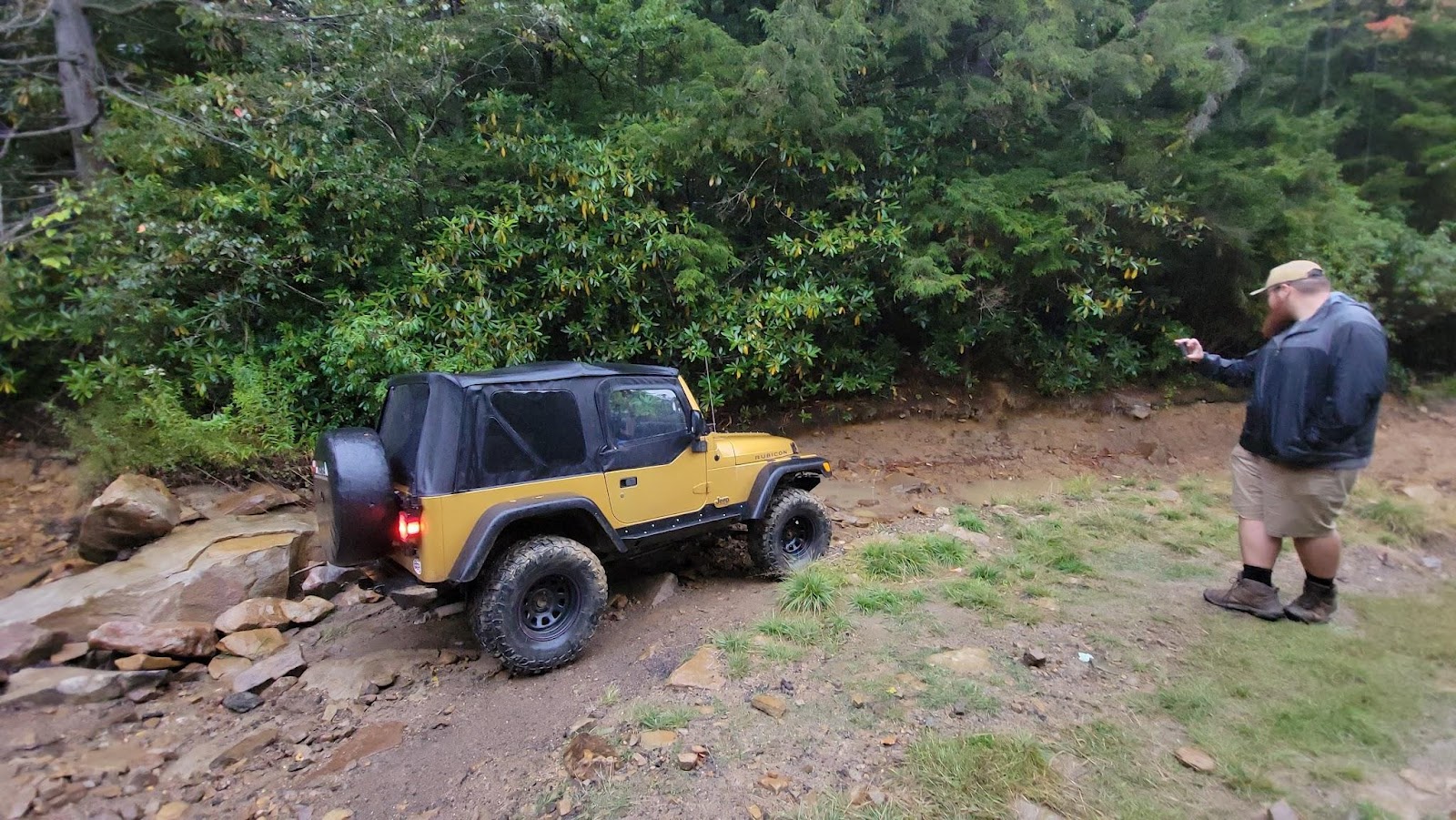

Ken and Matt chose the route most traveled. It looks easy in the pictures but the washout is roughly 4’ deep. The others were not going to wuss out but this time no road construction was required. Brian went first and showed that a TJ can almost climb out using the front axle only. Jendra and Ben had no issues.

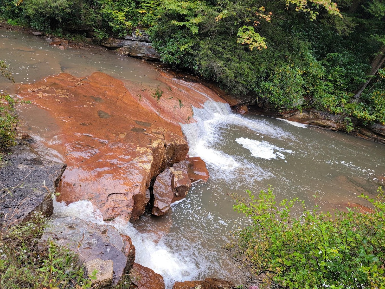
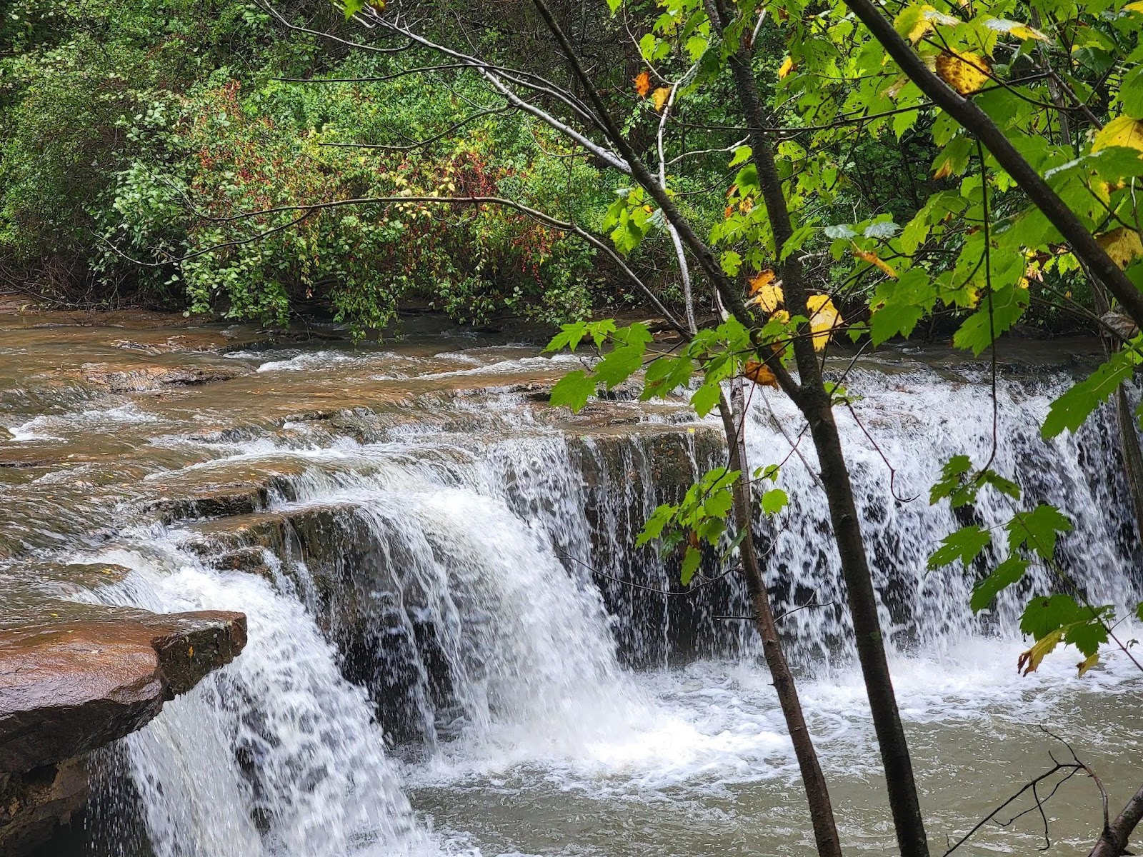
The worst obstacles I was expecting had now been overcome. On our way out, we stopped at Douglas Falls which I think everyone will enjoy next year. The waterfalls were awesome.
We had three sections done and the last one, Canaan Loop Road, was next. Some of the best scenery was there. The ferns were just gorgeous and the trees were just starting to turn colors.
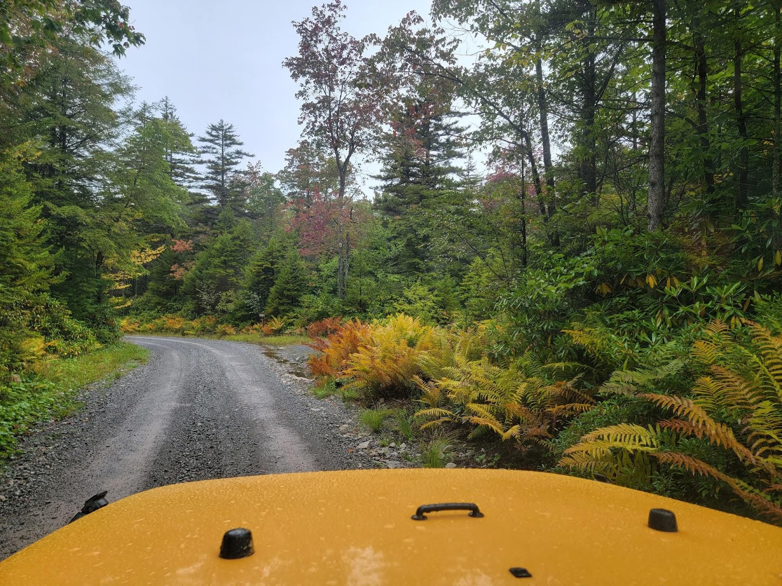
The majority of Canaan Loop Road was well maintained gravel and great scenery. The challenging section was only a few miles long and pretty straight forward. We stopped to scout a few times but no spotting was required.
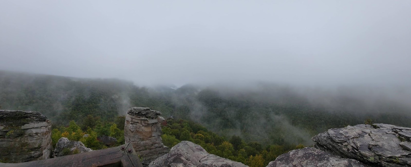
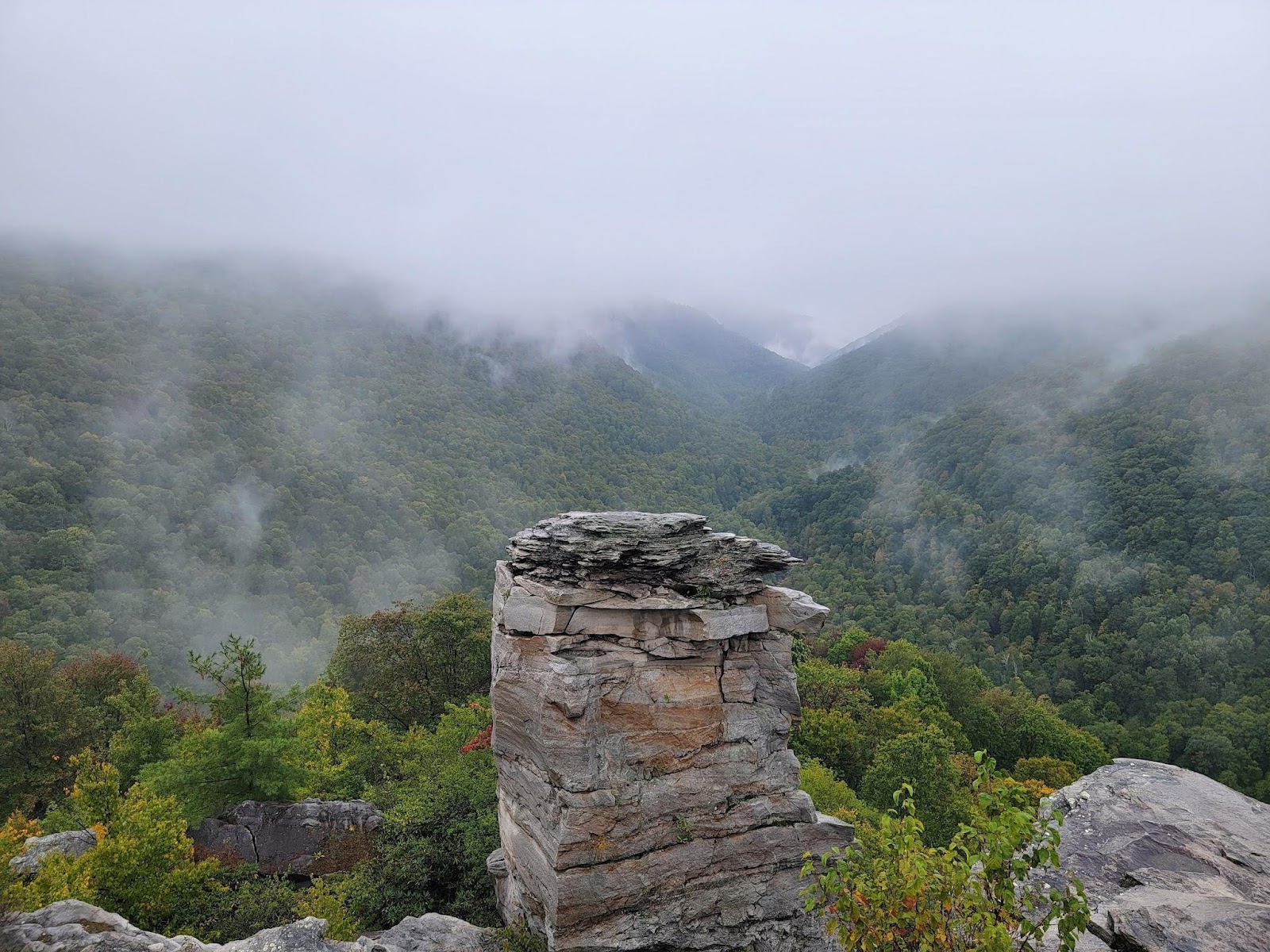
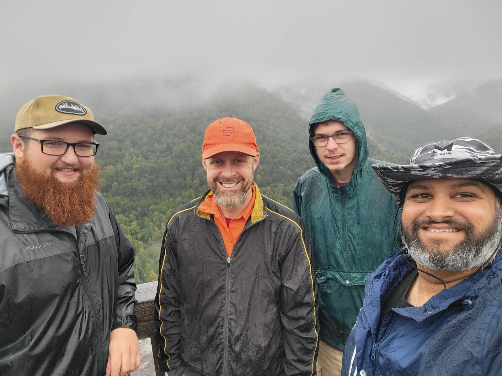
We met asphalt soon enough. There was a small parking lot where we aired up and engaged sway bars. Brian and Ken headed for home whilst the rest did the short hike to the overlook.
Next year’s trip should be a must-do on your calendar!
Canaan Day 1
Profile
No data
No data
No data
No data
No data
No data
Duration:
No data
Canaan Day 2
Profile
No data
No data
No data
No data
No data
No data
Duration:
No data
Trail Report written by Ken Kyler. Pictures contributed by Ken Kyler, Jendra Rambharos, Brian Souhan, Ben Dunkerton, and Matt Malone. GPS track provided by Jendra Rambharos