On a beautiful summer day in July, the CORE 4×4 Club decided to get together for its once every 2 months, regularly scheduled club meeting. The meetings are open to all members and club guests, who are registered under the CORE 4×4 forum.
Attendee List:
- Jendra – Orange JKU
- Dawn – Black 4Runner
- Niels – Black JK
- Zach – JKU
- Kathy – FJ Cruiser
- Steve – Frontier
- Brian – Silver JKU
- Kelly – Jeep Renegade
- David – Cherokee TH
- Toby – Cherokee TH
- Sergey – White JKUR
Given concerns for indoor restaurant meetings and safety, we decided to meet outdoors on a trail, combining the meeting with a trail ride on a mild trail that’s suitable for all vehicles. For this, we chose the Frederick Watershed, a scenic, forested road system north of Frederick, MD. The trail is mostly hardpack dirt road, dotted with the occasional muddy puddle.
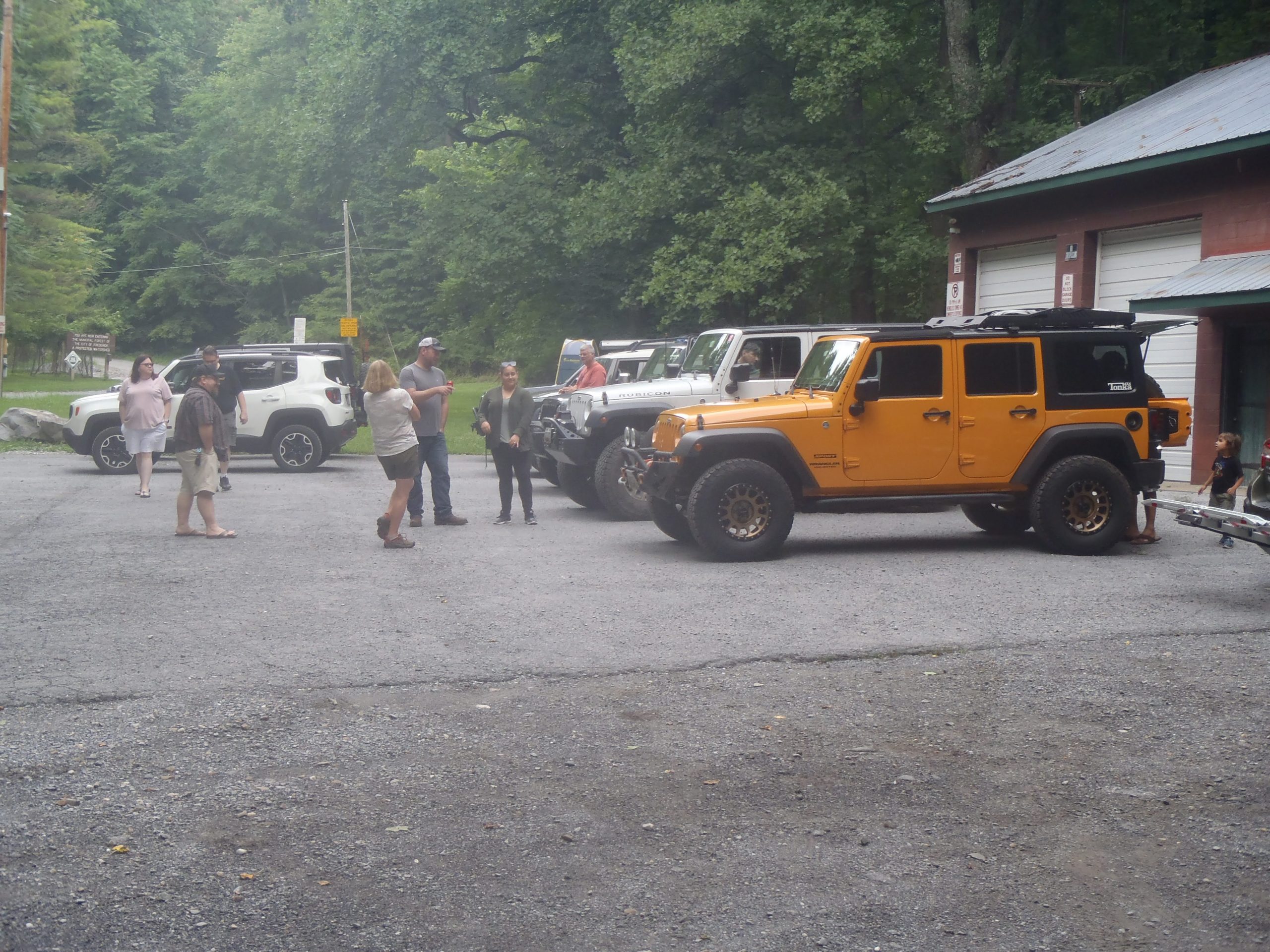
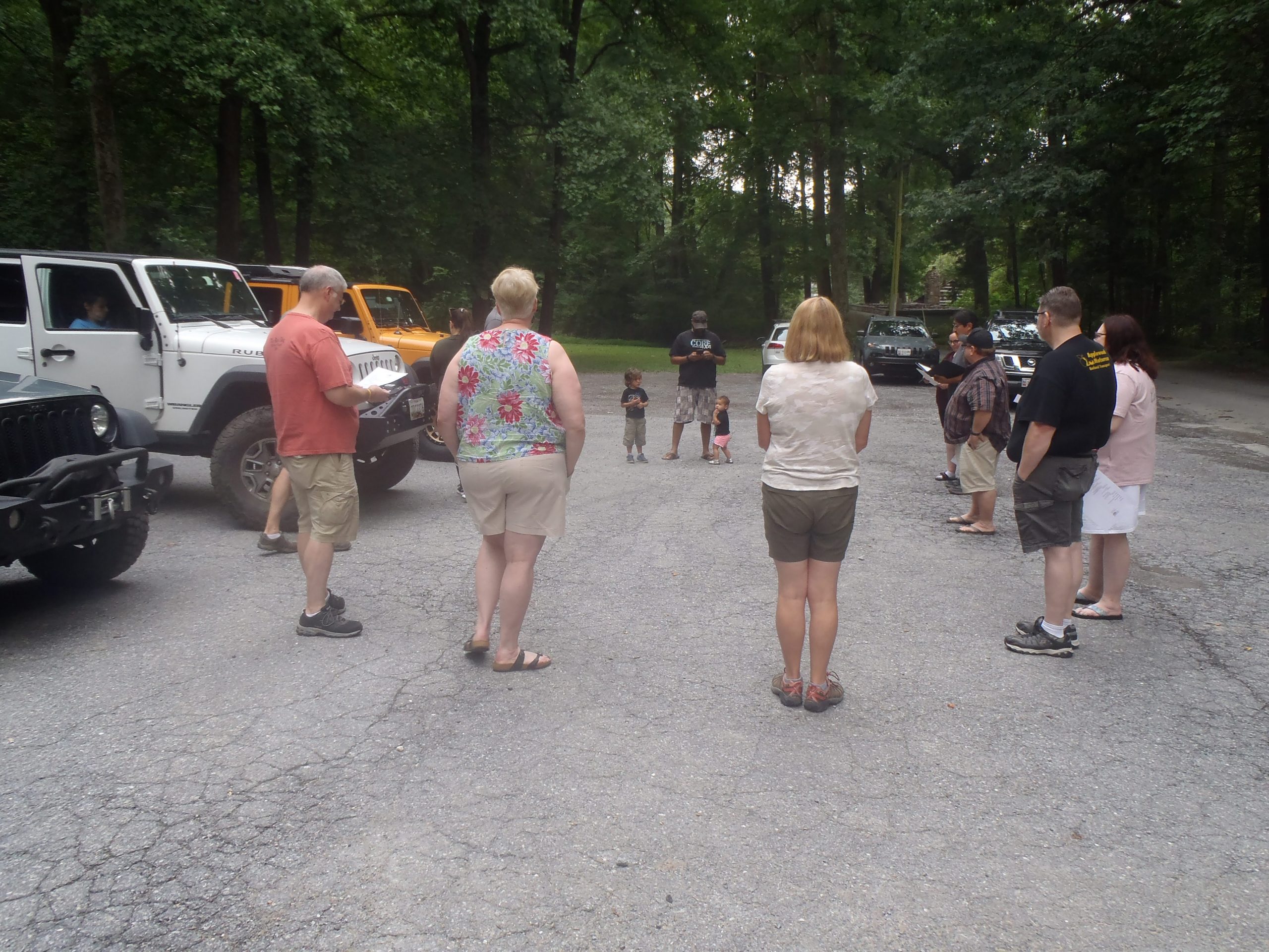
We met at the Mountaindale Parking lot at 3pm, located at: 6010 Mountaindale Rd, Thurmont, MD 21788. From there, we collected trip waivers, talked about what the planned route was, did a radio check, and then headed onto the trail.
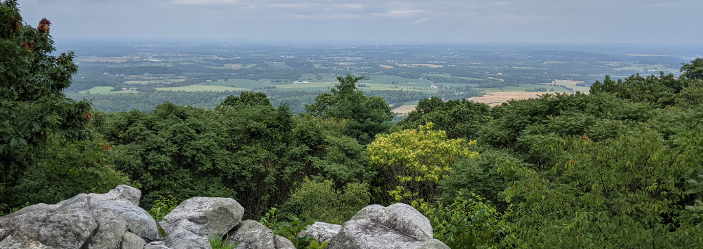
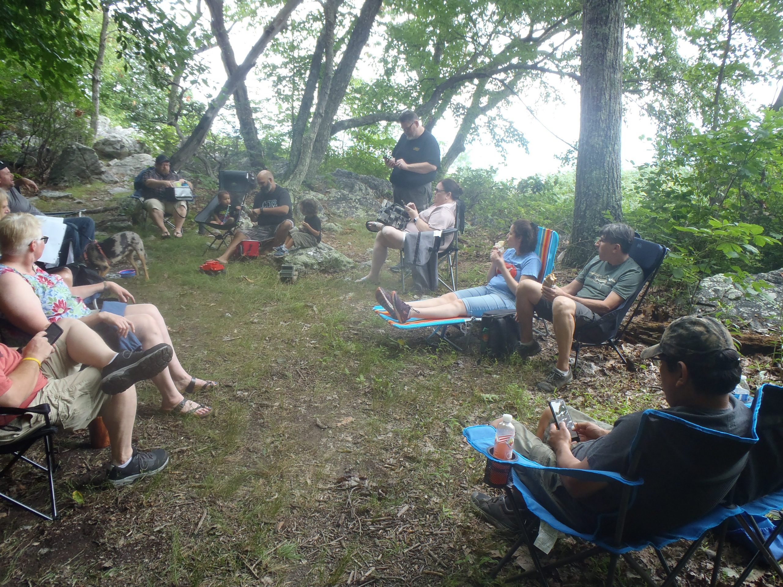
The weather was perfect, as we headed towards the White Rock overlook to hold the meeting component of the ride. We had a sizable group, which made for interesting parking at the trail head. We all managed to squeeze in, and then made the short hike to the overlook.
At the meeting, we discussed recent trail rides, ideas for new ones, some club business, and then some general topics related to the outdoors and off-roading. It was a great discussion, as always with an enthusiastic group, including some new faces to the club!
After the meeting, we got back in the vehicles, and proceeded back onto the watershed trail. On the map, there was a reference to a waterfall called “The Cascades”, so we ventured a couple of minutes down a side road to check it out. Unfortunately, we were unable to find it. We could hear water, but didn’t see the falls themselves. The treeline and brush were very thick though, and we saw remnants of a trail that may have led to it, but it was impassable, and we couldn’t see the other side. With that, we proceeded along the trail.
We eventually arrived at a fork, where we were presented with two options. Take the northern fork, and that would lead up the middle of the Watershed, then reconnect near the White Rock overlook, where riders could backtrack the trail and head out. The other shorter option was to take the southern fork, which leads directly out of the watershed. It was getting later in the day, so we took the southern route out to wrap up the day.
All in all, it was a delightful trip out to the Watershed! It’s not a technically challenging trail by any means, most vehicles outside of a low slung sports car could handle it fairly easily. But it’s beautiful, and the fresh air and scenery are always worth a trip there!
Track
Profile
No data
No data
No data
No data
No data
No data
Duration:
No data
Trail Reports written by Jendra Rambharos. Pictures contributed by Toby Turpin and Sergey Revashov. GPS track provided by Jendra Rambharos.