Over Memorial Day weekend CORE rode both the still open parts of Shoe Creek and what I believe is one of the best trails in Va and what should be more accurately called the Big Levels trail system due to the fact that its made up of a number of trails.
The drive time was punctuated by lots of photography stops, me getting bogged down in a mud hole, a short detour on a side trail, lunch, and Mike having a rock cut through the sidewall of a tire.
Saturday morning Andrew, Cherie and my family started out from Crabtree Falls Campground. We had chosen to stay at Crabtree because it’s one Andrew and I have stayed at before and highly recommend and it’s very close to the Shoe Creek trail. If you plan just to ride Big Levels you could save travel time to the trailhead by staying at Sherando Lake campground, the trailhead is about 45 minutes from Crabtree but you could cut your travel time in half by staying at Sherando.

Beautiful day on the trails
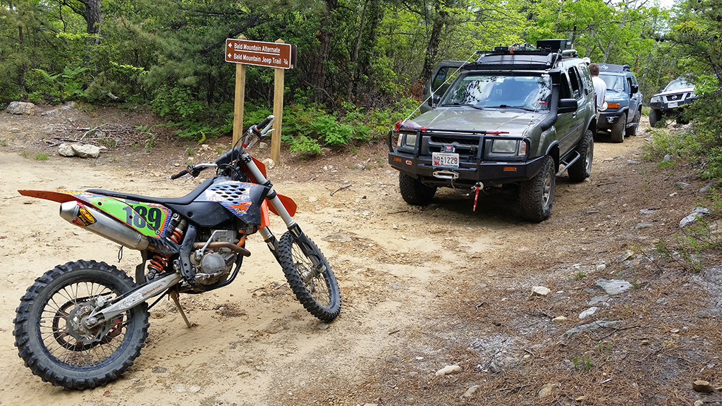
By 9:30 we had met up with Mike and his son Jake unloading his dirt bike at the trailhead just off Coal Road. The Big Levels trail system is used by a variety of enthusiasts ranging from 4X4’s, mountain bikes, dirt bikes, hikers and half-naked male Swedish swimsuit models on horseback.
By 10:00 we started up the main 10 mile long Bald Mountain jeep trail or as it’s marked just off Coal Road RT 162. The first change I noticed from last year are the great trail markers, all trails now have signs marked with the trail’s name and the mileage, also there are red diamond trail markers spaced all along the main trail.
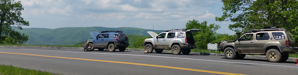
3 Trucks and a Bike!
The next thing I noticed was due to heavy use the trail has become much more challenging, rocks are more exposed and mud holes much deeper, so not the best trail to ride solo. Some things remain the same, the trails up there are great for pin striping whatever you’re driving but also great for their scenery. Over Memorial weekend the Mountain Laurel and Rhododendron are in full bloom and in the Oct/Nov it’s a great place to see the fall colors.
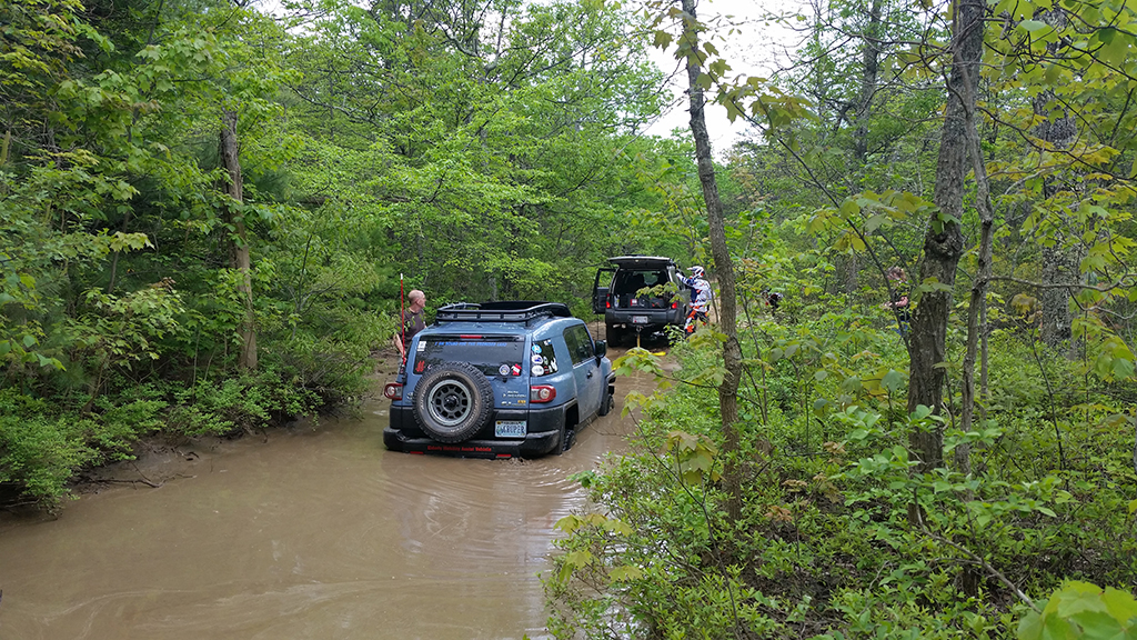
Roland stuck in the mud
Our total trail time was just under 5 hours. The drive time was punctuated by lots of photography stops, me getting bogged down in a mud hole, a short detour on a side trail, lunch, and Mike having a rock cut through the sidewall of a tire. Like I said, mud holes much deeper and rocks more exposed. Just as we got to the end of the trail we saw many others entering, including Ben from DirtRoadTrips.com! Bald Mountain ends at the Parkway where we said goodbye to Mike and Jake and headed back to camp.
Sunday morning Andrew, Cherie, me and my wife rode out to check out what’s left open of Shoe Creek. We started at the south end entrance and as always was blown away by the scenery, the trail snakes back and forth over Shoe Creek as it winds up the mountain. So sad this trail is now gated when it hits private land but for the 1 hour total drive time it’s well worth the trip. Later that day Cherie and Andrew went off to check out the other side of Shoe Creek, you can see that separate report by clicking here. Meanwhile my family and I did some hiking around Crabtree Falls and some just hanging out time at the camp ground. Monday we all packed up and headed home. Aside from some rain on Sunday I would give this trip 5 stars.
[sgpx gpx=”/wp-content/uploads/gpx/BigLevels-final.gpx”]
Trail report written by Roland Thro. Pictures courtesy of Roland Thro, Mike O’Grady, and Andrew & Cherie Taylor.