I had been wanting to do an Overland style trip for sometime now and when I realized the 4th would be on a 3-day weekend I knew that was when I wanted to do it. I wanted a trip exploring new dirt roads, preferably with as little pavement time as possible, and with a new camping location for each night.
…and then over the next minute her 3 cubs, each about the size of a house cat, also stumbled out of the grass and crossed the road in front of us. What a fun way to start our trip!
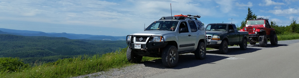
Along for the adventure this time were:
- Andrew & Cherie Taylor – Silver Nissan Xterra (members)
- George Mattacks – Red Jeep CJ8 (guest)
- Keith Graybeal & Brian Greene – Green Ford Ranger (guests)
Friday night we agreed to meet at a campsite in George Washington National Forest, not far from Flagpole Knob. On our way to camp that night Cherie and I were surprised to find a mama black bear crossing the dirt road in front of us.
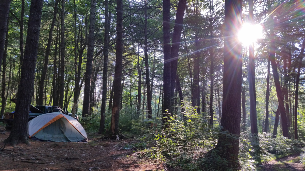
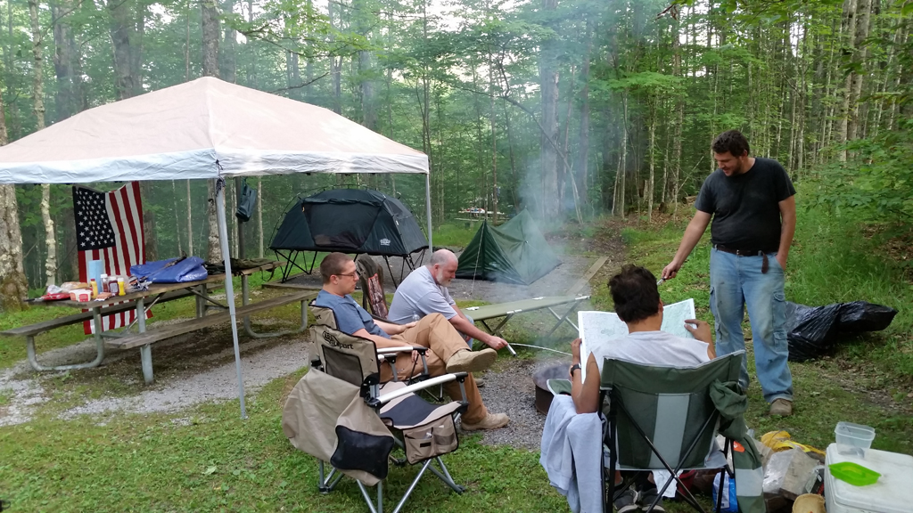
Camping spot on Friday night.
We stopped and watched and she jumped off the side of the road, and then over the next minute her 3 cubs, each about the size of a house cat, also stumbled out of the grass and crossed the road in front of us. What a fun way to start our trip! Cherie and I arrived last, just after Keith and Brian, to our campsite near Flagpole Knob. We setup camp and hung out for the evening, getting to know our new friends better.
Saturday
We all awoke early Saturday and left camp at exactly 9:02am, right on time. We got onto US-33 headed west and right at the stateline at the top of the hill turned onto our first new dirt. Unfortunately the gate was closed. I now see that on the GWNF MVUM that road (FR 85-2) is open seasonally, oops! We tried one other dirt road around the corner (Hall Spring Hunter Access Road), also open seasonally, then back tracked to Second Mountain Rd, which apparently is also closed to 33 now. Three strikes! By this time we had burned some time and I decided that our first two major dirt legs would be a no go, and so we headed back west on 33 toward our next stop.
Our first dirt roads would be 21/2 and 220/7 which were fun maintained gravel roads winding up through the mountains. They were an easy drive, other than for George’s CJ which was occasionally overheating due to a cooling system that needs some work. The work on the vehicle is never done though, right? After that we stopped for gas in Franklin, then continued on.
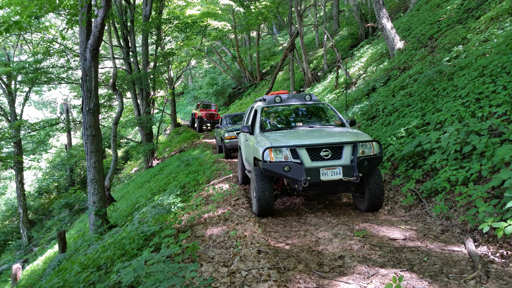
The highlight of the day though would be 28/6. The route started off fairly mild but with great views and progressively got rougher as we got further into the woods. Deep in the woods we ended up taking a wrong turn which led us up a maintained path nearly to the top of the mountain. Just a few hundred yards from the peak there was a gate, so we left our vehicles to checkout the top of the mountain. We had arrived at the Pike Knob Preserve, former home of a fire tower. The concrete corners were still visible and the views through the gaps in the trees were pretty nice.
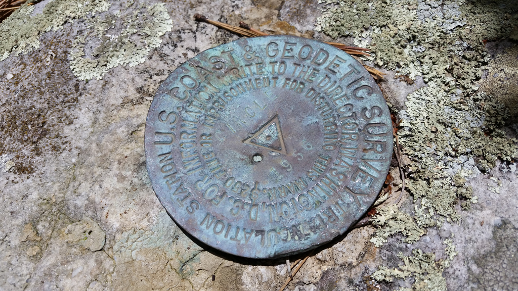
Marker we found at Pike Knob.
We headed back down the mountain a little ways and took the turn we had meant to take the first time, continuing along 28/6. Almost immediately after this intersection the road became a shelf road along the side of the mountain, which it would remain nearly to the whole way back to civilization. The road is plenty wide for a standard SUV, but has a very steep drop off on the one side, and appears especially narrow because the 2-track down the middle is clearly the width of a four-wheeler, not a full-sized vehicle. We eventually came to a gate, after several hours on the mountain, but were happy to discover it was not locked. We let ourselves through and made sure to close it behind us. On the other side were many cow patties, indicating to us what the gate was for.
The evening was spent hanging out around the fire, enjoying the majority of an 18-pack of hotdogs, and applying threadlocker to the steering pump bolts…
Shortly after the gate we were treated to a panoramic view across the farm we were on and the valley below.We stopped for a while to take in the view. We made our way the rest of the way down the mountain, through another unlocked gate (always close them behind yourself!) and on into Circleville.
Our next stop was Spruce Knob, the highest peak in West Virginia. Somewhere along 28/10 George realized there was something wrong with his steering. At Pikes Knob we checked on the steering to discover 1 of the bolts holding the steering pump on the vehicle was missing, and the others were wiggling loose because of it. Unfortunately we had just arrived at arguably the most remote part of our trip.
Saturday night camping
After enjoying the views at Spruce Knob, and the problem getting worse on the dirt road toward camp, we stopped on the road to further address the steering problem. We found another bolt that would fit in the hole at least to keep it from spinning further, tightened the remaining bolts and headed to Spruce Knob Lake Campground. Although this was technically the backup campground according to our plans, after checking it out we decided to set up camp there. We got 3 sites grouped together and set up for the night.
The evening was spent hanging out around the fire, enjoying the majority of an 18-pack of hotdogs, and applying threadlocker to the steering pump bolts and determining it would be good enough for the next day until we got to a town.
Sunday
We awoke to a quiet campground and another trail day ahead of us. We each ate, packed up, and got ready at our own pace. George even found a local body of water to take a quick dip in for a refresh! We filled up our water jugs on the way out of camp at 9:30, just a little behind our planned departure time.
Our first dirt route would be backtracking a little to 112 and then onto 916 on the other side of Spruce Knob Lake. It was a Grouse management area, and we were going along smoothly until we hit the gate about 1/2 way through. So we turned around and backtracked, back by camp, and continued west on 1.
We continued on decent quality gravel roads onto 40. There some locals told us about the Sinks of Gandy, which we’ll have to check out some other time. The views of the farms along this route were really great and took you back a few decades! Eventually we got to our planned campground for the night before, Laurel Fork Campground, and decided we much preferred the campground we had stayed out. Laurel Fork is basically two open fields with everyone facing each other, where Spruce Knob Lake Campground was many individual sites, separated by trees. We continued north on 423 until it intersected with 10, which goes on for many miles.
Middle Mountain Road, or 10, is a very improved 2 lane wide gravel road. We passed many dirt road intersections that one day we may come back to explore. Eventually we made it to Wymer, and US 33. We took this east to Harman where we turned north onto 32. We took 32 to 72 (Dry Fork Road) which was a very interesting road. Dry Fork takes you down through a valley on a narrow and winding road, going up and down, following and crossing various small creeks. It would be a great road for a motorcycle, but too torn up for a sports car, and it was interesting, to say the least, for lifted SUV’s and trucks!
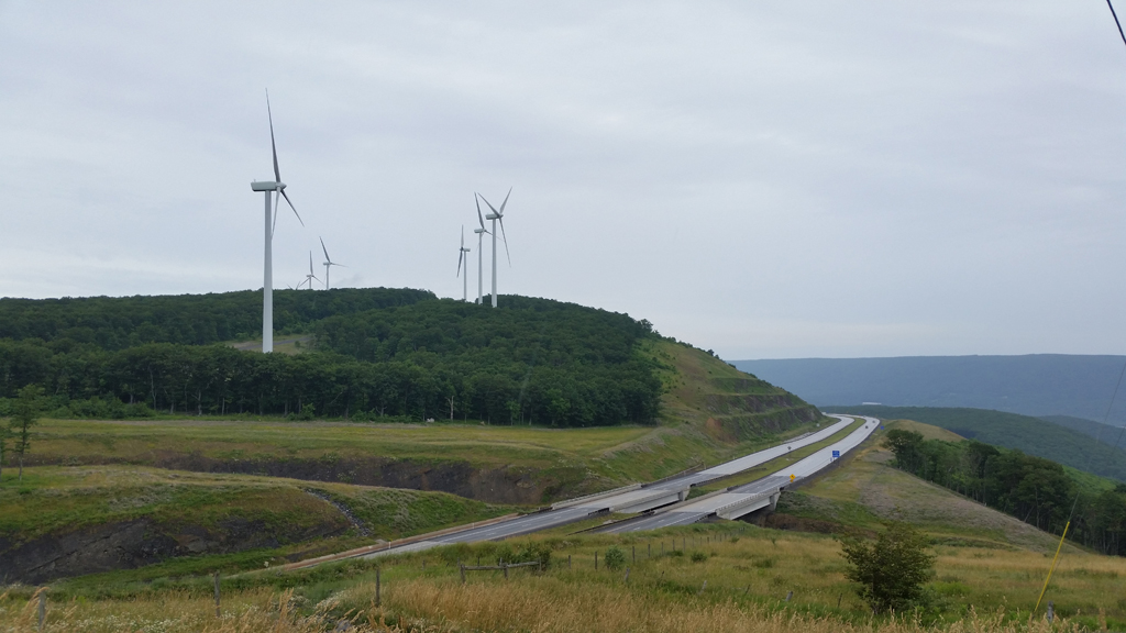
Windmills
Eventually we arrived at US-219 and went west into Parsons. We stopped for gas, a break, and lunch at the Sheetz. George got a lead on where he could find the bolt he needed on a Sunday morning and disappeared for a few minutes to resolve the steering issue. He returned triumphant with a bolt that was perfect in every way, except its length, which was resolved with a good stack of washers under its head!
We headed back east on US-219 until we saw dirt again, 18. We turned off the highway onto 18 , then left to stay on it and immediately noticed the quality of the road drop. Thanks for the tip DirtRoadTrip! The road wasn’t too bad, in fact I think all 3 of us did the entire thing in 2WD, but our high clearance vehicles defiently made the ride easier. We were treated to some nice cascading water and some remote campsites we’ve marked for the future. As suddenly as the road had degraded it improved and we found ourselves passing houses and farms again, we had made it through.
As we turned around George was approached by a local, with a mud terrain tread pattern tattoo from his wrist, up his arm and shoulder and up his neck, that said he knew of a fun trail.
We continued northeast and then east on the Appalachian and then Synergy Highways. These are as paved as they sound. My plan was to turn off the highway at Bismark, and head south along Communications Drive, parallel to the windmills on the ridge line, part of the Mount Storm Wind Farm. However shortly after stopping for pictures we met a gate. As we turned around George was approached by a local, with a mud terrain tread pattern tattoo from his wrist, up his arm and shoulder and up his neck, that said he knew of a fun trail. We decided to roll the dice and following George went in search of this trail.
After an hour, a few wrong turns, and a few phone calls to the local for guidance, we found ourselves on 2/1, known only as Schell by the street sign. We went a little ways down it, passed a hoard of side by sides and quads on their way to enjoy the same road, and eventually decided to stop and reassess things. George was itching for some hardcore wheeling, and based on the locals description thought it could be found on this road. Cherie, Keith, Brian and myself were getting fairly exhausted and were more content to mark the trail for another day. But George was interested in going on to check out this trail, with the side by sides there too, and so decided to continue on the trail alone, possibly to find us at camp that evening. The rest of us headed 30 minutes south, back toward a gas station and the original route.
Along the way it began to rain, 24 hours earlier than predicted, and Keith and Brian realized they were probably in a good position geographically to call it a trip and head back home. At the gas station we decided to part ways, Cherie and I headed south and Keith and Brian headed home, probably to enjoy a steak and fire there! In an hour and a half we had gone from 3 vehicles to 1!
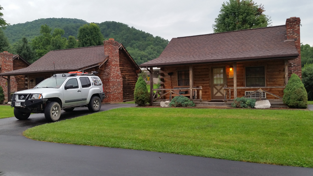
Cabins at Smoke Hole Caverns
Rolling with the changes Cherie and I assessed our options. With the rain setting in early, and us now headed south toward our next point of interest, Smoke Hole Caverns, much later than planned, into rain, and alone, we decided to check out the accommodations near the Caverns. There we found out about some Honeymooner Cabins available at a discounted rate just a few miles from the Caverns! We decided to bite and next thing we knew we were enjoying fresh pizza delivered to our cabin, ginormous farmed rainbow trout in the ponds, beautiful views of the rolling clouds in the valley from our porch, and enjoying a hot tub for two!
Monday
We awoke and headed back to check out Smoke Hole Caverns. It’s not a huge cavern, but memorable and interesting in it’s own ways. There are a few formations you can touch including a natural gurgling water feature inside! From there we decided we would continue south to check out our planned final campground. Recon for a future trip perhaps! We headed south along Smoke Hole Road (2/3), which was another windy and fun paved road, and eventually turned left onto Smoke Hole (2) toward Big Bend Campground. The road in was paved in places, gravel in others. The campground was nice and included plumbed bathrooms with showers in places. It is surrounded by a river which looks like it would be great for tubing down, which we’re fairly certain others were doing.
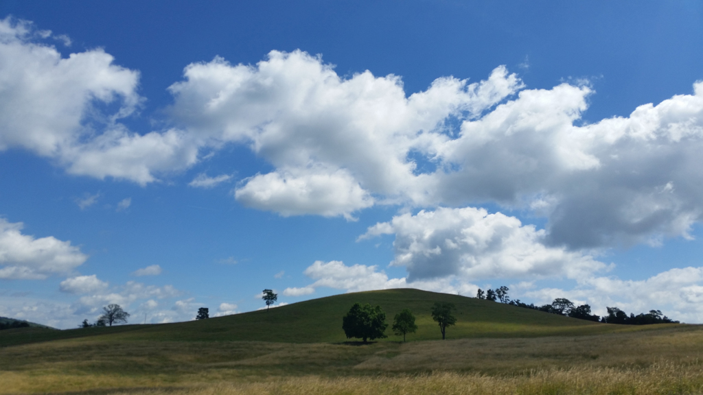
Beautiful farm country
From there we decided to take the scenic route home. The trip had several unplanned changes but most were easy to reroute around because of the ample planning and alternate routes I had spec’d out. In the end the group disbanded a little earlier than planned, but even that worked out, and we had a great time. I can’t wait until my next Overlanding trip. I have so many routes I found while preparing for this trip that I’ll have to put into my next one!
Trail report written by Andrew Taylor. Pictures courtesy of Andrew & Cherie Taylor.
GPS track for Saturday:
[sgpx gpx=”/wp-content/uploads/gpx/Day1_Final.gpx”]
GPS track for Sunday:
[sgpx gpx=”/wp-content/uploads/gpx/Day2_Final.gpx”]