Snow Wheeling in a Winter Wonderland
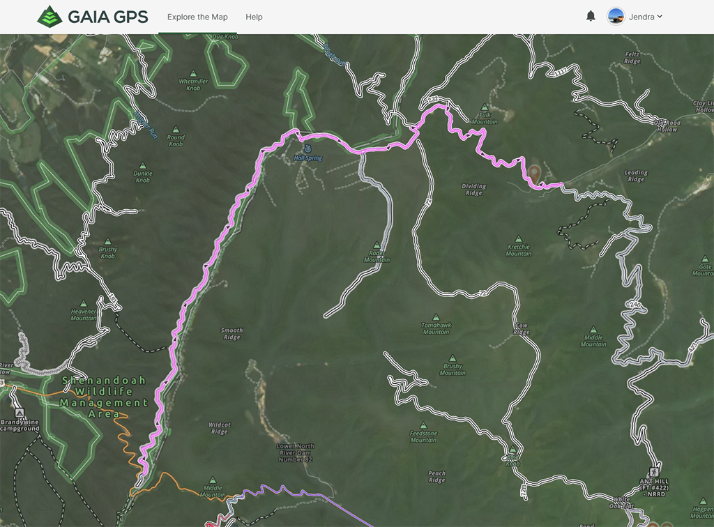
Snow was NOT in the plan for this adventure! This trip started out as what we called a “squiggle chase”. After another trip to some known trails out in George Washington National Forest, Andrew and I were reviewing our Gaia recorded maps and we noticed some very squiggly trail lines north of the area we travelled on our previous trip.
Doing some research on the MVUM (Motor Vehicle Use Map) of the trails we saw, we found out that they were limited use trails, specifically 85-2 which Andrew had researched previously, were only open for a couple of months in late fall/early winter. With that, we decided that we wanted to check it out, along with possibly some other trails in the area.
Given the unknown nature of the trip, we had to be prepared. For this type of trip, having good tires, recovery gear, and underbody protection was a must. Also, we brought along chainsaws, and other gear to clear debris or trees off the trail if necessary.
Given the unknown nature of the trip, we had to be prepared. For this type of trip, having good tires, recovery gear, and underbody protection was a must. Also, we brought along chainsaws, and other gear to clear debris or trees off the trail if necessary.
As for campsite, we planned for an area we were familiar with, where we could basecamp, and then go exploring from there. Camping would be primitive, with no food, water, or bathroom facilities available. It would be located in the area off the trail on Dunkle Hollow towards Flagpole Knob.
So…. that was the plan. As it would turn out, this trip would become something neither of us expected.
As the date for the trip approached, we saw that we had some weather coming in. The trip was planned for the weekend of Dec 18 – 20. The Monday before, we got reports of snow up in the mountains. That elevated some concerns, because many of the roads were mountainside shelf trails, with steep dropoffs on our sides. Driving on fresh snow provides decent traction, especially with our large mud and all terrain tires. Slick icy conditions, on the other hand, on trails like that would be beyond adventure and get into dangerous territory. Then mid-week, we had another big snow, both up in the mountains and here at home in Maryland.
The trip at this point was at big risk. We went back and forth on whether to cancel, given the risk. We finally decided to give it a shot, and rub noses with the mountain to see if it was something we were comfortable with. We decided that if either of us felt uncomfortable or at risk, we would call off the trip, no questions asked.
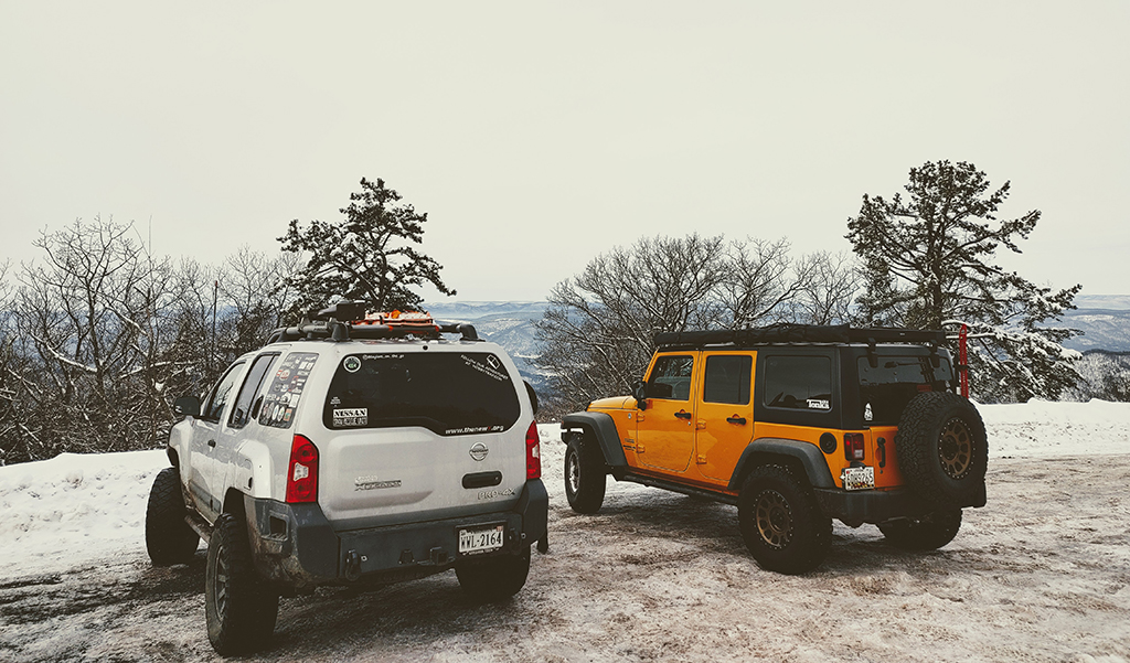
So, with that, we embarked on the trip. As we approached Harrisonburg, it was clear that the area got a significant amount of snow. After meeting Andrew and his wife Cherie for the firewood pickup and gas station, we headed towards the trail and our campsite.
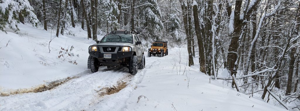
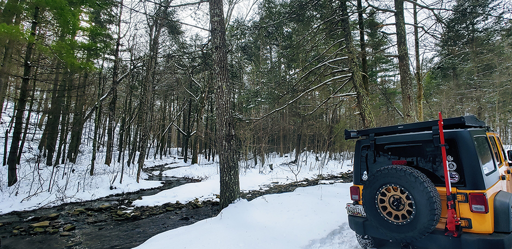
After pulling off of 33 onto Dunkle Hollow, we were met immediately with snow covered trails. Fortunately, it was snow, with no ice. This meant that we had traction, and were able to easily traverse the trails in 4 wheel drive.
Our campsite that we picked can only be described by one word, AMAZING. It is easily the most beautiful campsite I’ve ever seen. Dubbed (by Andrew) the “River Bend Campsite”, it is off the trail, down a bit, and settles down along a gorgeous twisty river. Simply amazing.
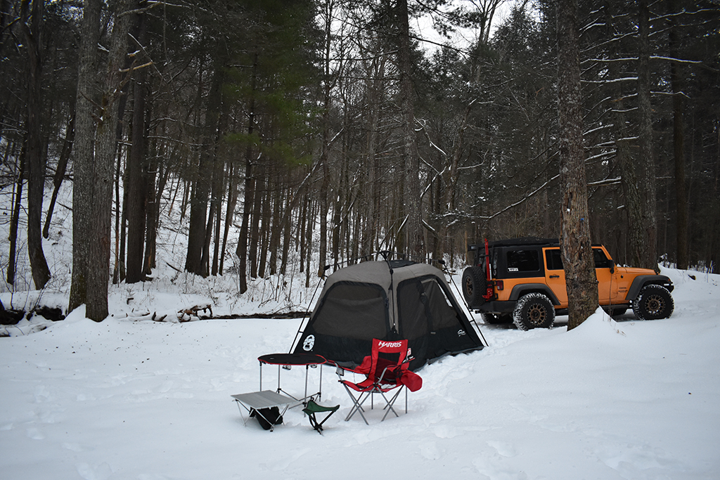
After setting up camp for the evening in over a foot deep snow, we settled in for a cold night, with lows in the upper teens and lower 20’s. Fortunately, I had a Mr. Heater Buddy Heater, two sleeping bags, and a cot in my tent. This kept me warm for the night. I also got to use my Coleman Instant Pop Up Tent for the first time.
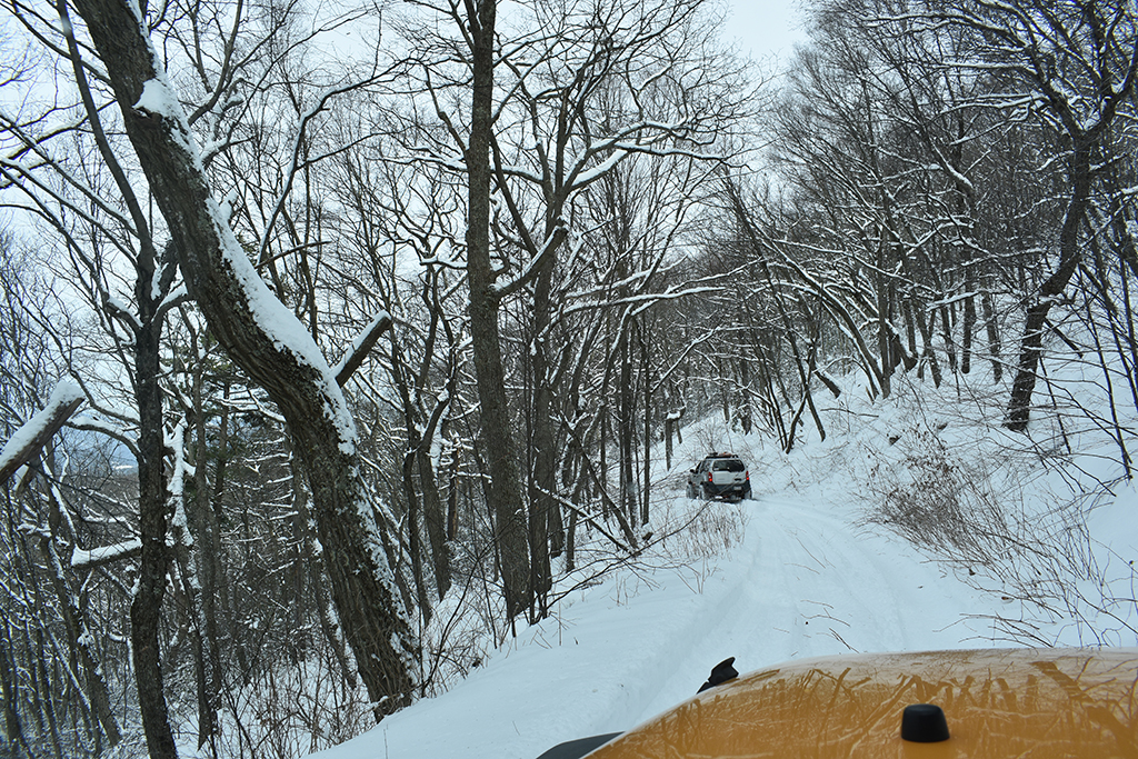
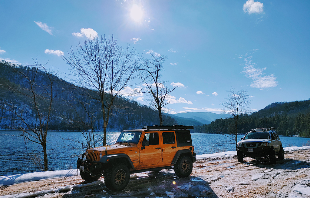
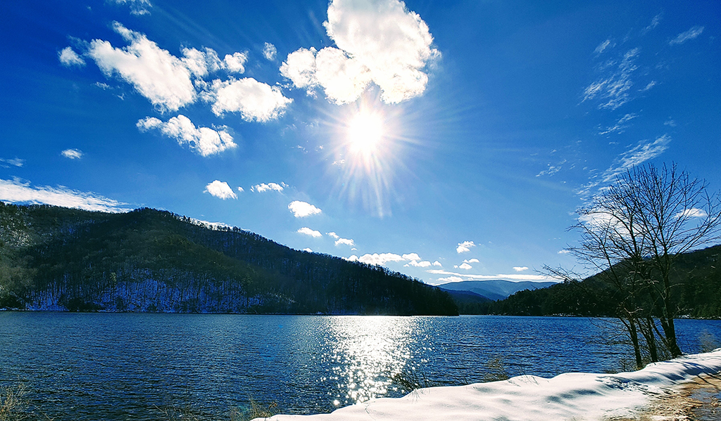
The next morning, after getting out of our tents and having breakfast, we ventured out to go exploring the 85-2 trail near High Knob. Pulling off of the road onto the trail greeted us with some of the most beautiful snow covered scenery I’ve ever seen.
We had 32 miles of trail planned for Saturday, but quickly discovered that taking our time on the snow covered shelf trails, stopping frequently for pictures and video of the incredible scenery, that we would not hit our mileage target. In fact, by the end of the day, we had only done about 13 miles. But that being said, it was 13 incredibly beautiful miles of trail.
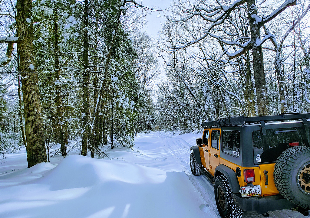
This trail looks like it would be a pleasant, easy trail to drive during normal good weather. Seemed pretty flat, with few ruts if any. It would make for a very scenic relaxed trail ride.
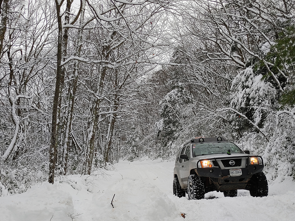
We called it a day, went back to camp, had dinner, chatted around the fire, and discussed our plans for Sunday. Our drive back to camp revealed pretty icy trails on the way back. That’s due to the rising temps during the day causing melting on the trail, followed by refreezing at night, turning the trail to ice. Because of that, we decided that we would not continue our exploring on Sunday. We had a very ambitious plan for Sunday, with nearly 60 miles mapped out. But given the icy conditions, and safety risk, we decided to end the weekend Sunday morning, head home, and save those trails for another day.
We felt like we did it right, planning ambitiously, and then seeing what the real world conditions had in store for us. Since we were very far from any cell signal, we needed to do all of our research and planning ahead of time, and then see what we actually can get done once on the trails.
All in all, it was an absolutely amazing, beautiful, tranquil, and peaceful weekend. Not the weekend we initially planned, but we wouldn’t trade it for anything!
FR85-2
Profile
No data
No data
No data
No data
No data
No data
Duration:
No data
Trail Report by Jendra Rambharos. Pictures provided by Jendra Rambharos, Andrew & Cherie Taylor. YouTube videos provided by Jendra Rambharos and Andrew Taylor. GPS Track provided by Jendra Rambharos .