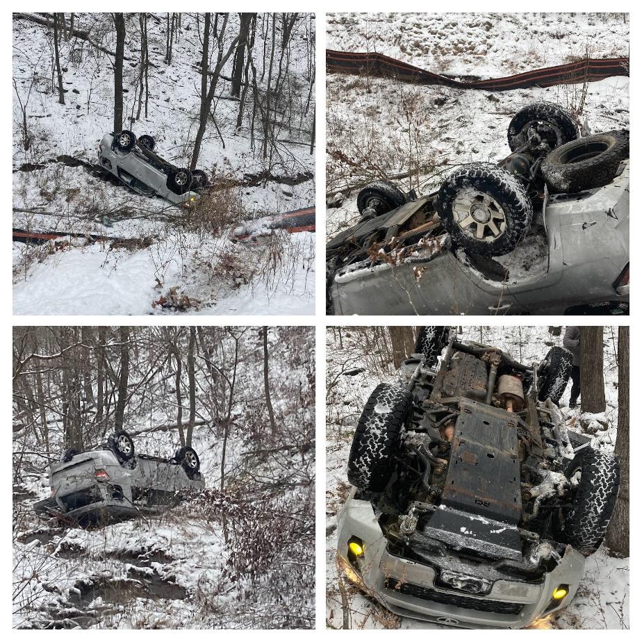
SPOILER ALERT, an amazing day of snowy scenery ended with disaster when Ben rolled his 4Runner 1-1/2 times down a hill. Fortunately, he walked away from the wreck almost completely uninjured! To figure out how we ended up at this point we need to start at the beginning.
In early January a trip to George Washington National Forest (GWNF) was planned for Monday January 15 (MLK Day). The hope was that we could explore some of the seasonal roads that are only open from October to January. Given the time of year a bonus would have been to get some snow wheeling in at the same time. Right before the trip it was realized that there is conflicting information on when these roads close with one source saying January 10 and another saying January 15. An alternate route was planned that would explore some of the same areas on roads that are open year round in the event of a road closure.
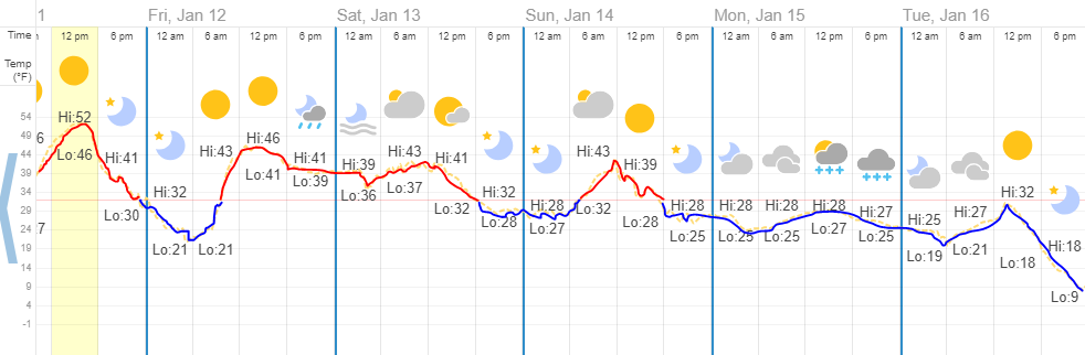
The week before the trip the weather was crazy…snow and rain; temps above and below freezing including the high elevations of the mountains we hoped to explore. This made it likely that poor road conditions would be possible during the trip so extra care was taken to make sure that everyone had tires up to the task.
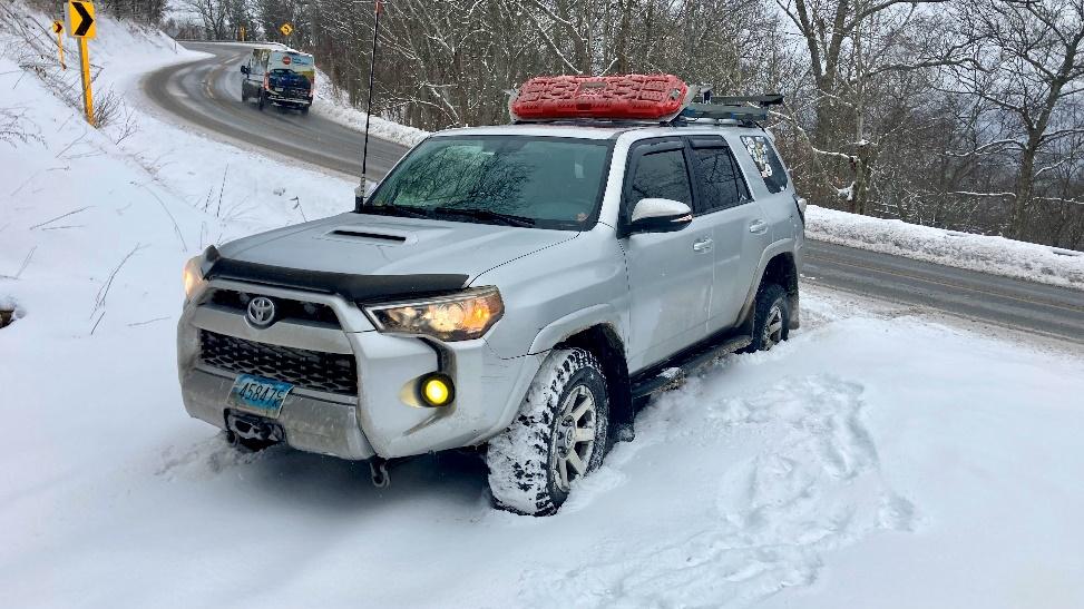
The morning of the trip brought snow showers to the region and poor road conditions on the paved roads to the trail (including the interstates!). Matt and Ben met early to check the conditions of the forest roads and to see if the seasonal roads were open. Ben got his 4Runner stuck as soon as he pulled off pavement and a short walk answered the other question…the gates were closed. Armed with that information and a snowy set of traction boards from recovering Ben’s 4Runner, Matt and Ben set off to meet up with the group.
The group of people that met at a small parking lot on Route 33 near the VA/WV border were as follows:
- Ben – 2014 Toyota 4Runner
- Matt M. – 2023 Toyota 4Runner
- Sergey and Ilya – 2017 Jeep Wrangler JKU
- Jeff K. – 2022 Land Rover Defender
- Robert D. – 2002 Toyota 4Runner
- Brian M. – 2017 Jeep Wrangler JKU
Everyone was running late that morning due to the poor conditions, a theme that would haunt us through the day.
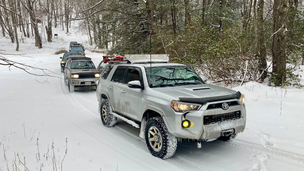
Since we had already established that we would be driving the backup route we headed down the mountain on Route 33 into West Virginia and turned on Forest Road 151, Westside Road. We quickly found ourselves on roads that had no tire tracks in the fresh snow which would continue through most of the day. Westside Road was clear under the fresh snow, so traction was good. Eventually we would find the nasty stuff that had melted and refrozen earlier in the week lurking under the fresh snow. The fresh snow on top generally aided with traction although there were a few icy spots. On Westside Road we found a couple of fun stream crossings that had enough water for a good splash without being too deep to cause concern for any SUV.
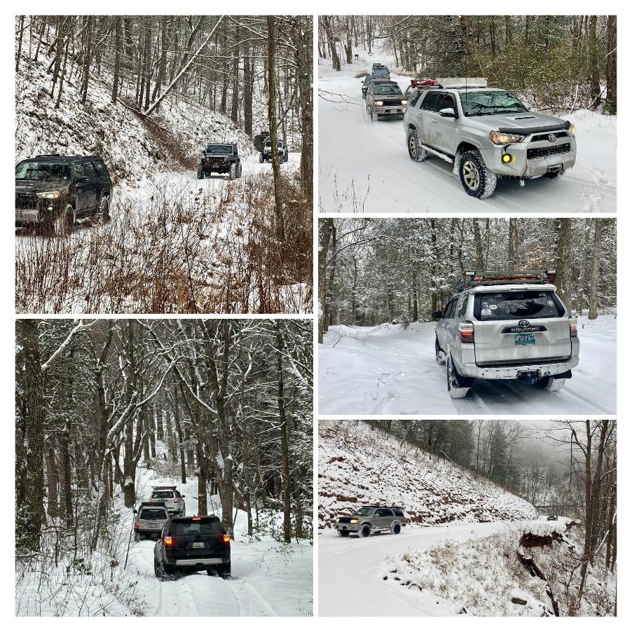

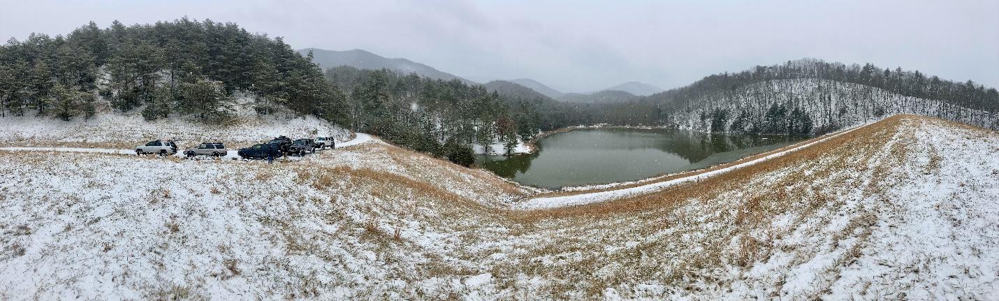
We decided to stop for lunch at a small body of water labeled Dam No. 9 and pulled off the road at a small pullout next to the earthen dam at the end of the small lake. We were treated to beautiful views as we enjoyed our lunches.
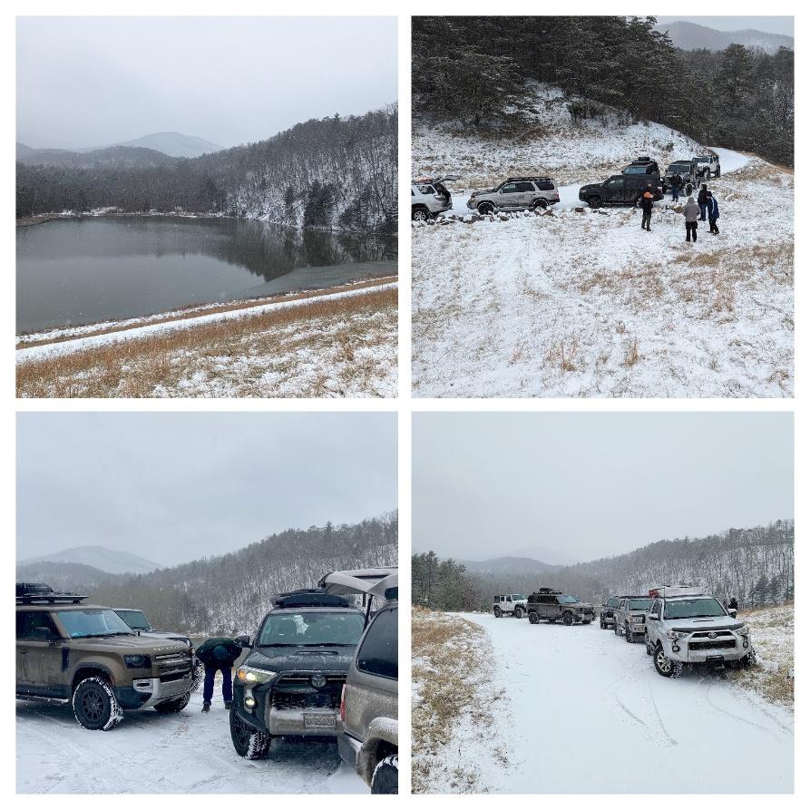
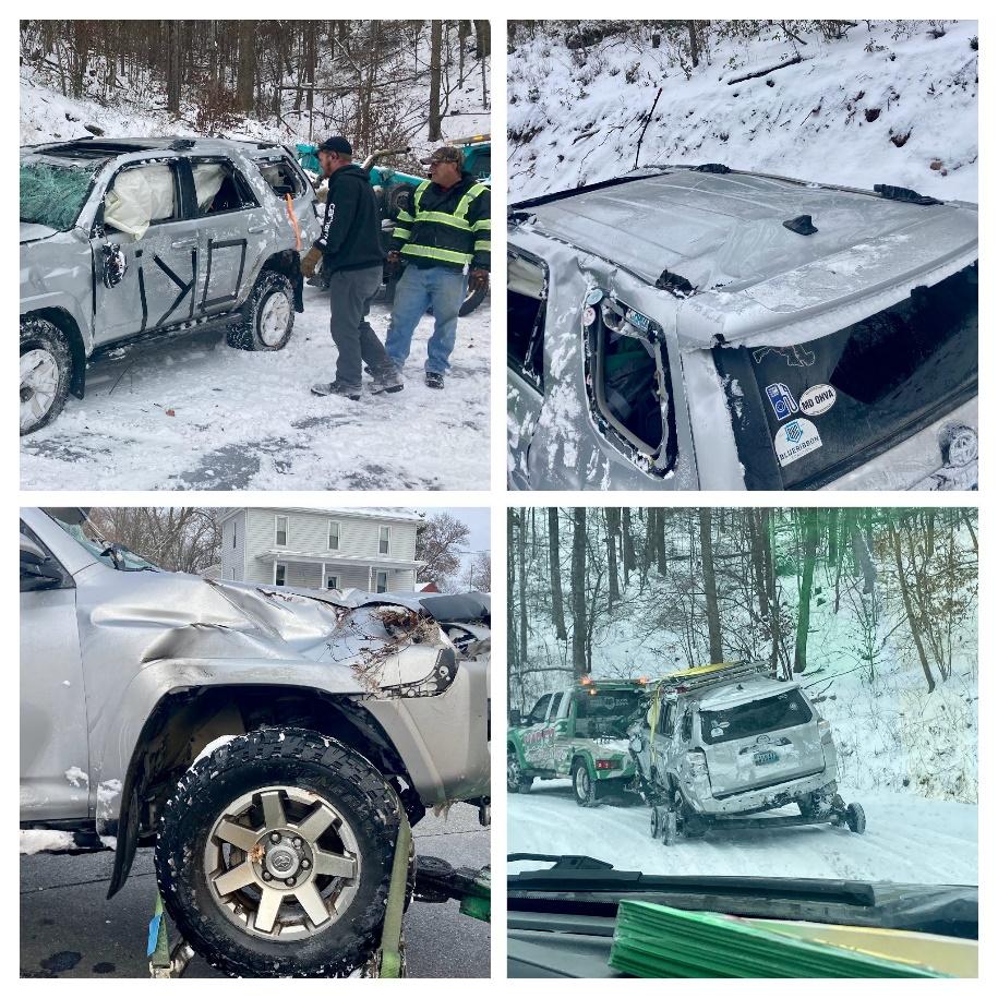
After lunch we finished Westside Road and turned onto Forest Road 87, Fort Seybert Road. It was like Westside Road including more stream crossings. Between both roads we probably did about 10 stream crossings! Near the end of Fort Seybert Road we turned onto Forest Road 85-1, Cow Knob Road which appeared on the map to follow the ridge line out to main roads. 1-1/2 miles later we encountered private road and no trespassing signs and a quick check of the MVUM confirmed the public road did turn private for a short stretch. We turned around and back tracked to Fort Seybert Road and followed it to Forest Road 72, Long Run Road. With a clear path out of the forest and daylight fading we knew we had to make good time to get off the shelf roads before dark. By now we had started to see other tire tracks in the snow. 2 miles from the end of Long Run Road, Ben carried a little too much speed into a switchback which happened to be one of the iciest sections of road we encountered all day. He slid off the inside of the turn and rolled 1-1/2 times down the hill and came to rest upside down against a tree 50 feet down the hill. Thankfully he quickly came over the radio saying he was fine. The rest of the group came to a stop and set up a line to get safely down the hill. Robert did an amazing job climbing up and down the hill to help Ben and retrieve a few things from the vehicle. Once everyone collected themselves the light was fast fading and the group carefully crept the rest of the way out of the forest to pavement. The next day Ben was still feeling fine and a local tow company was able to retrieve the 4Runner.
The trip home proved to be even more challenging than the trip to the trails with snow covered roads, poor visibility, and slow traffic (even on the major interstates). Eventually, everyone reached home safely. There was general agreement that the first part of the day on the trails was amazing and would have been one of the best trips in recent memory. Unfortunately, the day didn’t end great reminding us of the risks we take when we venture off the beaten path.
LESSONS LEARNED:
- Don’t discount the trip to and from the trail. In a snowstorm (even a relatively light one) this can be the most difficult part of the day.
- Pay attention to the pre-trip weather. Assume rain and freeze-thaw conditions will lead to ice and not crunchy snow.
- Don’t forgot to check the road conditions under fresh snow.
- Leave the group spread out a bit to prevent vehicles from colliding and being caught by surprise at the same time. At the time of the accident Ben was far enough ahead that everyone was able to safely stop before the icy section of road.
- Be mindful of distances between exit points and make sure you have enough time to reach your desired exit point.
Track
Profile
No data
No data
No data
No data
No data
No data
Duration:
No data
Trail Report written by Ben Dunkerton. Pictures contributed by Ben Dunkerton, Matt Malone, Sergey Revashov, Robert Dooley, and Jeff Kohler . GPS track provided by Matt Malone.