Big Levels (also known as Bald Mountain Jeep Trail), is a trail down in Lyndhurst, Virginia. CORE likes to make an annual weekend trip to the area, but we haven’t been able to visit since a trip back in 2021. So we decided to take a late summer trip out to the area for the weekend to hit up the trail!
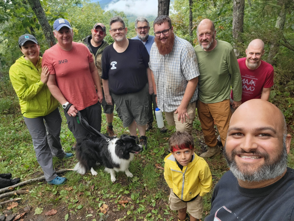
Attendees:
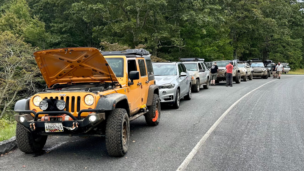
- Jendra (Jeep JKU)
- Matt (GMC Yukon)
- Andy (Toyota Tacoma)
- Rich (Jeep LJ)
- Jeff (Defender)
- James (LR3)
- Brian (Jeep JKU)
- Ben (4Runner)
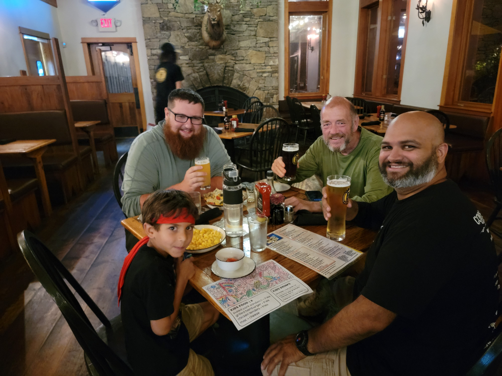
The weekend plan was to camp at the Devil’s Backbone Brewpub. It’s a great spot only about 17 minutes from the Big Levels Northern Trailhead. They have group sites, individual sites, and camper sites. And all of that surrounds the brewpub restaurant, with outdoor and indoor areas. They have a great selection of drinks, great food, and a nice atmosphere.
Matt, Andy, Rich, and I camped at Devil’s Backbone, Ben found a cool trailside primitive campsite along N River Forest Service Road. Brian, Jeff, and James joined us for the day on Saturday as day-trippers.
On Saturday, we met at the Big Levels 4X4 Trail – Northern Trailhead. The area there is a bit tight for our group of 8 vehicles. We would not have been able to fit any more vehicles along the side of Coal Rd. From there, we drove along Coal Rd to the start of the trail itself, which on Google Maps is called the “Big Levels 4X4 Trail – Mid Point”. That location makes for a better meet-up point if the group size exceeds 8 vehicles. Cell service can be spotty there, however, so something to keep in mind.
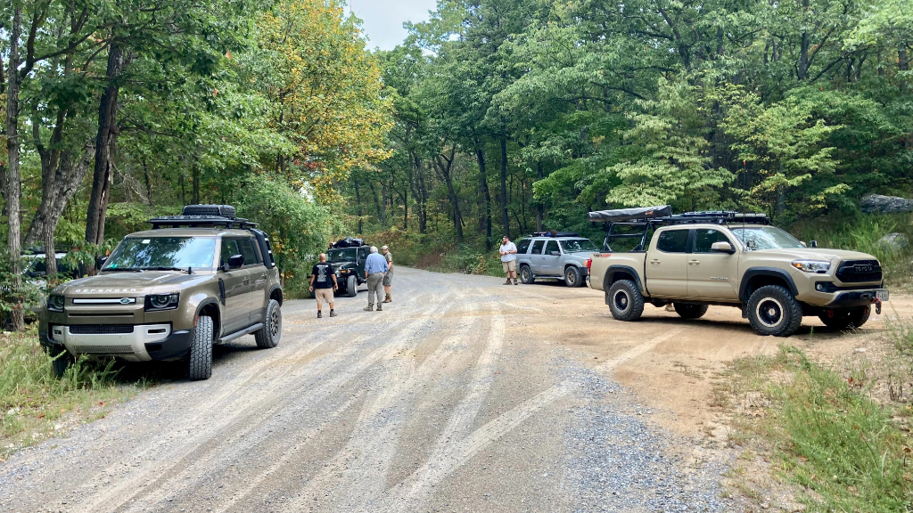
We aired down our tires at that spot, and hopped onto the trail. Big levels can frequently be a pretty tight trail, and it certainly was, but seemed to be less than in the past. It’s also possible that we frequently visit the trail in the spring, and this instance was a late summer run. So it’s possible that the trail has seen enough traffic to open it up a bit.
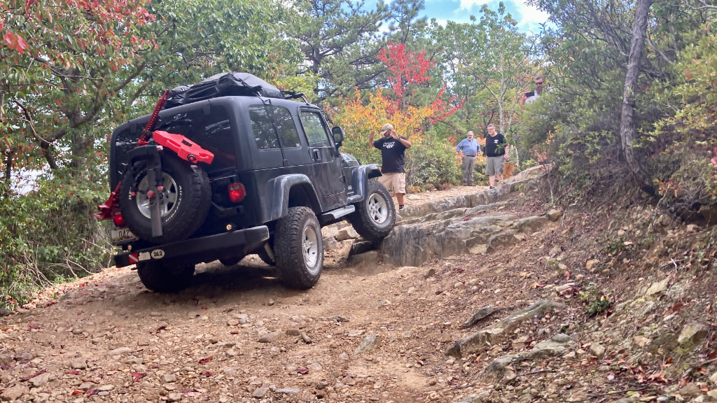
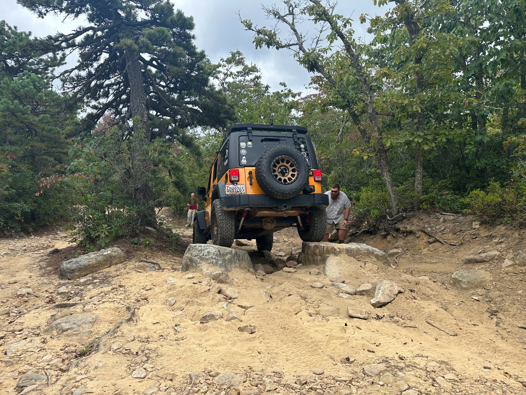
After a few miles of riding, we came across our first major obstacle. As with most of Big Levels, most obstacles have multiple lines, frequently one of which is an easy bypass. This obstacle was a steep rock shelf on the right side of the trail, around a curve in the trail. A few of us tackled the high right line, some down the middle medium line, and a couple along the far left easier line. After spending a moment on that obstacle, we continued on.
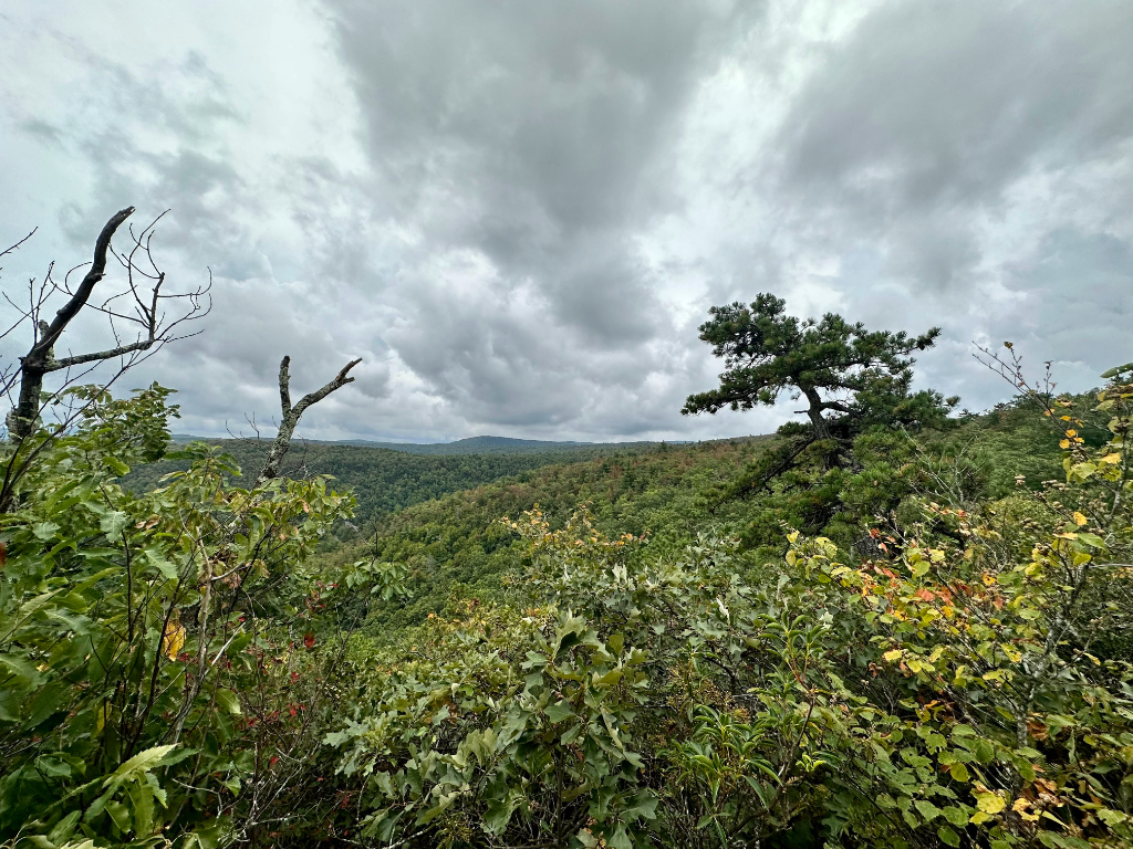
We stopped at an overlook pulloff for lunch, trying to beat the rain clouds that we saw coming our way.
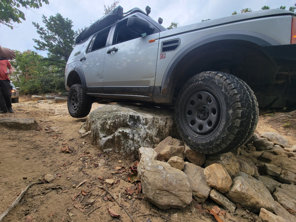
The trail presented some fun challenges, allowing folks to test their vehicles and learn the capabilities of their vehicles. After a few more miles of lovely scenic trail, we came up to another obstacle, this time a pair of tall rocks that are a guaranteed test of rock sliders and skid plates! There is also a bypass on the left side of this obstacle. Most of us made it through, with quite a bit of underbelly scraping! When James decided to tackle it, he ended up high centered on the rocks. It seems to have been a combination of a line that was slightly too far left, but also his traction control pivoting his vehicle to the side, slipping him off of the rock. After a few minutes of unsuccessful rock stacking, we went for his winch. As we were spooling it out, the skies opened up and we got drenched in rain! Certainly added a bit of excitement to the situation! We successfully winched him through, and continued on!
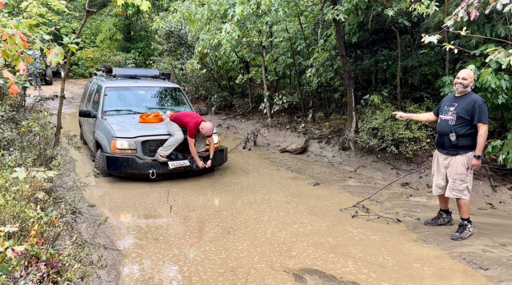
After that, we started coming across Big Levels’ famous (infamous?) large water and mud puddles. As has been noticed at a lot of area trails, water crossings have been much drier than in years past. So we came across puddles that appeared to be about a foot shorter than the high water line in the crossings. Even though the water level was low, some of the crossings had pretty soft and boggy bottoms that took a bit of gusto to pull through. One of the crossings, after I got across, Matt followed behind and got quite stuck. After some agile clambering from Ben to hook up a tow strap, we got Matt’s Yukon pulled out with no drama!
After a few more crossings, we made it to the end of the trail, where we took a quick run down to an overlook and campsite. After hanging there for a bit, we made our way to the end of the trail, a scenic overlook pull-off of the Blue Ridge Parkway to air our tires back up and head out. The day trippers headed home, and the rest of us went back to camp, where we enjoyed a nice dinner, a little time around the fire, and called it a night.
After that, we headed home on Sunday, after enjoying a fun weekend trip!
Big Levels
Profile
No data
No data
No data
No data
No data
No data
Duration:
No data