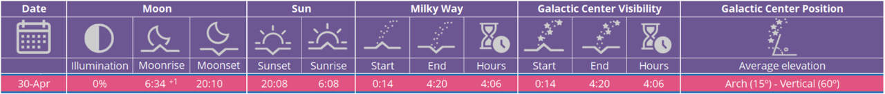
At the end of April in 2022, an opportunity presented itself for the possibility to see the Milky Way galaxy, if the conditions were right. Given this, the club decided to give it a shot, and find a dark sky spot in our area to go to, to give us the best opportunity for the viewing.
Based on the Milky Way calendar by Dan Zafra, we saw that the Milky Way should be visible for about 4 hours on April 30th. This is enabled by the fact that there was a New Moon that night, so the brightness of the moon would not outshine the Milky Way. Then, referencing a light pollution map, we found that one of the club’s frequented off-road destinations, Flagpole Knob, was in a dark sky area, and would minimize light pollution. With these pieces in place, we planned a weekend camping trip to Flagpole Knob, and set a plan to hit the trail at 11pm, and wheel our way up to the peak, and hope that we’d catch the galaxy, and maybe even get some photos!
So the plan was made to block out the entire weekend, meeting on Friday in Harrisonburg, heading onto the mountain, finding a campsite, and setting up for the weekend. Given that the priority of this trip was the 2 nights of stargazing, we had loose plans for Saturday, leaving it up to the group to decide what we wanted to get into, and possibly break up and reconvene that night for more stargazing.
Attendees:
- Jendra Jeep JKU
- Jan – Nissan Frontier
- Steve S – Nissan Frontier
- Ben D – Toyota 4Runner
- Rick – Toyota FJ Cruiser
- Zach – Jeep JKU
- John – Toyota Tacoma
- Adam – Nissan Xterra
- Isaiah – Toyota 4Runner
- Miguel – Lexus GX470
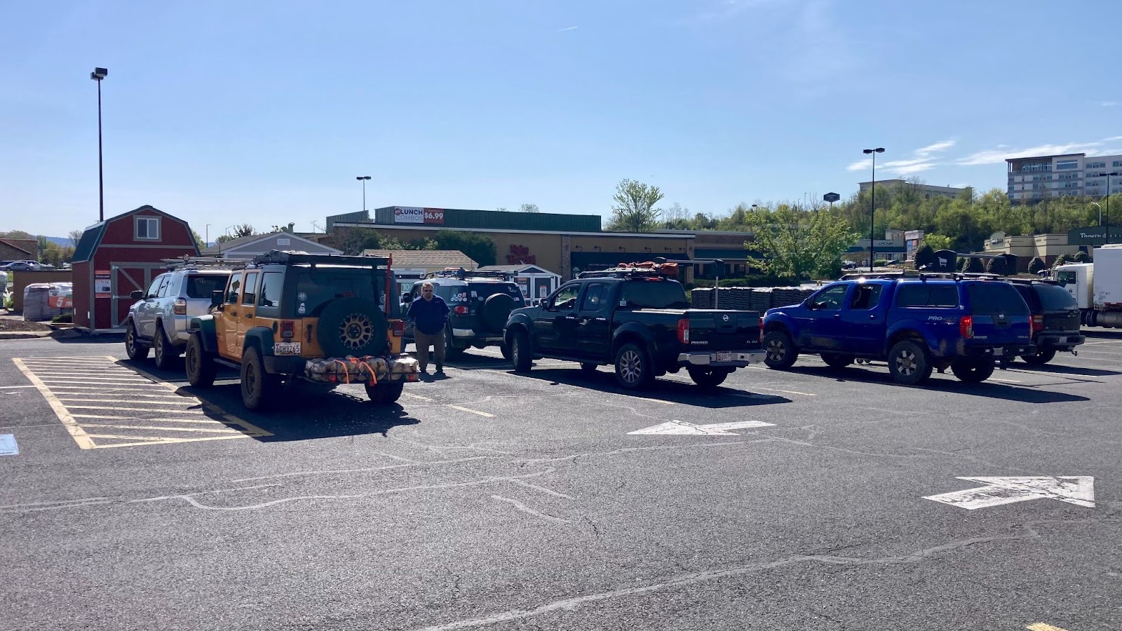
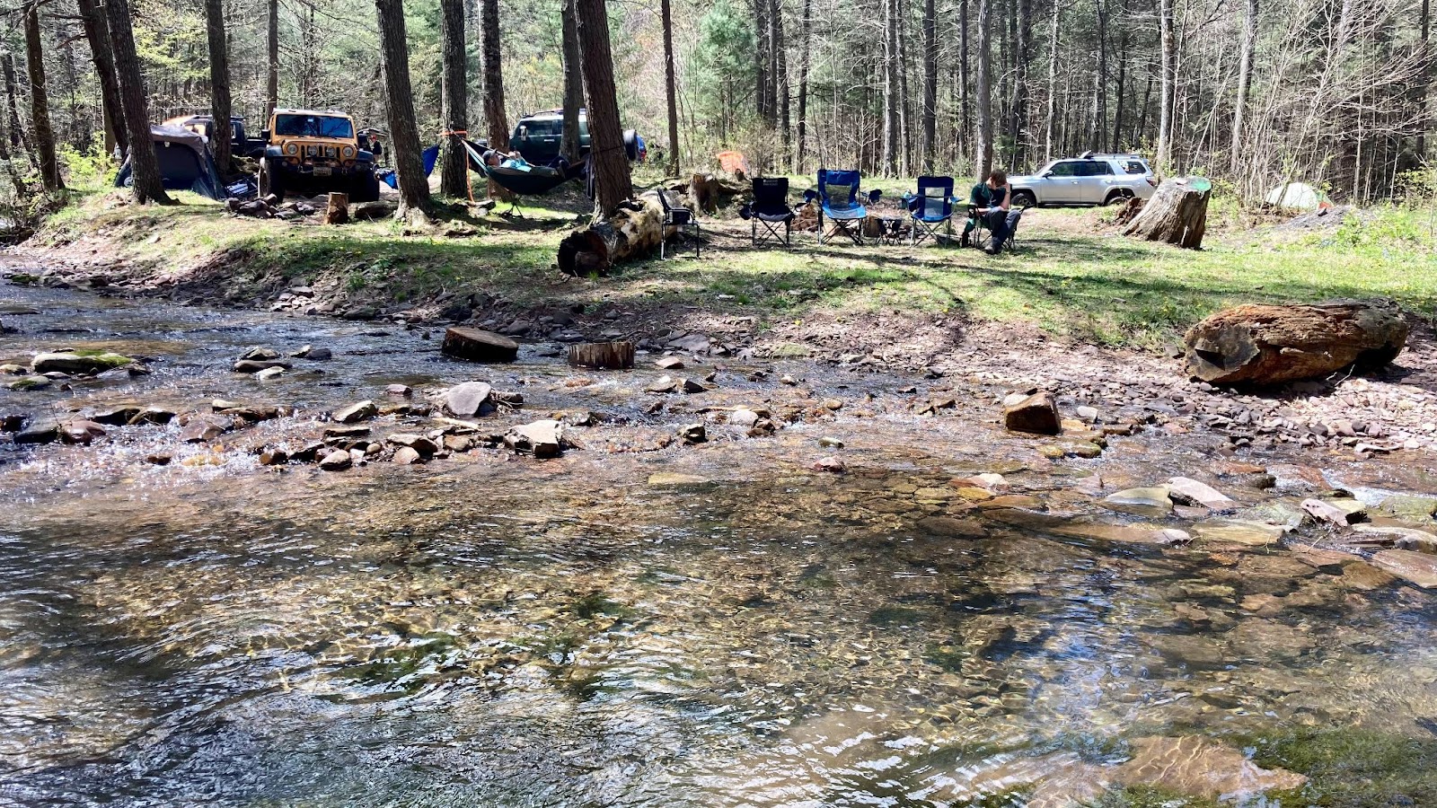
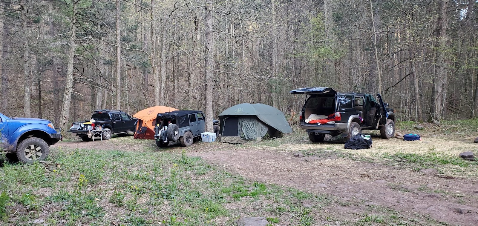
A few members were able to make the Home Depot 10am meetup time, with the rest planning on meeting us on the mountain on a campsite later in the day. After loading up with firewood, we headed towards the Dunkle Hollow Rd towards Flagpole, to make our way up the mountain and find a campsite to call home for the next 3 days. There had been a decently lengthy dry spell, so many of the creek crossings were pretty dried up to our surprise. This is the first of many trips in the area where the crossings were dry. We continued on our way, and found Campsite Riverbend, a club favorite for its seclusion and tranquil scenery, which fortunately was unoccupied. It’s a large site, and had enough room for our 10 vehicles and camping gear.
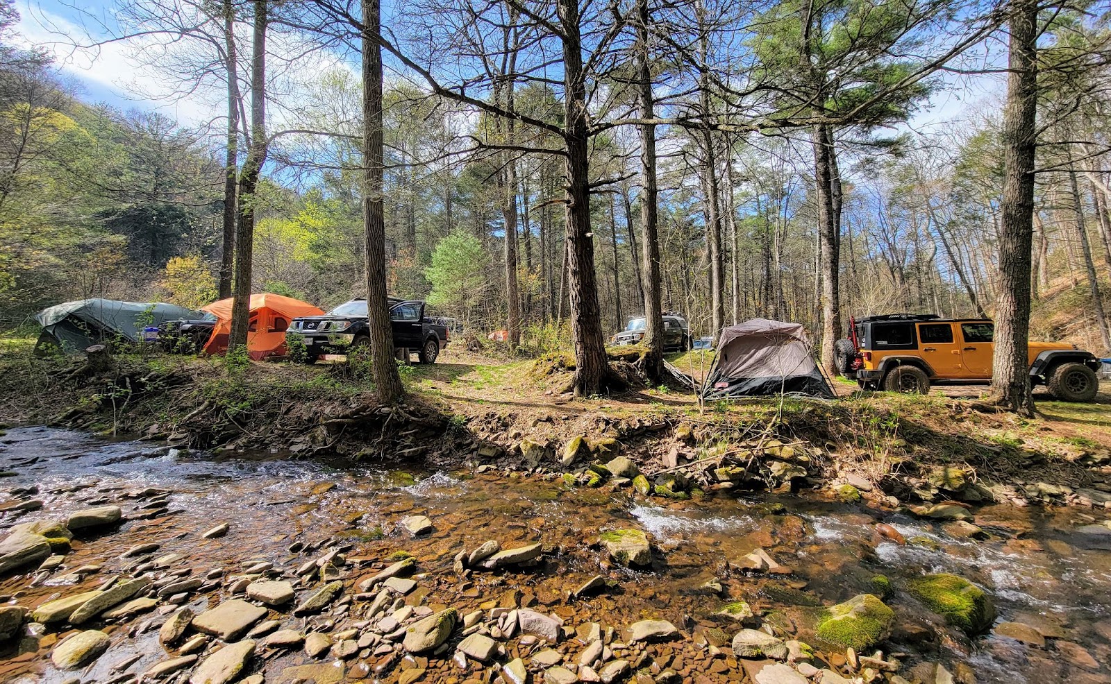
We set up camp, turned on the radios so that the late arrivals could reach us and find out where we ended up. This was vital, because the entire area is a cellular dead zone, so we would be out of communication with the outside world for most of the weekend! After a relaxing afternoon, we all made dinner, and settled in around the fire to rest up before the 11pm start up the mountain.
After shaking off our short naps in preparation for a long night, we had a quick drivers meeting where we talked about the plan for the night ride up the mountain. This interestingly also made for one of the first rides that I’ve done where GMRS was selected as the primary radio communication for the ride. This was after a call for hands for who had which type. Turns out most of the attendees had either built in GMRS radios, or GMRS handhelds. And we had extra handhelds for the couple of folks who didn’t have them. CORE, along with other groups, are in a bit of an odd transition period right now where we’re moving from CB to GMRS. We’ll see how this shakes out in future rides, but it will likely be a gradual transition, some rides using CB, and others on GMRS, until the entire club makes the shift.
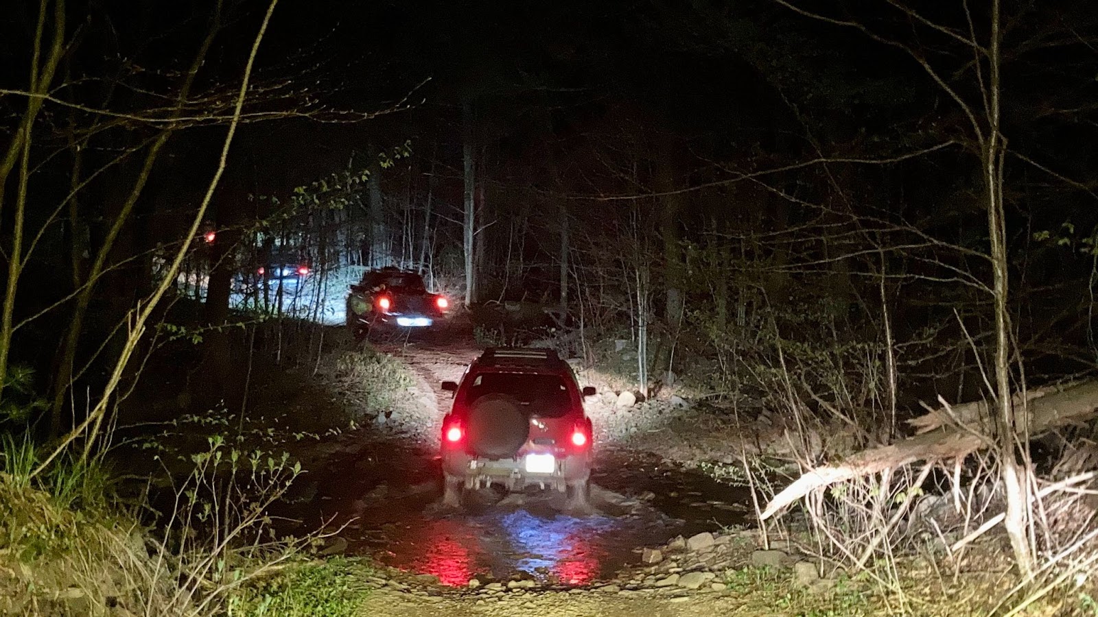
After the drivers meeting, we hit the trail. As we made our way up, we noticed that much of the side of the trail had been bush-hogged, with tree and branch debris scattered all over the trail. Also, it appeared that some of the Dunkle Hollow trail had become more rutted out and chewed up from when we were last there in March 2022. Seems like possibly there were some heavy rains that made their way though, followed by a prolonged dry spell. Most of the mud puddles along this route were almost completely dried up as well, which was a first for me.
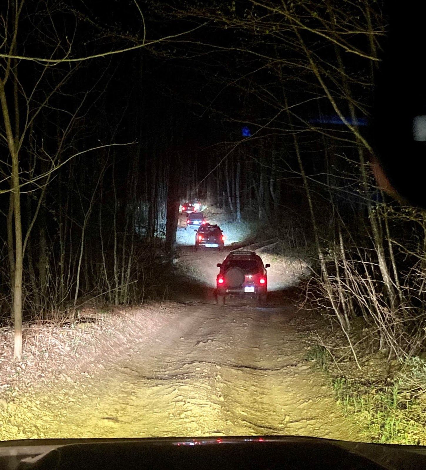
Eventually we made it to the top after about an hour of wheeling up in the dark. There was actually a Unimog and a tent set up at the top of Flagpole, so we were careful to keep our lights down to not disturb them. Additionally, at the top, for stargazing, you want to minimize light use anyway, to allow your eyes to adjust to the dark, and enhance the stargazing experience. Red lights help here, but they still affect night vision, so light discipline is very important for this type of event.
This is where we ran into some challenges. In the direction we were expecting the Milky Way to rise, was the town of Harrisonburg. Harrisonburg doesn’t generate a significant amount of light, but to our dismay, some wispy low level clouds began to move over the town. What this did was amplify the light from the town, uplighting the clouds, and drowning out any stars in that area. This meant that we would not be seeing the Milky Way unfortunately. We still saw a lot of stars directly overhead, and were able to easily make out a few constellations. Another factor working against us was that there were no planets visible. Because of this, focusing our cameras to capture the stars was a great challenge. All of this resulted in no Milky Way viewing or photos this time around. Guess that means we’ll have to try again next time! After about 2 hours of waiting in vain to see if the clouds would clear, we packed up our gear, and headed back down the mountain to camp. After another fun night ride down to camp, we settled in, and got some sleep for the night.
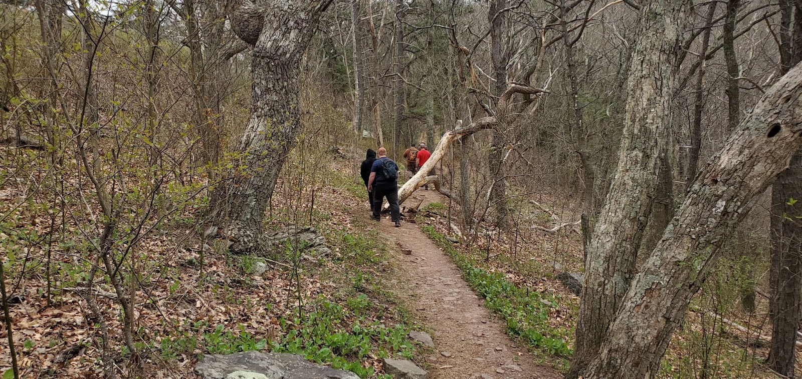
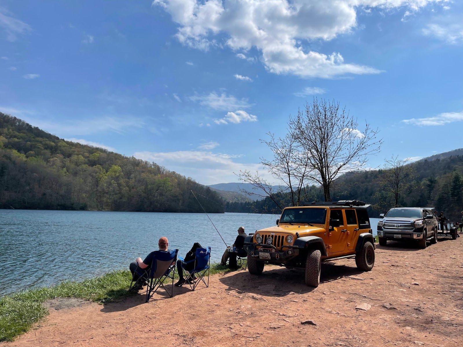
The next morning, after a late start due to the late night before, we decided to split up for the day, and poke around the area. One group went to explore some of the dead end off-road trails off of Dunkle Hollow. They came across a path that had not been driven in a while, and had some downed trees along it. After clearing them, they continued along a bit further before calling it and heading back to Dunkle Hollow. After that, Ben and Isaiah departed for the weekend, as they had other obligations. Zach continued exploring the area, and returned to camp around dinner time. The other group, led by me, decided to take a wheeling break for the day. We went on a short 2 mile hike from the High Knob overlook. We had lunch on the trail, and then headed back to the vehicles. We then headed to Skidmore Fork Lake, where we took advantage of a little quiet time and did a bit of fishing. As it goes, when you don’t catch fish, you just chat about other times that you did catch fish! So after a lot of reminiscing and not a lot of catching, we just enjoyed the tranquility of the lake, lures in the water, great company, and some time away from dings and beeps from our out of cell range phones, and relaxed for a bit.
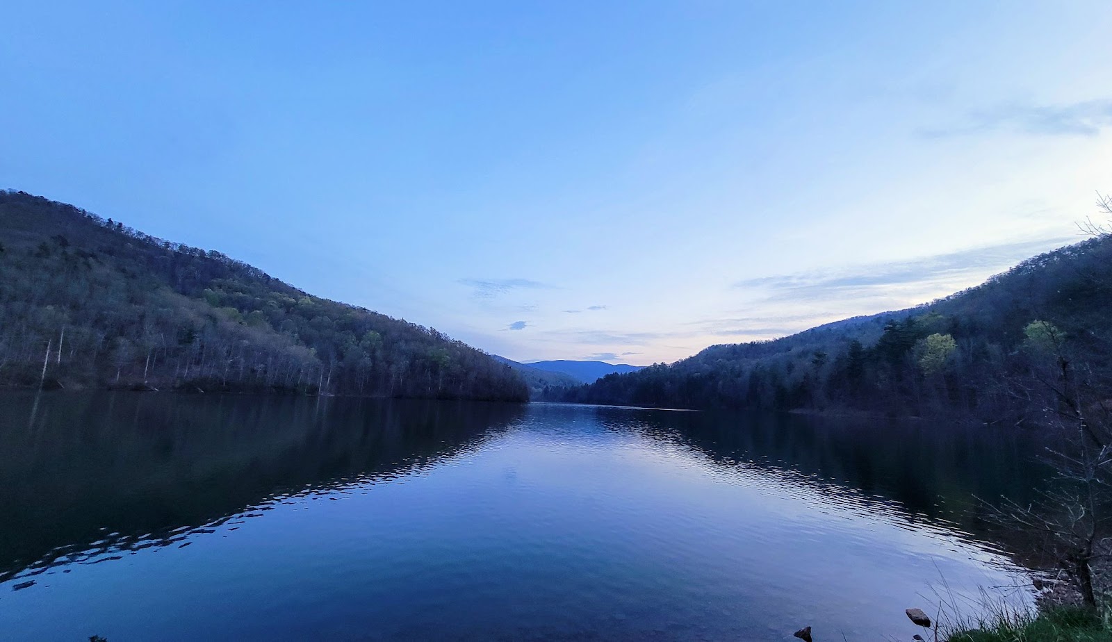
After a couple of hours, we packed up and headed back to camp. The forecast for Saturday night called for more clouds, and that’s what it looked like it was turning out to be. After dinner, however, a few of us decided to head back to the lake right around sunset, to try to see if the sky would light up for us with the setting sun. Unfortunately, the cloud cover was pretty wide, not allowing for low sun uplighting, so everything was just a bit gray as it descended into darkness. We sat around for a couple of hours however, chatting and watching the darkening lake. By about 10, we headed back to camp, and sat around the fire and chatted for a bit, getting to know each other a bit better and just relaxing. After that, we put the fire out and went to bed.
The next morning, we cleaned up camp, packed up, and headed out one by one. It was a really great weekend, and a bit of a different trail ride from our normal routine, but certainly one I would love to repeat in the future! Thanks to everyone who made it a great weekend, despite some of our atmospheric speed bumps! Guess we’ll just have to try again!
Flagpole Ride
Profile
No data
No data
No data
No data
No data
No data
Duration:
No data
High Knob Hike
Profile
No data
No data
No data
No data
No data
No data
Duration:
No data
Trail Report written by Jendra Rambharos. Pictures contributed by Jendra Rambharos, Ben Dunkerton , Zach Pittman, Steve Schueler, and John Altomare. GPS tracks provided by Jendra Rambharos.