Blue Ridge Overland Expedition
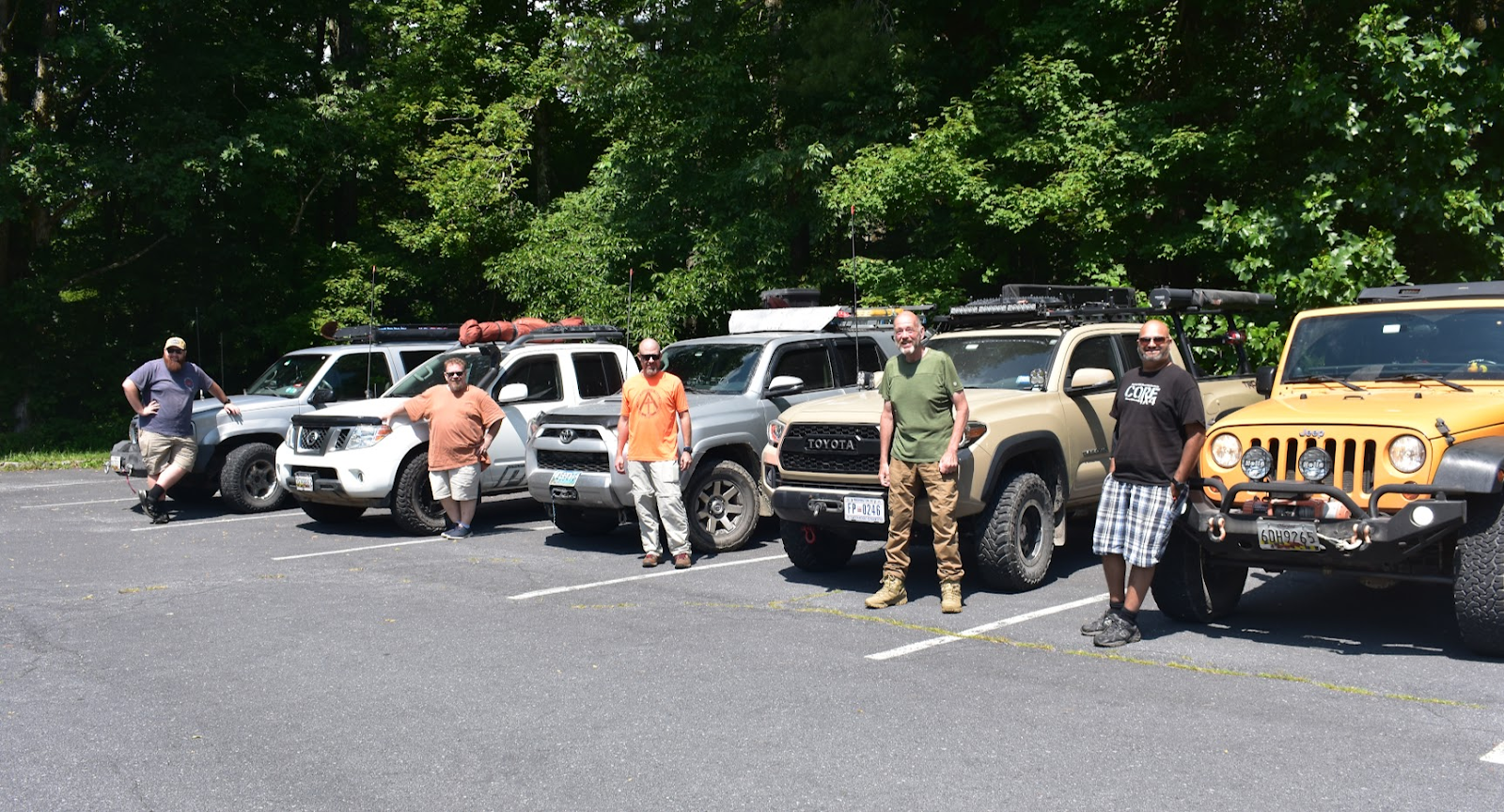
Attendees:
Matt – GMC Yukon Denali
Andy and Bronson – Toyota Tacoma
Jendra – Jeep Wrangler JKU
Steve – Nissan Frontier
Ben – Toyota 4Runner
If you have spent any time in any of the Virginia offroading Facebook groups, you may have noticed that 9/10 posts are about Flagpole Knob. There are good reasons for this, Union Springs is an awesome trail and Flagpole is day-trippable for many of us in the DMV area. But of course, there is so much more to Virginia than just Flagpole! Our objective was to cover a lot of ground each day, and camp in a different spot each night. This trip was less of an “offroad” trip, and more of an “overland” trip. Things didn’t go totally according to plan, but we absolutely made the most of our time out exploring the Blue Ridge Mountains!
For Andy, Jendra and I, the trip started on Wednesday night at the awesome Devils Backbone Basecamp. This is a beautiful campground with an on-site brewery/restaurant, and a clean shower house as well. This was a great way to start off the trip, with good food, drink and companionship!


Steve and Ben rolled in on Thursday morning, where we had a very impromptu drivers meeting. All of us have wheeled and camped with each other before, so there really wasn’t much to discuss. We started off with quite a bit of pavement driving, before dropping into the George Washington National Forest and exploring some gravel roads. We had our lunch at a roadside waterfall (where Ben saved the cooler of a woman who slipped in the water, what a gentleman!), and then enjoyed a beautiful overlook.


We found and set up camp at our first dispersed campsite, and then started off towards a short out-and-back trail called Shoe Creek. Shoe Creek used to run all-the-way through to Crabtree Falls, but several years ago someone (presumably the Forest Service) put a gate in the middle of the trail to stop people from fooling around and tearing up some private property. It’s an unfortunate reminder that illegal wheeling and bad decision making by a few can and will lead to trail closures for all of us.

Shoe Creek isn’t a difficult trail by any means, it’s stock 4WD vehicle friendly. Even a Subaru should be able to get through with careful driving. It’s just a short, rocky trail with a few small stream crossings along the way. I recommend turning around when you come to the clearing after the 3rd(?) stream crossing which has a tight rock on the passenger side. We did come across an unexpected obstacle though – a large downed tree! Luckily, Andy had brought a chainsaw with a 20” bar. Andy made quick work of the tree (with some help from a bottle jack to prevent binding), after which we pivoted the tree onto the side of the trail with a winch and pulley block. We finished the trail, made our way back to camp, and enjoyed a late dinner and campfire.


Friday morning, we packed up camp and started towards the Blue Ridge Parkway. The Blue Ridge Parkway runs all the way from the southern end of Skyline Drive (of Shenandoah National Park), to the start of the Smoky Mountains in North Carolina. We were only on the BRP for a few minutes before dipping back into civilization for a bit. We drove through the small towns of Buena Vista and gassed up in Lexington before ascending up some switchbacks to another trail called Pad’s Creek.

Pad’s Creek is a locally maintained road that isn’t much of a road at all. It’s a rough trail with several water crossings. I’ve seen it dangerously deep before, but we lucked out and the trail was very dry, to the point that many of the usually-underwater rock obstacles were sticking out of the water. This made them very easy to avoid, preventing any issues. I still walked a few of the longer crossings to make sure that there were not any surprises waiting for us. The last water crossing was longer than the others and especially fun – not because it was any harder but because there were people out floating in the creek! Several people were surprised to see us drive up what looks like a boat/kayak launch. The group seemed to really like Pad’s Creek.


After Pad’s Creek, a deficiency in my planning made itself obvious. When I am traveling alone or with a friend, I know that I can comfortably cover 100 miles (of a similar mix of terrain) in a long summer day. But with a group, I found that we could only cover around 50-60 miles per day. Our average moving speed throughout this trip was just slightly over 15MPH. When you account for breaking down camp in the morning, stopping at any overlooks/attractions, a break for lunch, bathroom breaks, gas/ice stops, cooking meals, finding a dispersed campsite, setting up camp at night, and general socializing, this leaves you with 4-6 hours of actual driving time in a day. Because I had planned our camps to be approximately 100 miles apart from each other, we had to use highways a few times to get to camp at a reasonable hour.
As we aired up after finishing Pad’s creek, a storm was quickly rolling in. We spent about an hour driving on highways through this storm to reach our campground for the night, Wilderness Adventure Campground. We did not get the worst of the storm, but the high winds knocked down a lot of limbs and trees that we would have to dodge/clear for the rest of the trip. As we neared the campground, I recalled reading on their website that there was a water crossing on the way to the campground that we should avoid. Naturally, we wanted to try it!

Still a little wet from walking the crossings at Pad’s Creek, I waded in again to walk the crossing. The rain had made the crossing deeper than those at Pad’s Creek, but there was a rock shelf on the left side of the crossing that served as the “safe” line. The middle got a bit deeper, and the right side was the “hard” line. As we were lining up to do the crossing, a local farmer in an old, 2WD Tacoma on farm-use plates pulled up and asked if we were going across. I said yes, and he said “back up and let me show you how it’s done!”. He made it across the safe line to the left, but the 2WD truck did spin a wheel looking for traction.

Ben went first, going right up the middle. Ben thinks that water went right up to the Toyota logo on the front of his 4Runner. Naturally, Jendra chose the most difficult route and went to the right. He didn’t have his lockers on, and one of his rear wheels lost traction as his Jeep got a little floaty in the deepest section of the crossing. He powered out of it just fine, but he said water washed up over his hood at one point. Andy, Steve and I all took the safe route to the left without any drama.
We arrived at Wilderness Adventure Campground to find that the storm had knocked out their power! We were primitive camping, but this meant the restaurant was closed and there wasn’t any water for showers. Thankfully, the staff were very accommodating and let us help ourselves to some pasta, homemade meat sauce, and garlic bread they had already made for a different large group. Steve’s brother and nephew were nice enough to come out from Roanoke to visit him, and they enjoyed dinner and a campfire with us.
On Saturday morning, the staff had run a generator over to the shower house which let us take warm showers (BYO lights though). Of course, as we were getting ready to leave, the power finally came back on! Despite this, the stay at Wilderness Adventure Campground was very nice. It gave us a chance to catch our breaths, clean up and refill our water supplies. The days were very hot on this trip, but we had well-shaded campsites each night to help us keep cool.

We started the day with another water crossing, and then headed off for Bald Mountain, an easy trail up a mountain with good views. After that, we drove on pretty but paved country roads for a long time, before heading onto the highway to drive towards the Falls of Dismal, where we wanted to camp. We entered from the top, near Woods Hole Hostel and spent about an hour on gravel roads working our way down. We were very lucky to find a campsite large enough for our whole group, and we did not need to split up between two less-than desirable campsites. As we made and ate dinner, a storm rolled in. We heard some distant but still scary loud thunder, saw some lightning, but only got a couple minutes of light rain. The storm mostly passed over us, but it hit our homes in the DMV area pretty hard. My apartment and Jendra’s house both lost power, but luckily it wasn’t too bad for us out in the woods.


Jendra realized at around this time that his K&N cleanable air filter wasn’t holding up well to the dust. With a standard paper filter, you can shake out the dust periodically to extend its life. But the K&N cleaner is oil based, which just seemed to just trap all of the dust inside the filter. Jendra observed a noticeable difference in power, and had to shift into 4LO for a pretty gentle hill climb at one point. I had a lot planned the next day, and knew from our pacing up until this point that we couldn’t possibly do it all. So we decided that we would skip most of what I had planned North of I-81, and that we would instead highway it to the town of Wytheville so that Jendra could get a new air filter and so the rest of us could run a few errands as well.
On our Sunday morning ride into Wytheville, Andy noticed that my Yukon’s left brake light wasn’t working. When Jendra went to the auto parts store to get his filter, I had him grab me what I thought was the right bulb. Of course, when I go to pull the bulb, it ends up being a completely different bulb. We were at a Walmart, so I ran inside and grabbed the right bulb. But it turns out the bulb isn’t the problem, I think it’s the entire tail-light circuit board. At some point during this diagnosis, Jendra walked over to a Wendy’s and bought himself lunch.
After that, we drove some twisty graded gravel roads towards Mount Rogers National Recreation Area in the Jefferson National Forest. We came across several downed trees, which we cleared with a combination of Andy’s chainsaw and a few bow saws. Eventually, we came across a “road closed” gate across a Forest Service road that was supposed to be open according to the MVUM. I had heard that there was a gate dispute elsewhere in this area, which I thought we were avoiding. But the gate ended up being right where we wanted to travel. Not wanting to backtrack an hour, we took the road that I thought had a gate across it, but luckily it did not. Ben and I did some research, and it appears that the Eastern part of Forest Service road 86 – Glade Mountain runs through a working farm. I surmise that the landowner placed this gate here to prevent people from driving through their farm to access the National Forest. From what I have read online, they also put up no-trespassing signs on the other side of this road.


We then took some curvy paved roads to one of my favorite camping areas in Virginia. It is called “the Scales”, it is a bald on top of a mountain with free-ranging cattle and wild horses. The road up is rocky, which keeps a lot of car campers away. The Appalachian Trail and several local trails run through, which usually leads to some fun interactions with hikers. We aired down, and drove up. At the camping area, you are at 4,600ft, which I believe is the highest you can park and camp in Virginia.

We ran into a nice pair of hikers who were out doing a short weekend hike on the Appalachian trail. After talking for a bit, we made sure to refill their water bottles before they continued on. There is a spring towards the top of the Scales, but I would be hesitant to drink it without treating it first. There was another group of guys camped up there as well, and at one point they came over and asked for a jumpstart on their truck. They were prepared with a set of jumper cables, but I just walked over with my jump box and had them started a few seconds later. If we weren’t there they would have been SOL for at least the night. There were other vehicles parked up at the Scales, but their owners were away hiking.

Ben and I decided to go for a short hike, which turned into a ~2 mile hike down the Bear Pen trail that eventually turned into the Appalachian Trail. We hiked to the top of Stone Mountain, which overlooks the Scales from the East. Being out of shape, I struggled with the uphill sections of this trail but for Ben it was a walk in the park! The hike was well worth it though for the unspoiled views of the Virginia Highlands. We also found some wild blueberries and blackberries, we were a little early but if you come in mid-August these should be ready to harvest.


We returned to camp, made dinner, and had our last campfire of the trip. We had a nice sunset that produced a cotton candy sky, and a similarly beautiful moon-rise. Around the campfire, we enjoyed s’mores graciously provided by Steve and talked about the many lessons learned on this trip, what we should do differently next time, and what we liked about this trip. We all turned in fairly early, getting ready for the 6+ hour car ride home.


The next morning, we all rolled out at our own pace. Jendra and Ben caught the sunrise and were gone before I even woke up, and Andy and Steve were packing up as I rolled out at around 9am. This was a great trip, and I’m very thankful that I was able to share this trip with such a great group of guys!
Day 1
Profile
No data
No data
No data
No data
No data
No data
Duration:
No data
Day 2
Profile
No data
No data
No data
No data
No data
No data
Duration:
No data
Day 3
Profile
No data
No data
No data
No data
No data
No data
Duration:
No data
Day 4
Profile
No data
No data
No data
No data
No data
No data
Duration:
No data
Trail Report written by Matt Malone. Pictures contributed by Matt Malone, Jendra Rambharos, Andy Beaton, Steven Schueler, and Ben Dunkerton. GPS tracks provided by Matt Malone.